While humans were busy trying to stay warm and keeping cars from skidding out of control during Winter Storm Hercules, the view from NASA’s Aqua satellite was decidedly more peaceful.
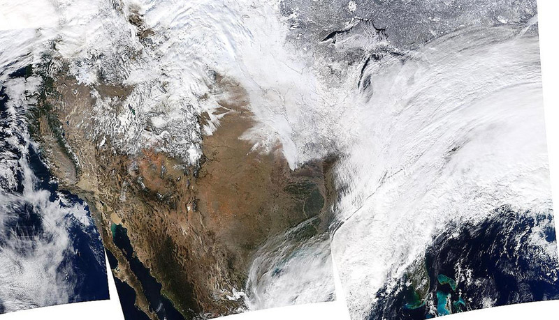
The satellite passed over the United States multiple times, allowing the Moderate Resolution Imaging Spectroradiometer on board to capture this true-color image of the massive winter storm moving up the eastern seaboard.
According to the National Weather Service, the winter storm that impacted the Midwest and Northeast through early Friday has moved into the Atlantic. It’s going to be cold now this weekend in its wake.
Extreme wind chills to minus-55 F are possible in the northern Plains this weekend. Get out there and enjoy it — just be sure to seriously gear up!
