A few people really can spoil the fun for everyone.
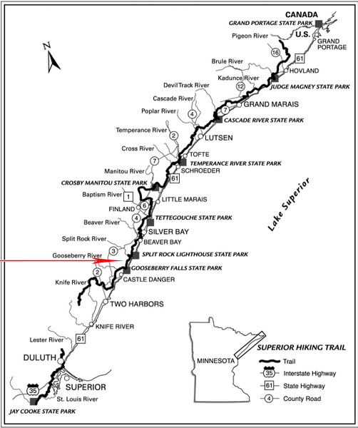
In northern Minnesota, a landowner has withdrawn public access to his land, causing a portion of the Superior Hiking Trail to be re-routed onto existing paved and unpaved roads.

Randy Bowe, who owns land crossed by a 1.6-mile segment of the trail, will close access to his land on May 1. He said the primary reason was hikers harassing him for hunting and using ATVs, on his own property.
“It wasn’t an easy decision,” Bowe, 55, told the Star Tribune. “We’ve had plenty of sleepless nights. But it came down to a few people spoiling it for everyone.”
Bowe said that hikers have left behind smoldering fires, yelled at him for riding ATVs, and even accosted a friend who was bow hunting by howling like wolves near his tree stand for an hour.
Private Land Crossings
The 300-mile Superior Hiking Trail traverses mostly public land on its route from Jay Cooke State Park to the Canadian border. It does, however, rely on the good will of about 50 private landowners for access along the way.
This is something too many hikers take for granted. Private lands are well marked on the trail, and traversing them is a privilege that landowners can revoke at any time.

Trail users must show respect and should be thankful for access that is afforded on trails across the country. Even if you disagree with a landowner’s legal use of their lands, keep it to yourself. You could be spoiling it for everyone.
The Superior Hiking Trail Association posted the following announcement:
A 1.6 mile section of the Superior Hiking Trail (SHT) will close permanently Friday, May 1, from the northern boundary of Gooseberry Falls State Park to Blueberry Hill Road, due to a private landowner closing the trail. A signed detour on the paved Gitchi Gami State Trail will be used to go around this section.
*** The detour will start at the Gooseberry Falls State Park Visitor Center, cross on the pedestrian bridge under Hwy. 61 over the Gooseberry River and travel for 2.1 miles on the Gitchi Gami State Trail to the Blueberry Hill Road intersection. This intersection is located at about Highway 61, milepost 41.6 by blue fire number #3486.
*** At that point, there are two options. Hikers can either cross Highway 61 and walk 1.2 miles north on Blueberry Hill Road, a gravel Lake County forest road, to connect to the SHT and then continue east on the SHT to the Blueberry Hill Campsite, Bread Loaf Ridge, and the Split Rock River Wayside, OR continue another 2.4 miles on the Gitchi Gami Trail to the Split Rock River Wayside, and use the box culvert underneath the highway to reach the parking lot and the continuation of the SHT.
