Hiking and Denver Are Inseparable
off-season Winter adventures

7 Snow-Free Hikes in the Seattle Area

From the Olympic Peninsula to the foothills of the North Cascades, these trails are perfect for off-season adventures just outside the city.

While winter storms cover trails across the country in snow, Seattle’s mild coastal climate offers outdoor enthusiasts a unique opportunity for ample snow-free hiking throughout the colder months. Thanks to the city’s proximity to multiple national and state parks, hikers don’t need to venture far to enjoy stunning natural landscapes.

To the west, discover coastal ecosystems and lush rainforests on the Olympic Peninsula. Or travel just an hour or two to the east for winter-friendly low-elevation mountain trails with towering snowy peaks in the background.

These mountain and coastal areas are the perfect places to immerse yourself in the wild this winter. So load your backpack, bundle up, and head outside to discover the incredible beauty outside Seattle.

off-season Winter adventures

Hoh Rainforest

Length

Up to 18.5 miles; most winter hikers turn around sooner

Difficulty

Moderately challenging

Hours:

24 hours a day year-round, with some holiday closures

Parking

Main lot at the trailhead and overflow parking at the nearby campground

Dog friendliness:

No dogs allowed in the national park

Restrooms

At the Hoh Rainforest Visitor Center

Trail Details:

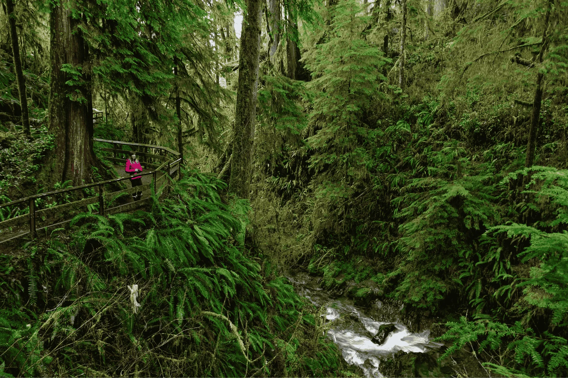
A short ferry ride and drive from Seattle, the Olympic Peninsula is one of the most ecologically diverse regions in the Pacific Northwest. Here, visitors can explore rugged coastlines, towering mountains, and one of the best-preserved temperate rainforests in the world — the Hoh Rainforest.

Hike through an enchanting landscape of moss-draped trees, ferns, and crystal-clear streams on the Hoh River Trail. This route extends 18.5 miles to the Blue Glacier moraine with views of Mount Olympus. In winter, hikers typically turn around at 5 Mile Island for a 10-mile, round-trip hike.

If you’re short on time, the Hall of Mosses Trail winds 0.8 miles through old-growth forests and features an impressive grove of maple trees covered top to bottom in club moss.

off-season Winter adventures

Ozette Triangle and Coast

Length

9.3 miles

Difficulty

Moderately challenging

Hours:

24 hours a day year-round, with some holiday closures

Parking

Lot at the trailhead

Dog friendliness:

No dogs allowed in the national park

Restrooms

At the trailhead; pit toilets on the trail at Sand Point and Cape Alava

Trail Details:

For a coastal adventure in Olympic National Park, the Ozette Triangle hike offers a stunning mix of forest and seaside landscapes. Starting at Ozette Lake, the 9.3-mile loop follows a boardwalk through old-growth forests before opening up to the expansive Pacific coastline.

Enjoy views of rugged cliffs, towering sea stacks, tidepools brimming with life, and the boulder-strewn shoreline from Sand Point to Cape Alava. As you approach the cape on the northern stretch of the coastal trail, keep an eye out for petroglyphs carved into the boulders at Wedding Rock. This historic artwork created by inhabitants of the Ozette Village dates back 500 years and depicts orcas, clam shells, and other images of life on the Olympic coast.

While you won’t have to contend with snow on the trail, tides higher than 5 feet can make sections of shoreline impassable at high tide. Be sure to check the tide chart before you start your hike.

off-season Winter adventures

Moran State Park

Length

2.6 miles

Difficulty

Easy

Hours:

8 a.m. to dusk in winter

Parking

3 lots with trail access available

Dog friendliness:

Dogs allowed on leash

Restrooms

Available at several points along the trail

Trail Details:

In addition to Sanitas, the other must-visit hike in Boulder is the 3.3-mile climb to Royal Arch in Chautauqua Park. The trail features several uphill and downhill sections, climbing 1,400 feet up into the iconic Flatirons south of the city. The reward at the top is a large sandstone arch, along with sweeping views that stretch from Boulder to Denver on clear days.

Take a scenic ferry ride to the San Juan Islands north of Seattle. Known for its diverse landscapes and ample trails, this peaceful archipelago is a hiker’s paradise. Head to Orcas Island — the largest land mass in the island chain — to explore Moran State Park.

With nearly 40 miles of trails, the park is home to the most extensive trail network in the San Juans. For a low-key winter hike, try the Cascade Lake Trail. This 2.6-mile loop hugs the forested shoreline and connects to several spur trails leading to a lagoon and waterfall.

Along the route, catch views of Mount Constitution. At 2,400 feet, this peak is the highest point in the San Juan Islands and offers sweeping vistas of the surrounding islands. Often covered in snow in the winter, the trail to the summit is a popular option for summer hikers and lucky off-season visitors who catch the trail when it’s snow-free.

off-season Winter adventures

Boulder River Wilderness

Length

8.1 miles

Difficulty

Moderate

Hours:

24 hours a day

Parking

Small lot at the trailhead

Dog friendliness:

Dogs allowed on leash

Restrooms

None on location; pit toilet available at the nearby Washington State Department of Natural Resources campground 2.8 miles east

Trail Details:

If you are in Denver and short on time for a hike, North Table Mountain in Golden is a perfect choice to get your outdoor fix. The 2,000-acre park sits on a 60-million-year-old lava flow that rises several hundred feet above the surrounding plains. Once you ascend the several hundred feet to the mesa, the trails are relatively flat and there are several loop options to choose from among the 15 miles of trail.

East of Seattle, the Cascade Range beckons with its towering peaks, alpine lakes, and dramatic vistas. While high-elevation areas typically receive an average of 37 inches of snow each winter, low-elevation trails remain accessible most of the cold season.

With a maximum elevation of 1,550 feet, the Boulder River Trail offers a chance to experience the North Cascades year-round. Hike among moss-covered trees, which are especially stunning in wetter winter months, and past multiple waterfalls on the 8.1-mile trail. After prolonged cold weather, this already-gorgeous trail takes on an ethereal look, with frozen waterfalls and icicles dripping from branches and rocks.

off-season Winter adventures

Tiger Mountain State Forest

Length

7.5 miles

Difficulty

Moderately challenging

Hours:

Daily from 6 a.m. to 9 p.m.

Parking

Roadside parking

Dog friendliness:

Dogs allowed on leash

Restrooms

No toilet at trailhead

Trail Details:

Just over thirty minutes west of Denver, Lair o’ the Bear Park is the perfect spot for a family outing. The wide, flat trails that border Bear Creek and ample picnic areas make it an ideal hike for kids to tag along. The 1.5-mile Bruin Bluff Trail is an easy introduction to the park, while those who want a challenge can climb over 1,000 feet to Panorama Point.

A local favorite, Tiger Mountain and the surrounding forest offer hikers options for outdoor recreation outside the city. In the winter, low-elevation trails, including the South Tiger Mountain Loop, remain mostly snow-free for winter hiking.

Access this unassuming trailhead on the side of Tiger Mountain Road Southeast. From there, the route follows Tiger Mountain Trail, which gently ascends through the dense southern part of the forest and along the eastern slope.

At Hobart Gap, catch the South Tiger Traverse to venture into clearings where the forest has been logged over the years. Altogether, the trails form a 7.5-mile loop that peaks at just over 2,000 feet — keeping hikers entertained with year-round hiking.

off-season Winter adventures

Carbon River

Length

Up to 10 miles, with a variety of shorter trail options

Difficulty

Moderate

Hours:

24 hours a day year-round, with limited services in winter

Parking

Roadside

Dog friendliness:

No dogs allowed in the national park

Restrooms

At the Carbon River Entrance Area a few miles from the trailhead

Trail Details:

For an easy yet immersive experience of the beauty that the Rocky Mountains provide, Chief Mountain is just a quick one-hour drive from Denver. The trail is short but steep, climbing nearly 1,000 feet over 1.4 miles to the peak. You’ll travel through dense alpine forests, exit the tree line to experience a Rocky Mountain tundra ecosystem, and reach the summit at 11,713 feet. The views from Chief Mountain are expansive, with one of Colorado’s iconic 14ers, Mt Evans, visible to the west.

No exploration of Seattle’s hiking scene is complete without mentioning the crown jewel of the Pacific Northwest — Mount Rainier and its namesake national park. Washington’s tallest mountain dominates the city’s skyline on clear days and offers some of the most spectacular and varied terrain in the region.

At 14,411 feet, this iconic peak receives an average of 670 inches of snow annually, which means winter adventures on the mountain involve skis.

But in the far northwest corner of Mount Rainier National Park, temperate rainforest climates surrounding Carbon River offer visitors a chance to explore a section of the park without snow year round. Once accessible to cars, Carbon River Road now caters exclusively to bike and foot traffic.

Choose from several spur trails along this 10-mile corridor, including the 2.7-mile Old Mine Trail, which winds through dense rainforest along the bank of the Carbon River until it reaches a historic mine.

off-season Winter adventures

Bonus: Trails in Seattle’s Backyard

Length

2.4 to 5 miles

Difficulty

Easy to moderate

Hours:

Daily from dawn to dusk

Parking

Lot parking at both trailheads

Dog friendliness:

Dogs allowed on leash

Restrooms

Multiple available along the Seward Perimeter Loop; none at the trailhead in Cougar Mountain Regional Wildland Park

Trail Details:

The hike to Devil’s Head provides classic panoramic views of the Front Range and a glimpse into Colorado's history. The lookout tower atop the granite outcropping is the last of seven such towers that were once operated on the Front Range. The Devil’s Head tower, which was built in 1919 and rebuilt in 1951, is the last in operation and has been added to the National Register of Historic Places.

Perched at over 9,700 feet atop the Rampart Range, the hike up to the tower ascends nearly 900 feet over 1.4 miles. The trail winds through towering aspen groves and interesting rock formations before it reaches the final 143 steps that lead to the top.

Read Full Article
Gear

Fjällräven Seattle

Gear

Fjällräven 

Seattle

Gear recommendations from the Fjällräven Seattle store.

Nuuk Lite Parka

A lightweight version of best-selling Nuuk Parka designed for milder conditions with a long, generous cut that reaches down over the rear and thighs.
Produced without PFAS.

Shop Men's Shop Women's

Keb Trousers

Award-winning, trekking trousers in stretch fabric and G-1000. Now updated for even better performance, comfort and durability. Produced without PFAS.

Shop Men's Shop Women's

Abisko Hike Foldsack

Versatile and lightweight backpack, perfect for day hikes and travelling. Produced without PFAS.

Övik Heavy Flannel Shirt

A classic, comfortable flannel shirt made from double-sided brushed organic cotton. The relaxed fit allows for easy layering underneath once the cooler months kick in.

Shop Men's Shop Women's
Location

101 Pine Street,
Seattle, WA 98101
(206)-338-6468
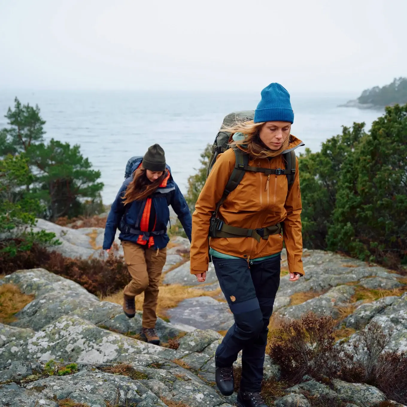
two hikers walking across a rock with large lake in distance
Trekking Bend's Fiery Past

6 Volcanic Hiking Trails

Bend, Oregon is home to some of the most fascinating geological terrain in the Pacific Northwest.

Towering volcanoes, ancient calderas, and fresh lava flows are a testament to the region's dramatic volcanic history, which continues to shape the landscape today. If you're visiting Bend and looking for a hike, it’s only natural to explore the area’s volcanic features. Here are six must-visit hiking trails that were forged by the Cascade Range’s fiery eruptions.

Trekking Bend's Fiery Past

Tumalo Falls Loop Trail

Length

<1-8 miles


Difficulty

Easy to moderate


Hours:

Accessible 24 hours; no overnight parking at day-use area

Parking

$5 recreation pass required

Dog friendliness:

Dogs allowed on leash on North Fork Trail; no dogs allowed in City of Bend Watershed (Swampy Lakes and Bridge Creek Trails)

Restrooms

Yes, at trailhead

Trail Details:

Tumalo Falls is one of the classic side trips in Bend. The picturesque waterfall drops 97 feet over a ledge of dense volcanic basalt. The top layer of soil in the area is formed mainly of ash and pumice deposited by the ancient eruptions of Mt. Mazana – the volcano that blew its top 7,700 years ago to become present-day Crater Lake in southern Oregon.

The trailhead is just 14 miles west of Bend and is accessible to all hiking abilities. The hike can be as quick as a 0.4-mile out-and-back to the viewpoint atop the falls, or you can continue on the North Fork Trail to discover even more waterfalls upstream. For a longer hiker, the Tumalo Falls loop covers seven miles and passes by six waterfalls.

The hike is equally beautiful in the winter months, offering snowy scenery and a stunning frozen waterfall.

Trekking Bend's Fiery Past

Lava River Cave Trail

Length

2.2 miles


Difficulty

Easy


Hours:

Accessible 24 hours; no overnight9 am to 4 pm; last entry is at 2 pm; the cave is currently closed for the 2024 season; it will re-open May 2, 2025 parking at day-use area

Parking

$5 recreation pass required with reservation

Dog friendliness:

No dogs allowed

Restrooms

Yes, at trailhead

Trail Details:

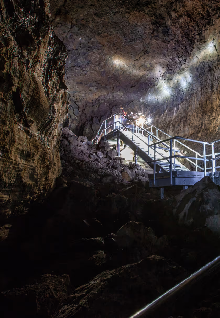
The volcanic history of the land around Bend is visible not only on the surface but also below it. Twelve miles south of town, you can pay a visit to Lava River Cave. This underground lava tube extends for more than a mile beneath Central Oregon.

When lava streams out of a volcano eruption, the outer edges begin to cool and harden. Eventually, as a deep channel forms, the lava can become completely covered with solid crust. Once the lava drains, a hollow chamber remains, such as Lava River Cave.

This cave is the longest known lava tube in Oregon. A staircase provides easy access to the spacious interior, and walking to the end and back is a 2.2-mile round-trip journey through pitch darkness. If you plan to hike the cave, you'll need to book a reservation in advance. Also, be sure to bring or rent two light sources – just in case one fails – and bundle up, as the cave’s temperature remains a chilly 42 degrees Fahrenheit year-round.

Trekking Bend's Fiery Past

Smith Rock State Park Trail

Length

<1-6 miles


Difficulty

Easy to difficult

Hours:

Dawn to dusk

Parking

$5 per vehicle

Dog friendliness:

Dogs allowed on leash

Restrooms

Yes, at Welcome Center and Bivouac Area

Trail Details:

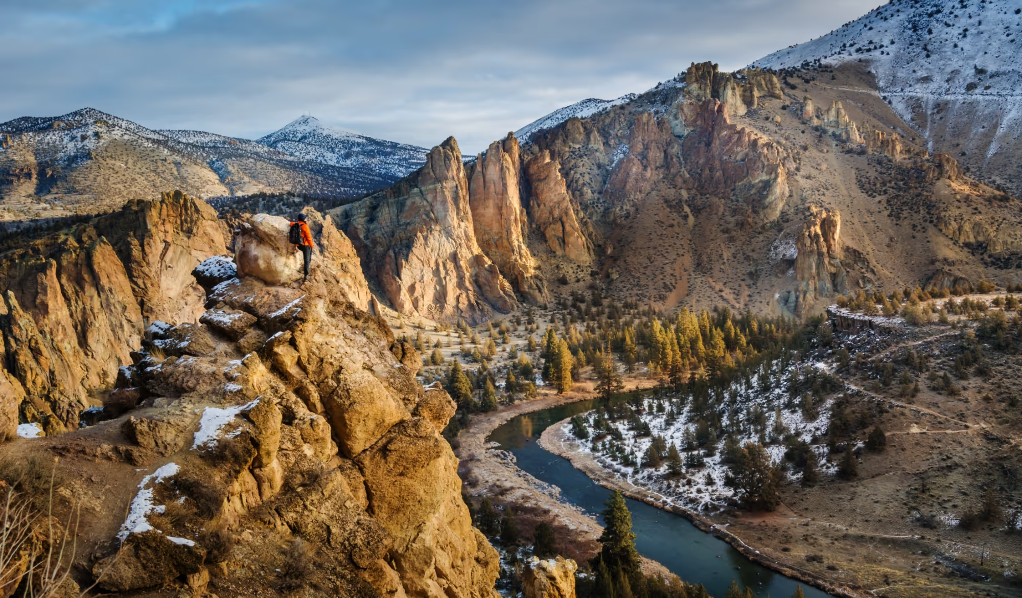
Smith Rock State Park, located northeast of Bend, is a classic example of the region’s tumultuous volcanic history. Around 29.5 million years ago a massive eruption caused the land around the park to collapse into an underground molten lava chamber, forming the caldera in which the park is found today. The eruption deposited an incredible 140 cubic miles of material, creating sediment layers as far as 75 miles from the caldera. Much of the ash and pumice consolidated into a rock called tuff, which is how the park’s towering spires were formed.

In more recent history, around 400,000 years ago, runny basaltic lava from Newberry Volcano to the south flowed over much of the tuff, leaving only the tall spires exposed above the flow. 

The result is a volcanic playground featuring steep climbs to peaks or gentle strolls around the Crooked River, which meanders through the park in two dramatic 180-degree turns. There’s a trail for everyone to hike at Smith Rock, whether it’s the challenging 6-mile loop trail on Misery Ridge, or the casual Rim Rock Trail, which provides amazing views without breaking a sweat.

Trekking Bend's Fiery Past

Mount. Bachelor Trail

Length

6 miles, 2,651 elevation gain

Difficulty

Difficult

Hours:

No restrictions, but if you plan on using chair lifts, hours start from 10 am until 5 pm or 7 pm depending on the day

Parking

Free at Sunrise Lodge or West Village; also can park along Century Drive

Dog friendliness:

Dogs allowed on leash

Restrooms

Yes, at West Village and Pine Marten Lodge; hours subject to change

Trail Details:

Mt. Bachelor is Bend’s premiere ski destination in the winter, but exploring this dormant stratovolcano isn’t limited to the snowy months. The 9,065-foot peak also offers excellent hiking and sweeping 360-degree views from its summit.

Mt. Bachelor is relatively new in the grand scheme of Bend’s volcanic past, formed between 18,000 and 15,000 years ago. Hikers can start from either Sunrise Lodge or West Village, with a 2,600-foot climb to the top over six miles round-trip.

Be mindful of designated hiking zones so you don’t accidentally stray onto a busy mountain bike trail.

Trekking Bend's Fiery Past

Lava Butte, Lava Lands Trail

Length

3.8 miles, 593 feet elevation

Difficulty

Moderate

Hours:

Dawn to dusk

Parking

$5 per vehicle

Dog friendliness:

Dogs allowed on leash

Restrooms

Yes, at visitor center

Trail Details:

Lava Butte and its corresponding lava flow were formed by a single eruption 7,000 years ago. Located south of Bend on I-97, Lava Butte is a textbook example of a cinder cone. A paved road makes a trip to the top accessible via a 3.8-mile hike that climbs nearly 600 feet. At the top you can see the fire lookout tower, take in views of the cinder cone’s lava flow that extends northeast to the Deschutes River, and, if you are up for it, complete a loop around the volcano’s rim.  

While you are at Lava Lands Visitor Center, you can also check out the Trail of the Molten Lands to explore the basalt flow that poured out of Lava Butte millennia ago.

Trekking Bend's Fiery Past

Big Obsidian Flow Trail

Length

1 mile

Difficulty

Easy

Hours:

No restrictions

Parking

$5 per vehicle

Dog friendliness:

Advised not to bring dogs due to sharp, jagged rocks

Restrooms

Yes, at trailhead

Trail Details:

Big Obsidian Flow is Oregon’s most recent lava flow, formed during an eruption of the Newberry Caldera 1,300 years ago. Visitors can access this unique geological feature via stairs and a short trail that winds through the field of pumice and shiny black obsidian.

The flow was historically significant to local tribes who sourced the obsidian for making tools like arrowheads and blades. While visiting, feel free to admire the mesmerizing volcanic glass, but remember that it's illegal to take any home. Be cautious when touching it, as obsidian is extremely sharp.

Read Full Article
cavern with wooden boardwalk and stairs
Gear

Fjällräven Bend

Gear

Fjällräven 

Bend

Gear recommendations from the Fjällräven Bend store.

Keb Padded Hoodie

Lightweight and pliant reinforcement jacket with a fixed hood – the perfect insulation garment that slides easily under or over a shell jacket and that takes up almost no room in your pack when it is not being used.

Shop Men's Shop Women's

Keb Trousers

Award-winning trekking trousers in stretch fabric and G-1000, now updated for even better performance, comfort and durability. The trousers have classic, large pockets, generous ventilation zippers and openings for kneepads (an accessory).

Shop Men's Shop Women's

Singi 28

Versatile and hardwearing trekking backpack with a robust carrying system that can handle the weight of everything you need for a long day out. With 28 litres of volume, it fits all your gear for a full day of hiking, hunting or fishing.

Singi Merino Henley

Light and comfortable base-layer sweater in a soft jersey knit that combines the functional properties of merino wool with the durability of synthetic fibres.

Shop Men's Shop Women's
Location

830 NW Wall St
Bend, OR 97701

(541)-241-7063

two hikers walking across an open space
Read Full Article
San Francisco is a Hiker’s Paradise

7 Must-Visit Trails in the Bay Area

With nature adventures in every direction, San Francisco is a treasure trove for outdoor enthusiasts. While the national parks of the nearby Sierra Nevada often overshadow the local preserves, you don’t need to leave the Bay Area to access a wide variety of ecosystems and trails.

From the Marin headlands to the north to the marsh wetlands of the South Bay, and the Santa Cruz Mountains of the peninsula to the drier peaks of Mount Diablo, San Francisco is a perfect launch-off point to quickly become immersed in nature. Within a short drive or via public transportation you can be on the trail and hiking in no time.Whether you are planning a weekend visit to the City by the Bay, or a resident looking to make a spontaneous day trip, here are seven Bay Area hikes to consider that are well worth your time.

San Francisco is a Hiker’s Paradise

Muir Woods: Canopy View Loop

Length

3 miles, 530 feet elevation gain

Difficulty

Moderate

Hours:

8 am to sunset

Parking

Parking at trailhead; entrance fee is $15 per person 16 years and over, free for people 15 years and younger

Dog friendliness:

No dogs allowed

Restrooms

Yes, at trailhead

Trail Details:

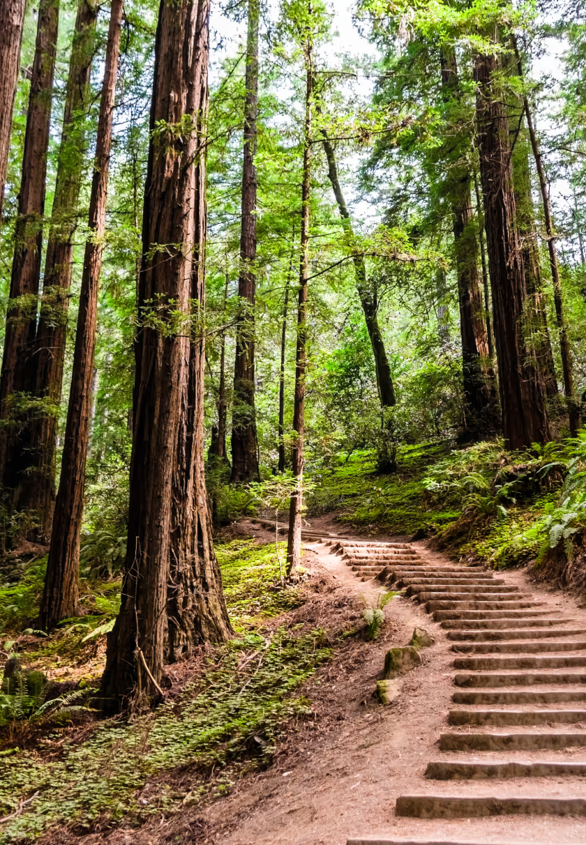
Just a 20-minute drive north of the Golden Gate Bridge you can escape into a redwood wonderland. The Canopy View Trail in Muir Woods ascends a tranquil canyon with a flowing creek surrounded by old-growth coast redwoods. The park has been a national monument since 1908 and a longtime favorite getaway of San Francisco residents for a day hike.

To complete the loop, ascend the Canopy Trail and connect to the Lost Trail and Fern Creek Trail.

San Francisco is a Hiker’s Paradise

Lands End Loop Trail

Length

2.9 miles

Difficulty

Easy

Hours:

Accessible 24 hours; parking lots open sunrise to sunset

Parking

Free

Dog friendliness:

Allowed on leash, beware of coyote activity

Restrooms

Yes, at all three parking lots in the park

Trail Details:

Located on the western shore of the city of San Francisco, Lands End is a scenic and simple getaway for San Franciscans seeking a break from the bustle of city life. Easily accessible via the 38 Muni bus, Lands End provides stunning views of the Pacific Ocean and Golden Gate Bridge. You’ll find wildlife like cormorants and seals, the ruins of Sutro Baths (which burned down in a 1966 fire), and the remains of Mile Rocks Lighthouse jutted out from the choppy sea.

The Coastal Trail is a 2.9-mile out-and-back hike that provides several viewpoints and the option to descend to the water’s edge at Mile Rock Beach.

San Francisco is a Hiker’s Paradise

Marin Headlands: Hawk Hill

Length

1 mile

Difficulty

Easy

Hours:

Accessible 24 hours

Parking

Free at trailhead

Dog friendliness:

Dogs allowed on leash

Restrooms

At parking lot

Trail Details:

Hawk Hill, located in the Marin Headlands, offers one of the most breathtaking views of the Golden Gate Bridge and San Francisco skyline. It is a great spot for observing migrating birds of prey like hawks, eagles, falcons, and vultures. In addition to its unparalleled views of the city, Hawk Hill showcases the area’s military history as it features an artillery battery constructed during WWII to protect the bay’s entrance. The military buildings that once existed on the hill have since been removed, but you can still see the remnants of their concrete foundations.

San Francisco is a Hiker’s Paradise

Purisima Creek Trail

Length

8.6 miles, 1,840 feet elevation gain

Difficulty

Hard

Hours:

Open a half-hour before sunrise until a half-hour after sunset

Parking

Three parking lots around the park – North Ridge, Redwood, and Purisima Creek

Dog friendliness:

No dogs allowed

Restrooms

At Skyline Blvd parking lot, Purisima Creek parking lot, and Redwood parking lot

Trail Details:

If you’re looking for a redwood nature escape south of the city, the 5,412-acre Purisima Creek Redwoods Open Space Preserve is an excellent option. While hiking through Purisima Creek Canyon on the west slopes of the Santa Cruz Mountains, visitors can marvel at towering coast redwoods, lush ferns, and plentiful banana slugs as the trail crosses several moss-covered wood bridges over the rushing creek.

Most of the coast redwood trees in the preserve are second-growth forests – around 100 years old – after the original giants were logged in the late 1800s. Yet the new forest is returning to its old form and regaining its timeless beauty. The 8.6-mile round-trip hike from Purisima Creek trailhead to Redwood trailhead is a great option to see much of what the reserve has to offer. However, there are many possibilities for connecting other trails and loops if you want a shorter or longer hike.

San Francisco is a Hiker’s Paradise

Mori Point Loop Trail

Length

3.2 miles; 298 feet elevation gain

Difficulty

Easy

Hours:

Accessible 24 hours

Parking

Parking on Mori Point Road or Bradford Way

Dog friendliness:

Dogs allowed on leash

Restrooms

Yes, at Mori Point parking lot off Highway 1

Trail Details:

In the town of Pacifica, where the concrete of San Francisco gives way to rolling coastal hills, Mori Point is a nature preserve with sweeping ocean views and fresh Pacific Ocean air. It’s a great place to watch a sunset or look for whales, with views stretching to the Golden Gate Bridge and beyond on a clear day.

The Mori Point loop trail starts from the trailhead off Highway 1 and heads to the vista overlooking the ocean. However, the open space features six other trails that can be connected as you please.

Tip: If you want to get to Mori Point without a car, take the 110 bus from the Daly City BART station and get off at Highway 1 and Westport Dr.

San Francisco is a Hiker’s Paradise

Mount Diablo Summit Trail

Length

7.3 miles, 2,139 feet elevation gain

Difficulty

Hard

Hours:

Gates open 8 am and close at sunset

Parking

Vehicle entrance fee can range from $6-10 depending on the park entrance

Dog friendliness:

Dogs allowed on leash

Restrooms

At Summit Visitors Center and several camps that you pass on the way

Trail Details:

Perhaps the best view of the entire Bay Area is from Mount Diablo in the East Bay. From the summit of the peak 3,849 feet above sea level, you can catch views that stretch west to the Farallon Islands, south to Loma Prieta, east to the Sierra Nevada, and – on an exceptionally clear day – north to Mt. Lassen in the Cascade Range.

While it’s possible to drive to the top of Mt. Diablo, that’s no fun! Why not enjoy nature on the mountain’s slopes, break a sweat, and hike to the top? The distance and elevation gain may vary depending on where you park, but if you start around Curry Point, it will be roughly a 7.3-mile round-trip hike.

With 20,000 acres to explore in Mount Diablo State Park, heading to the summit is by no means the only option. 350,000 visitors come each year to explore the park’s various trails and peaks.

San Francisco is a Hiker’s Paradise

Alviso Marina County Park

Length

9 miles

Difficulty

Moderate

Hours:

8 am to sunset

Parking

Free at trailhead

Dog friendliness:

Dogs are allowed only in the picnic areas and pathways but not on the trails

Restrooms

Yes, at parking lot

Trail Details:

Alviso Marina County Park provides a quick nature getaway for South Bay residents. The Alviso Slough Trail completes a 9-mile loop through the park's vast marshes and wetlands that serve as a refuge for many species of birds. The hike is flat as it hugs the water’s edge with panoramic views of the mountains that surround Silicon Valley. One unique feature that draws visitors is the salt deposits from the old mining industry, which turn certain pools into a mesmerizing reddish color.

Tip: Save some gas and take the 59 bus from Santa Clara to arrive at the park.

path winding through a lush forest
Gear

Fjällräven San Francisco

Gear

Fjällräven 

San Francisco

Gear recommendations from the Fjällräven San Francisco store.

Expedition X-Lätt Jacket

Perfect for cold, active days when you need a little more warmth than a shell jacket can offer. Expedition X-Lätt Jacket has the exact amount of ultra-light padding you need to keep warm when your own body heat isn’t enough.

green men's epedition x-latt hoodie by Fjallraven
red women's epedition x-latt hoodie by Fjallraven
Shop Men's Shop Women's

Vidda Pro Ventilated Trousers

Durable trekking trousers with technical features, made from wind- and water-resistant G-1000. The model is based on our best-selling Vidda Pro but has improved ventilation options and a slimmer fit with stretch fabric in crotch so still has great freedom of movement.

women's vidda pro ventilated trousers by fjallraven
Shop Men's Shop Women's

Kånken Outlong

Introducing a new member of the Kånken family – a slightly more spacious version of everyone’s favourite backpack.

Abisko Grid Fleece Hoodie

Warm hooded fleece sweater with a knitted outer layer and lofty grid-structured inner for enhanced warmth and comfort.

men's abisko grid fleece in dark green by fjallraven
women's abisko grid fleece in bright orange by fjallraven
Shop Men's Shop Women's
Location

478 Jackson St.
San Francisco, CA 94111
(415)-732-0364
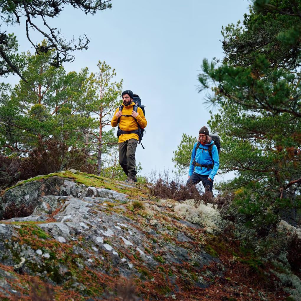
two hikers walking across a rock in the forest
Nature Getaways
Nature Getaways

7 Nature Hikes Near Chicago

After a busy week of work in the fast-paced city of Chicago, escaping for a breath of fresh air is an essential way to recharge.

While visitors may not come to the Windy City in search of a nature experience, locals know that there is much more to Chicago than meets the eye. Within a relatively short drive, you can be immersed among the towering dunes of Indiana Dunes National Park, explore vertical sandstone cliffs at Starved Rock State Park, or watch bison retake their natural prairie habitat in Midewin National Tallgrass Prairie. In this guide we’ll highlight seven outdoor getaways for Chicagoans to get their dose of nature without a long, burdensome drive.

Nature Getaways

Indiana Dunes National Park

Length

1-5 miles


Difficulty

Easy to moderate


Restrooms

Available throughout the park

Dog friendliness:

Dogs allowed on leash

Parking

Various access points; $25 per vehicle, $20 per motorcycle, $15 per person on bicycle or foot; passes are valid for seven days

Hours:

Varies in each area of the park, for example: West Beach and Porter Beach are open 6 am to 9 pm, Kemil Beach is open 24 Hours, and all other beach areas are open from 6 am to 11 pm

Trail Details:

From the shores of Indiana Dunes National Park you can see the skyline of Chicago across Lake Michigan. Just a one-hour drive east of the city, the park’s ecosystems of expansive beaches, thick forest canopies, and shifting dunes feel worlds away from the bustle of city life. Granted national park status in 2019, Indiana Dunes is one of the nation’s newest parks, boasting 13,000 preserved acres, 15 miles of Lake Michigan's coast, and 15 trail systems that stretch over 50 miles. Its proximity to Chicago makes it a quick and convenient escape to find a slower pace in the outdoors.

One of the most popular hiking trails is the Succession Trail at West Beach – a one-mile loop that climbs 75 feet up to the top of Diana’s Dune via a long staircase. For a longer hike, the 4.7-mile Cowles Bog Trail offers a variety of habitats including ponds, marshes, black oak savannas, and beaches. Don’t be afraid to check out the park outside of the summer season for more solitude away from the summer crowds.

Nature Getaways

Starved Rock State Park

Length

1-8 miles


Difficulty

Easy to moderate


Hours:

7 am to sunset

Parking

Free

Restrooms

Available throughout the park

Dog friendliness:

Dogs allowed on leash

Trail Details:

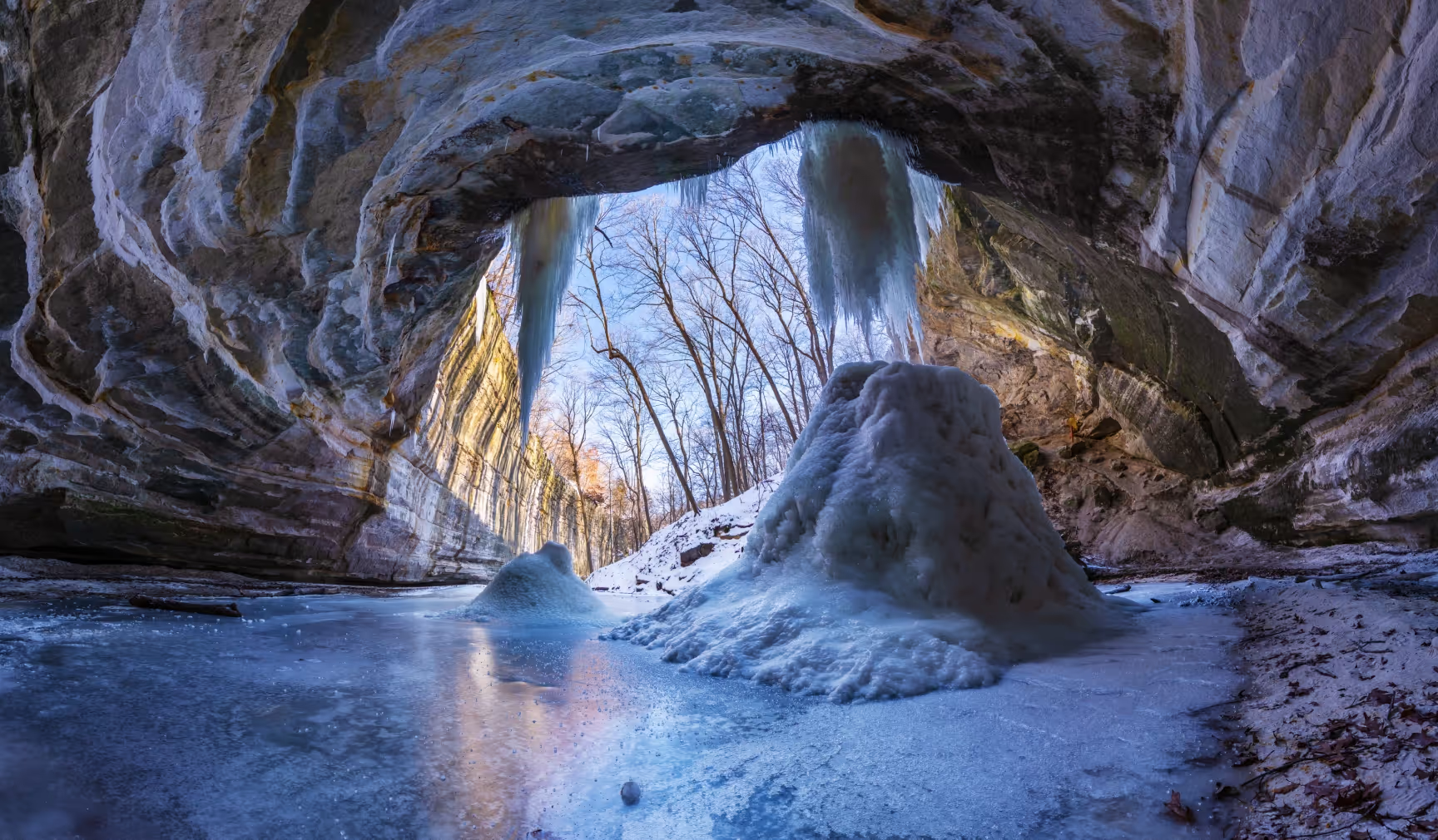
Starved Rock, the most visited state park in Illinois, sits on the banks of the Illinois River southwest of Chicago. A striking contrast to the typical central plains landscape, the park is renowned for its 18 sandstone canyons carved by floods from retreating glaciers 14,000 to 17,000 years ago. These canyons feature dramatic overhangs and rain-fed waterfalls, surrounded by dense forests of oak, maple, hickory, pine, and cedar.

There’s something for everyone at Starved Rock, whether you want a short stroll or a long hike. You can climb up to Sandstone Point overlook, check out St. Louis Canyon’s waterfall, or explore the depths of Wildcat Canyon, among many other trails.

NATURE GETAWAYS

Midewin National Tallgrass Prairie

Length

1-10 miles


Difficulty

Easy to moderate


Hours:

4 am to 10 pm

Parking

Free at trailheads

Restrooms

Yes, available at trailheads

Dog friendliness:

Dogs allowed on leash

Trail Details:

Located in the town of Wilmington just an hour’s drive from downtown Chicago, Midewin National Tallgrass Prairie offers a quick escape into nature with 18,225 acres of land and 34 miles of trails, 12 of which are reserved for hiking. The park is a model of habitat restoration, returning vast areas to their original prairie state and reintroducing bison, which once roamed the region in abundance.

For the best chance of spotting grazing bison, hike the Group 63 Loop Trail and bring binoculars in case they are at a distance. To experience the array of habitats within the park, check out the Prairie Creek Woods Trail where you can find ponds, woodlands, and restored tallgrass prairie.

Nature Getaways

Waterfall Glen Forest Preserve

Length

9.3 miles


Difficulty

Easy to moderate


Hours

One hour after sunrise to one hour after sunset

Parking

Free, three parking lots in the park

Restrooms

Yes, at entrance parking lots

Dog Friendliness

Dogs allowed on leash

Trail Details:

Out on the edge of Chicago’s suburban sprawl, Waterfall Glen Forest Preserve is a popular hike among city dwellers to get a dose of rolling hills, thick forests, and diverse wildlife. The park, which features 11 miles of trails over its 2,503 acres, is known for its ecological diversity of fauna, birds, fish, amphibians, reptiles, and mammals.

A popular route is the Waterfall Glen Trail. This 9.3-mile well-maintained loop showcases the park's main attractions: Rocky Glen waterfall, the scenic overlooks over DesPlaines River and Sawmill Creek, and savannas and prairie ecosystems. Don’t be afraid to visit outside the summer months, as a snowshoe exploration can be just as fun in the park.

Nature Getaways

Moraine Hills State Park

Length

1-6 miles


Difficulty

Easy to moderate


Hours

Varies by season, but it’s a day-use area only so plan on returning to your car before sunset

Parking

Free throughout the park

Restrooms

Yes, available at day-use areas

Dog Friendliness

Dogs allowed on leash

Trail Details:

Moraine Hills State Park is an excellent example of Illinois’ glacial history. From the glacier-formed lakes to the moraine deposits, hiking around the park provides a geology lesson about the formation and retreat of glaciers in the area thousands of years ago. The 48-acre Lake Defiance is one such glacial lake and one of the few examples in Illinois that remains unaltered, essentially left in its original state.

The 2,200-acre park is composed of lakes and wetlands with more than 10 miles of trails. The area is particularly known for its biodiversity, featuring more than 200 species of birds that frequent the park. Great blue herons and green herons come to feed in the park’s marshes during their summer migration.

For an introduction to the park, take the Lake Defiance Trail – a 3.8-mile loop around the largest lake in the park. And leave the headphones at home; listening to the chirping birds is a must to fully experience Moraine Hills.

Nature Getaways

Deer Grove Forest Preserve

Length

1-7 miles


Difficulty

Easy to moderate


Hours

Sunrise to sunset

Parking

Free, several parking lots in the park

Restrooms

Yes, throughout the park

Dog Friendliness

Dogs allowed on leash

Trail Details:

Northwest of Chicago in the town of Palatine, rolling upland forest, wooded ravines, wetlands, and prairies await at Deer Grove Forest Preserve. The park spans 2,000 acres and is traversed by both paved and unpaved trails. While strolling through the quiet woodlands, keep an eye out for the white-tailed deer, the park’s namesake.

A popular hike in Deer Grove is the Yellow Loop Trail, which gives hikers a taste of the woodlands, deep ravines, and quaint bridges. If visiting in the spring, keep an eye on the vernal ponds that form and provide habitats for amphibians like blue-spotted salamanders and chorus frogs.

Nature Getaways

Illinois Beach State Park

Length

1-3 miles


Difficulty

Easy


Hours

8 am to sunset

Parking

Free, parking lots in the North Unit and South Unit

Restrooms

Yes, several throughout the park

Dog Friendliness

Dogs allowed on trails and in campgrounds/picnic areas while on leash; dogs not allowed on beach or nature preserve

Trail Details:

Illinois has 63 miles of shoreline along Lake Michigan, but most of it has been developed. The last remaining swath of pristine shore is protected within Illinois Beach State Park. The 6.5 miles of lakeshore and 4,160 acres of land feature ever-shifting dunes, oak savannas, marshland, and rivers.

The park is split into two areas – the North Unit and South Unit – which each have their own trail systems. A popular choice is the Dead River Trail in the South Unit. The 2.5-mile loop crosses a variety of ecosystems before it reaches the Dead River, which alternates between free-flowing and blocked due to sand build-up at its mouth into Lake Michigan.

Read Full Article
outdoor adventurer and influencer
Gear

Fjällräven Chicago

Gear

Fjällräven 

Chicago Stores

Gear recommendations from the Fjällräven Chicago stores.

Expedition Lätt Hoodie

Expedition Lätt Hoodie is a lightweight, pliant reinforcement jacket perfect for a range of winter activities. Padded with 100% recycled polyester free-fibre insulation that gives a down-like puffiness and loft.

Shop Men's Shop Women's

Singi X Trousers

Hardwearing and comfortable G-1000 trekking trousers. They have multiple functional pockets, integrated ventilation and an integrated, detachable webbing belt.

Shop Men's Shop Women's

Skule 28

This 28L backpack is perfect for everyday trips to school or work and just as suitable for day hikes. Made from hardwearing, water-repellent Oxford fabric in recycled polyester.

Expedition Fleece Hoodie

Comfortable, warm and hardwearing fleece hoodie made from a blend of recycled polyester, virgin polyester and elastane. The polyester fleece fabric will wick moisture away from base layers and dry quickly.

Shop Men's Shop Women's
male hiker looking out over a large lake
Hiking and Denver Are Inseparable

7 Trails Within an Hour of Denver

Denver’s allure lies in its proximity to breathtaking natural landscapes. With the high plains giving way to the majestic Rocky Mountains, the area is a gateway to a network of trails so extensive that it can take a lifetime to explore.

Fortunately, you don’t need to venture far from the city to discover a wealth of stunning hiking options. Within just an hour’s drive, you can access trails stretching from Boulder to Colorado Springs and beyond. In this guide, we’ll highlight seven exceptional hikes that never fail to provide a quality outdoor experience.

Hiking and Denver Are Inseparable

Garden of the Gods Trail

Length

1-6 miles


Difficulty

Easy to moderate


Hours:

5 am to 9 pm (Nov 1 to April 30); 5 am to 10 pm (May 1 to Oct 31)

Parking

On-site, free

Dog friendliness:

Dogs allowed on leash

Restrooms

Yes

Trail Details:

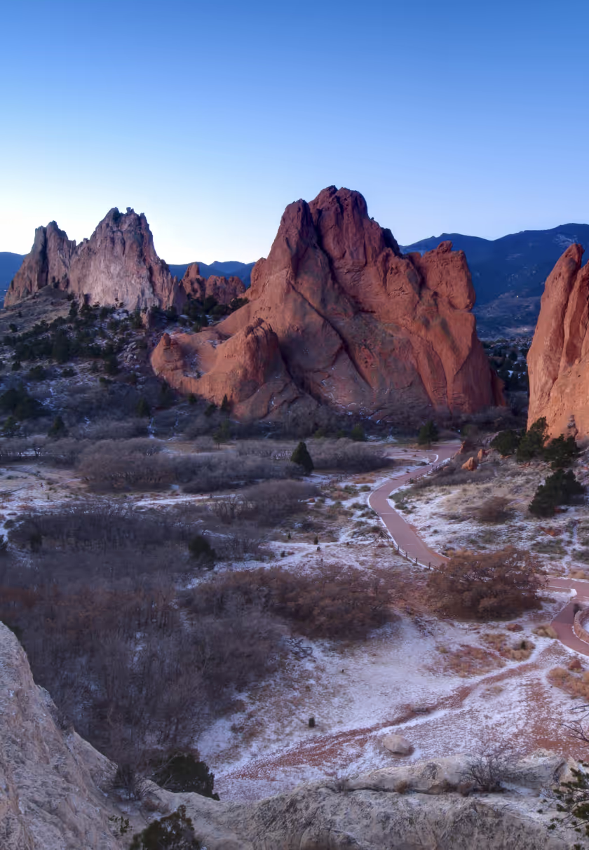
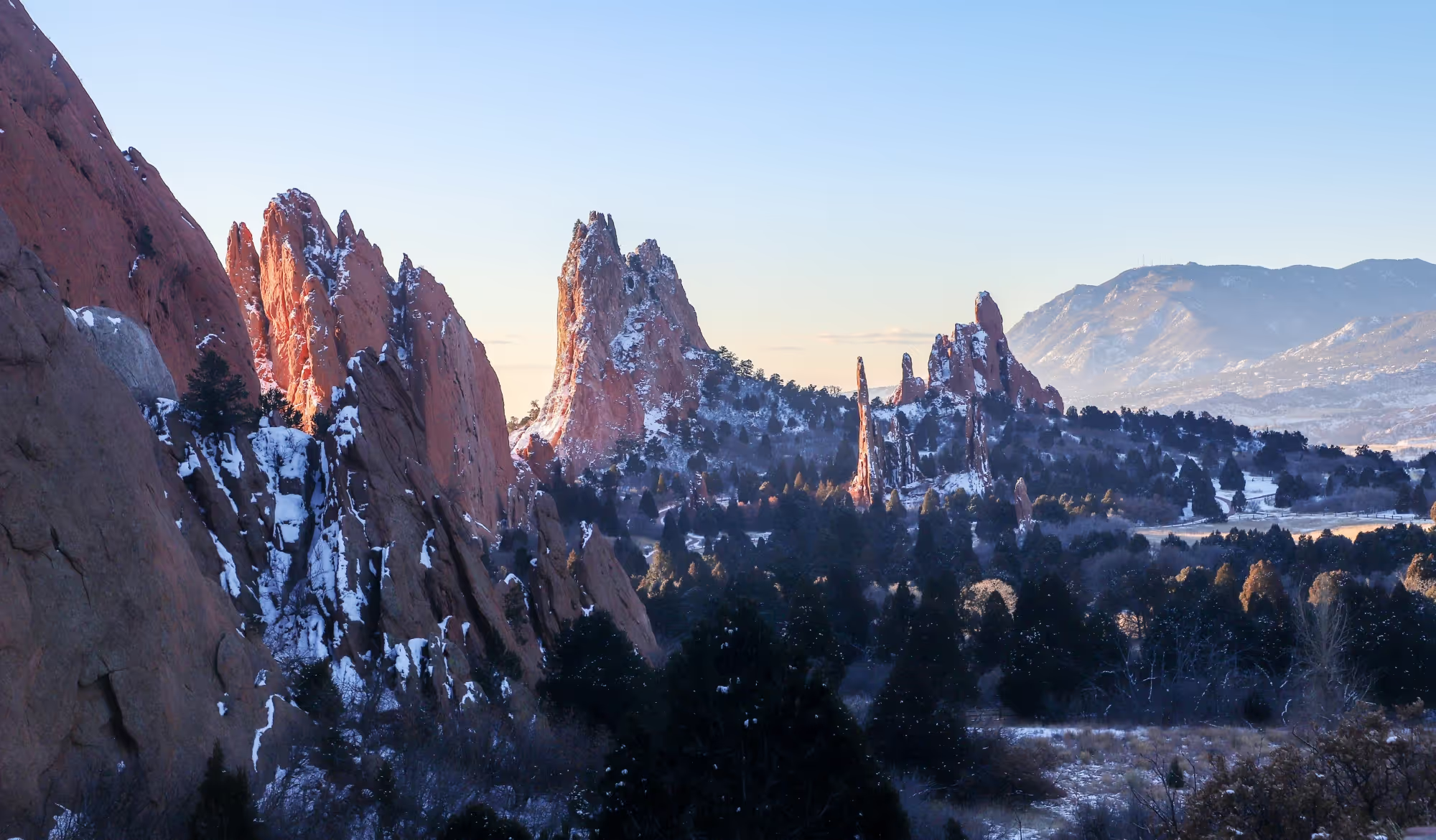
Located just outside Colorado Springs, Garden of the Gods is a stunning getaway for hikers of all abilities. In a little over an hour’s drive from Denver, you can immerse yourself among the vertically thrust sandstone, limestone, and conglomerate rock formations that have made the park a favorite for Colorado hikers. Two million visitors explore its 1,300 acres and 21 miles of trails annually.

Garden of the Gods caters to everyone. Hikers looking for something easy can try the paved Perkins Central Garden Trail, a 1.1-mile loop that visits the highest rock formations in the park. If you’re seeking a longer hike, the 6-mile Outer Loop Trail provides added distance and elevation change.

Hiking and Denver Are Inseparable

Mount Sanitas Peak Trail

Length

3.2+ miles

Difficulty

Difficult

Hours:

Accessible 24 hours

Parking

Free at trailhead, possible to walk from town

Dog friendliness:

Dogs allowed on leash

Restrooms

Yes

Trail Details:

A visit to Boulder is not complete without summiting Mount Sanitas. The 6,800-foot peak on the west side of the city is perhaps the most popular trail for locals. Getting to the top of Sanitas requires 1,300 feet of elevation gain and at least 3.2 miles of hiking depending on whether you decide to do an out-and-back or take one of several loop options on the return trip. From the summit, you’ll enjoy 360-degree views of the entire city and Front Range.

Hiking and Denver Are Inseparable

Royal Arch Trail from Chautauqua

Length

3.3 miles

Difficulty

Difficult

Hours:

5 am to 11 pm

Parking

Paid parking on weekends and summer holidays, $2.50 per hour; free during weekdays, and outside of summer season; free parking is also available in surrounding neighborhoods

Dog friendliness:

Dogs allowed on leash

Restrooms

Yes, at the Chautauqua Ranger Cottage

Trail Details:

In addition to Sanitas, the other must-visit hike in Boulder is the 3.3-mile climb to Royal Arch in Chautauqua Park. The trail features several uphill and downhill sections, climbing 1,400 feet up into the iconic Flatirons south of the city. The reward at the top is a large sandstone arch, along with sweeping views that stretch from Boulder to Denver on clear days.

Given its popularity among the Boulder hiking community, the trail can get busy on weekends and holidays, so be sure to get an early start to avoid the congestion.

Hiking and Denver Are Inseparable

North Table Mountain Trail

Length

2.8 miles

Difficulty

Moderate

Hours:

One hour before sunrise to one hour after sunset

Parking

Free at trailheads

Dog friendliness:

Dogs allowed on leash

Restrooms

Yes, at West Trailhead, Golden Cliffs Trailhead, and East Access

Trail Details:

If you are in Denver and short on time for a hike, North Table Mountain in Golden is a perfect choice to get your outdoor fix. The 2,000-acre park sits on a 60-million-year-old lava flow that rises several hundred feet above the surrounding plains. Once you ascend the several hundred feet to the mesa, the trails are relatively flat and there are several loop options to choose from among the 15 miles of trail.

North Table Mountain is open for hiking year-round, but it’s especially beautiful in the spring and early summer when wildflowers are in bloom. The Tilting Mesa to Mesa Top loop is a popular trail in the park, climbing 500+ feet over 3.2 miles on the west side of the mesa.

Hiking and Denver Are Inseparable

Lair o’ the Bear Trail

Length

1.6 miles

Difficulty

Easy to moderate

Hours:

One hour before sunrise to one hour after sunset

Parking

Free at trailheads

Dog friendliness:

Dogs allowed on leash

Restrooms

Yes, at Lair o’ the Bear Park trailhead

Trail Details:

Just over thirty minutes west of Denver, Lair o’ the Bear Park is the perfect spot for a family outing. The wide, flat trails that border Bear Creek and ample picnic areas make it an ideal hike for kids to tag along. The 1.5-mile Bruin Bluff Trail is an easy introduction to the park, while those who want a challenge can climb over 1,000 feet to Panorama Point.

On your way out of the park, don’t forget to make a pit stop at Red Rocks Ampitheatre for a quick stroll around the trails of the iconic venue.

Hiking and Denver Are Inseparable

Chief Mountain Trail

Length

2.8 miles

Difficulty

Moderate

Hours:

Sunrise to sunset

Parking

Free; pullout on Highway 103

Dog friendliness:

Dogs allowed on leash

Restrooms

None

Trail Details:

For an easy yet immersive experience of the beauty that the Rocky Mountains provide, Chief Mountain is just a quick one-hour drive from Denver. The trail is short but steep, climbing nearly 1,000 feet over 1.4 miles to the peak. You’ll travel through dense alpine forests, exit the tree line to experience a Rocky Mountain tundra ecosystem, and reach the summit at 11,713 feet. The views from Chief Mountain are expansive, with one of Colorado’s iconic 14ers, Mt Evans, visible to the west.

Chief Mountain can be hiked during all seasons, but be sure you are properly equipped with traction if you visit during the snowy months.

Hiking and Denver Are Inseparable

Devil’s Head Loop Trail

Length

2.8 miles

Difficulty

Moderate

Hours:

One hour before sunrise to one hour after sunset

Parking

Free at trailhead

Dog friendliness:

Dogs allowed on leash

Restrooms

Yes, at trailhead

Trail Details:

The hike to Devil’s Head provides classic panoramic views of the Front Range and a glimpse into Colorado's history. The lookout tower atop the granite outcropping is the last of seven such towers that were once operated on the Front Range. The Devil’s Head tower, which was built in 1919 and rebuilt in 1951, is the last in operation and has been added to the National Register of Historic Places.

Perched at over 9,700 feet atop the Rampart Range, the hike up to the tower ascends nearly 900 feet over 1.4 miles. The trail winds through towering aspen groves and interesting rock formations before it reaches the final 143 steps that lead to the top.

Read Full Article
dawn in a desert landscape in us
Gear

Fjällräven Denver

Gear

Fjällräven 

Denver

Gear recommendations from the Fjällräven Denver store.

Expedition Pack Down Hoodie

Expedition Pack Down Hoodie is a lightweight, flexible hooded down jacket for winter activities. Perfect as a reinforcement garment on top of or under a shell jacket.

Shop Men's Shop Women's

Keb Agile Winter Trousers

Created to be your favourite all-round trekking trousers in cold conditions, Keb Agile Winter Trousers are soft-shell winter trousers made of a double-weave, four-way stretch fabric with a brushed inside that makes them both warm and extremely comfortable.

Shop Men's Shop Women's

Ulvo 30

A daypack for everything – well almost in any case. Ulvö 30 is as versatile and hardwearing as its smaller sibling, but offers more volume and a second compartment inside that makes it easy to separate work and training gear.

Singi Flannel Overshirt

Perfect for all kinds of casual outdoor activities, this long-sleeved flannel shirt in a heavy organic cotton twill can be worn both as a light jacket and a shirt over a t-shirt or base layer.

man wearing a checked overshirt by Fjallraven
woman wearing a checked overshirt by Fjallraven
Shop Men's Shop Women's
Location

1510 Platte St.
Denver, CO 80202
(720)-452-6300

two hikers walking across a rock with large lake in distance
Hiking and Denver Are Inseparable
Outdoor adventures Year-round in The Six

6 Winter Nature Trails in Toronto

Toronto is a vibrant city celebrated for its global cuisine, championship sports, and diverse communities. While the city pulses with world-class culture, its true heartbeat lies in its unique balance between urban life and natural spaces. In Toronto, nature isn’t a distant escape. It’s woven into the city’s fabric. Trails run alongside rivers and through neighborhoods and parks across the city—all seamlessly connected through public transit routes to create an urban ecosystem where the outdoors feels effortlessly accessible.

These green corridors are the gateway to experiencing the full essence of the Queen City. Here’s a look at the parks and trails you won’t want to miss on your next visit to Toronto.

Outdoor adventures Year-round in The Six

Toronto Beltline

Length

Up to 8 miles

Difficulty

Easy

Hours:

24 hours; year round

Parking

Paid parking at nearby rail stations

Dog friendliness:

Dogs allowed on leash

Restrooms

Yes, some locations are seasonal from May-October

Trail Details:

Located just outside Colorado Springs, Garden of the Gods is a stunning getaway for hikers of all abilities. In a little over an hour’s drive from Denver, you can immerse yourself among the vertically thrust sandstone, limestone, and conglomerate rock formations that have made the park a favorite for Colorado hikers. Two million visitors explore its 1,300 acres and 21 miles of trails annually.

Like many cities in North America, Toronto heavily relied on railway infrastructure for about a century, beginning in the mid-1800s. In the late 80s and early 90s, Toronto joined the Rail to Trails movement—converting many abandoned rail lines into public trails, including the Toronto Beltline. This multi-use pathway follows the historic Toronto Belt Line Railway through the Rosedale, Moore Park, Forest Hill, Chaplin Estates, and Fairbank neighborhoods on the northeast side of the city. The 8-mile trail has three sections, with multiple access points along the route.

If you’re new to the area, opt for the central Kay Gardner Beltline Trail, accessible via the Davisville Station. The most developed of the three sections, this 5.5-mile stretch winds through forested areas and connects to public gardens, murals, and parks.

Outdoor adventures Year-round in The Six

Humber River

Length

11.5 miles

Difficulty

Easy

Hours:

24 hours a day; year round

Parking

Public parking at the trail access point

Dog friendliness:

Dogs allowed on leash

Restrooms

Yes, some locations are seasonal from May-October

Trail Details:

As one of two rivers flanking Toronto, the Humber River is part of the city’s largest watershed and is important in supporting native wildlife. Explore the river on the paved Humber River Recreational Trail, which stretches 11.5 miles from the north end of the city to Humber Bay, where the river flows into Lake Ontario. To enjoy a popular section of the trail, start at the Old Mill Station, just north of King’s Mill Park. Look for impressive ice jams that often form at the Old Mill Bridge in winter. In the summertime, you can usually spot anglers landing trout, pike, and salmon from this bridge. Then, make your way south to the waterfront, where you can enjoy the views of Lake Ontario before crossing the river via the pedestrian-only Humber Bay Arch Bridge.

Outdoor adventures Year-round in The Six

High Park

Length

3 miles

Difficulty

Easy

Hours:

24 hours a day; year round

Parking

On-site at Parkside Drive and High Park Boulevard

Dog friendliness:

Dogs allowed on leash

Restrooms

Yes, some locations are seasonal from May-October

Trail Details:

At nearly 400 acres, High Park is the biggest public green space in Toronto. Approximately two-thirds of the park remains in its natural state, including a 56-acre section of rare black oak savannah—the largest remaining ecosystem of its kind in the city. For an overview of the park, walk the High Park Loop. This 3-mile partially paved trail follows the shoreline of Grenadier Pond on the park perimeter, past the grasslands, and through a forested area in the northeastern corner of the park.

Don’t miss a chance to check out the public art along the trail. Many of the works displayed in the park date back to the International Sculpture Symposium, held here in 1967.

Outdoor adventures Year-round in The Six

Scarborough Bluffs

Length

3-8 miles

Difficulty

Easy

Hours:

24 hours a day; year round

Parking

Paid lots on site

Dog friendliness:

Dogs allowed on leash

Restrooms

Yes

Trail Details:

Located on the eastern side of Toronto, Scarborough Bluffs stretches nine miles along the shoreline of Lake Ontario. Thousands of years of wind and erosion exposed the 12,000-year-old sedimentary deposit visible here today.

Take in stunning views of the majestic cliffs that plunge into the lake on the Scarborough Bluffs Trail. This 3.5-mile loop hugs the shoreline before leading out on a spit of land past Bluffer’s Park Marina that offers views of the lake. Then, continue to Cathedral Bluffs Lookout. As the highest point on the Scarborough Bluffs, this overlook provides some of the best views along the trail.

Outdoor adventures Year-round in The Six

Don River

Length

6 miles

Difficulty

Easy

Hours:

24 hours a day; year round

Parking

Street parking available nearby

Dog friendliness:

Dogs allowed on leash

Restrooms

Available at Evergreen Brick Works

Trail Details:

Parallel to the Humber River, the Don River flows on the east side of Toronto. Although the Don River has seen more development than the Humber over the course of Toronto’s history, the river corridor offers a slice of nature amid the hustle and bustle of the city. Explore the 6-mile, multi-use Don River Trail, which runs alongside the river and connects several city parks. Pass through a mix of landscapes, including forested areas, open fields, and wetlands.

At the south end of the trail, check out Evergreen Brick Works. Once an industrial brick factory, the building now serves as a hub for community events and pop-up markets throughout the year.

Outdoor adventures Year-round in The Six

Tommy Thompson Park

Length

7.6 miles

Difficulty

Easy to Moderate

Hours:

Weekdays 4 to 9 p.m.; weekends and holidays 5:30 a.m. to 9 p.m.

Parking

Free lot; additional street parking available

Dog friendliness:

Dogs not allowed

Restrooms

Multiple throughout the park

Trail Details:

Step away from the industrial noises ubiquitous with modern living at Tommy Thompson Park on the edge of the city. Known locally as The Spit, this park sits on a small peninsula that juts into Lake Ontario.

To best experience the park, hike the 7.6-mile Leslie Street Spit Trail, which passes through reclaimed natural habitats, including wetlands, forests, and meadows. Once part of an industrial dumping ground, these ecosystems have been carefully rehabilitated and now function as a wildlife preserve that’s home to more than 300 species of bird and other wildlife. At the tip of the spit, you’ll find the park’s iconic lighthouse and some of the best views. From this unique position, visitors can enjoy views of the Toronto skyline as they look back toward the city.

Gear

Fjällräven Denver

Gear

Fjällräven 

Toronto

Gear recommendations from the Fjällräven Toronto store.

Expedition Long Down Parka

Expedition Long Down Parka is an extra-long parka version of the classic Expedition Down Jacket from 1974. Just as comfortable for everyday use as for forest walks or ice fishing outings, where the roomy hood and generous length protect against cold winds.

Shop Men's Shop Women's

Abisko Winter Stretch Trousers

Created to be your favourite all-round trekking trousers in cold conditions, Abisko Winter Stretch Trousers are soft-shell winter trousers made of a double-weave, four-way stretch fabric with a brushed inside that makes them both warm and extremely comfortable.

Shop Men's Shop Women's

Skule 28

This 28L backpack is perfect for everyday trips to school or work and just as suitable for day hikes. Made from hardwearing, water-repellent Oxford fabric in recycled polyester.

Övik Lite Fleece Half Zip

Lightweight microfleece sweater with a half-length zipper for hiking and everyday outdoor life, made from recycled polyester. Timeless design with raglan sleeves and carefully placed seams to reduce the risk of chafing under backpack straps and give superior comfort and freedom of movement.

Shop Men's Shop Women's
Hiking and Denver Are Inseparable
Rail to Trail

NYC’s 7 Best Hikes Accessible by Train

When you think of New York City it’s easy to imagine peaking skyscrapers, swarms of yellow taxi cabs, bustling sidewalks, flashing lights, and billboards. After all, it is the concrete jungle. For Fjallraven, New York City is all about being outside. A city with as much to offer as New York there’s always something to do on every block. But beyond the lights and iconic buildings lies the natural areas and green spaces that are just as quintessentially New York as a day spent roaming SoHo. These are the pockets of New York City that remind us to take a moment to pause amid all the hustle. Green spaces provide a necessary reset so what better place than in the entertainment capital of the world

New York is made up of five boroughs connected by transit. Half the adventure in New York is getting on the train to your destination. So here are the best trails just a train ride away.

Rail to Trail

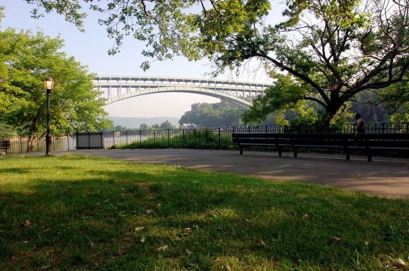
Inwood Hill Park (Manhattan)

Length

2 miles

Difficulty

Easy

Hours:

6 a.m. to 1 a.m.

Parking

Paid parking at nearby rail stations

Dog friendliness:

Dogs allowed on leash

Restrooms

Yes

Trail Details:

The only forest in Manhattan is just off the A-line in Uptown. The orange trail at Inwood Hill Park is a 1.5 mile breezy loop that includes red and black oak trees, softwood pines, and some wild birch. This green space is right off the Hudson River, so after some quality forest bathing, make your way near the water for a pleasant discovery. Inwood Hill provides a peaceful hike for bird-watching, especially as a group. Keep an eye out for Barred owls, Red-tailed hawks, and some migratory fowls. The original natives of the land, the Lenape people, used this forest as a seasonal campsite. You can still view some of their caves in this part of Inwood.

If you’re in the mood to keep strolling, waltz over to Fort Tryon Park. It’s a gothic, elf-haven park resembling a piece of Tolkien lore here on our middle earth. Make your way through the ridge past the museum (the Cloisters) all the way back to 190th Street. Treat yourself to a Washington Heights delicacy, the udon noodles at Tampopo Kitchen. Enjoy it at the highest natural point in Manhattan, Bennett Park.

Rail to Trail

Pelham Bay Park (The Bronx)

Length

3.5  miles

Difficulty

Easy

Hours:

6 a.m. to 10 p.m.

Parking

On-site (free parking at Orchard Beach Lot)

Dog friendliness:

Dogs allowed on leash

Restrooms

Yes

Trail Details:

Take the 6 train from Canal Street heading to the Bronx and get off at Buhre Avenue. A five-minute bus ride on the 0045 or a two-minute bike ride and you’ll find yourself in New York City’s largest park, Pelham Bay Park. Here you can choose your adventure, from seaside trails (Kazimiroff trail) to deeply forested ones (Siwanoy trail). Pelham Bay Park is vastly remote. A perfect place to log off while ladened with water features. It’s forked by the Hutchinson River, and you can even find a glacial erratic here. During the Summer and Fall the park lights up with festive programs celebrating Native American heritage, environmental stewardship, Merengue and Bachata workshops, and movie screenings.

Via bike, a local favorite adventure at Pelham Bay is cutting through Shore Road Greenway, going past Split Rock Golf Course, until you’re in the sprawl of white oaks and the road comes out into a Westchester neighborhood and on the left you find the finest greasy establishment in New Rochelle, Leno’s Clam Bar. Get the cheese burger on the kaiser roll.
Bring your own beer, it’s a New York specialty.

Rail to Trail

Idlewild Park (Queens)

Length

I mile

Difficulty

Easy

Hours:

9 a.m. to 9 p.m.

Parking

Off-site, free

Dog friendliness:

Not allowed

Restrooms

No

Trail Details:

Let’s go under the East River (on the J train) to Queens to a nature preserve that’s part saltmarsh and full coastal forest. A short stroll here in southeast Queens opens you up to a world of culture (Queens is known for its open markets). Idlewild Park embodies Queens in the variety of life you’ll find in its ecosystem. Crabs, mussels, marsh birds, and at times even Canada Geese make their residence here. The wildlife here shows you a better understanding of our place in the web of these natural spaces. Idlewild implores an existential restoration of our commitment to the natural world. There’s weekly programs dedicated to taking care of the park. Do your part .

Idlewild Environmental Learning Center does an exceptional job of reconnecting New Yorkers to the green spaces that stabilize our hurried lives. Every Saturday there’s yoga provided by the environmental center. Through exploratory workshops and open classrooms, Idlewild Park reminds us of the environmental responsibility we all have to the world around us.    

Rail to Trail

Central Park- Hallett Nature Sanctuary (Manhattan)

Length

1 mile

Difficulty

Easy

Hours:

10 a.m. until sunset

Parking

Paid lots on site

Dog friendliness:

No dogs allowed

Restrooms

No

Trail Details:

Despite New York being more than just Manhattan. Everyone spends a majority of their time here. So off  the A train, you step out on Columbus Circle and walk east on West 59th Street. You’ll find a wooden gate plotted in the south east corner of Central Park. Hallett Nature Sanctuary. This four acre oasis is Central Park’s smallest wooded area preserved within it,
a world of fulfillment.

Restored in 2016, Hallett Nature Sanctuary carries a kind of nourishment that supplements the thrill of the city. A sweetness blooms here among the birds, the radiant plants and glass pond. Coming here you get a chance to reflect on life, the day, or what to have for lunch.
The best part of coming here is knowing you’re moving at the same pace as the cars stuck on 5th Avenue. The stillness you find at the sanctuary is just the right mode of transportation for any day. The Hallett Nature Sanctuary takes you to a space between a dream and the azaleas you find along the way. A visit to the MoMa is encouraged.

Rail to Trail

Fresh Creek Nature Preserve (Brooklyn)  

Length

1 mile

Difficulty

Easy

Hours:

6 a.m. to 1 a.m.

Parking

On-site, $5 per car  

Dog friendliness:

Dogs not allowed

Restrooms

No

Trail Details:

Parallel to the Humber River, the Don River flows on the east side of Toronto. Although the Don River has seen more development than the Humber over the course of Toronto’s history, the river corridor offers a slice of nature amid the hustle and bustle of the city. Explore the 6-mile, multi-use Don River Trail, which runs alongside the river and connects several city parks. Pass through a mix of landscapes, including forested areas, open fields, and wetlands.

A great place to look for oyster shells. There’s none but an appetite for tasty bivalves comes up after some time at Fresh Creek Nature Preserve. It might just be the salt marsh effect as you meander onto Fresh Creek Path. The A train, a quick transfer at Broadway Junction on the L, and a soft jaunt down East 105th brings you to this East Brooklyn haven.

Fresh Creek Nature Preserve is a soul-satisfying experience that shows the necessity of keeping wild places wild. Especially the ones that keep a community protected from floods. Life here is casual; the path encourages you to take your time and smell the flowers. The spiced Nigerian and Jamaican dishes at nearby EKO Restaurant will keep you satisfied. There might not be any oysters, but the oxtail dumplings will do.

Rail to Trail

Van Cortlandt Park (The Bronx)

Length

2-7 miles

Difficulty

Easy to Moderate

Hours:

6 a.m. to 1 a.m.

Parking

On-site, free

Dog friendliness:

Dogs allowed on leash

Restrooms

Yes

Trail Details:

Step away from the industrial noises ubiquitous with modern living at Tommy Thompson Park on the edge of the city. Known locally as The Spit, this park sits on a small peninsula that juts into Lake Ontario.

The Bronx really is slept on. In terms of variety, Van Cortlandt park provides the best hike for any pursuit. Right off the 1 train on 242nd Street the park is packed with trails for any style hiker. If you want a short trek, take the John Muir trail. If you’re seeking to stay balanced on some pavement, Putnam Trail is fitting. If you’re looking to keep your heart rate going but in a natural setting, take the Cross Country Course.

No matter your definition of a hike, Van Cortlandt has you covered. The forested areas carry a comfort to them. Here you can encounter a deep autumn, a layered winter, and a vibrant summer. The Bronx is infinite in its energy, and this park brings that out in all the best ways. There’s even an Oktoberfest-inspired hike put together by the Van Cortlandt Park Alliance. In need of a Cold beer off a fresh hike? Make your way to the Bronx Brewery, a local staple.

Rail to Trail

Prospect Park (Brooklyn)

Length

1 mile

Difficulty

Easy

Hours:

6 a.m. to 1 a.m.

Parking

On the streets (metered)

Dog friendliness:

Dogs allowed on leash

Restrooms

Yes

Trail Details:

Step away from the industrial noises ubiquitous with modern living at Tommy Thompson Park on the edge of the city. Known locally as The Spit, this park sits on a small peninsula that juts into Lake Ontario.

For the cream on top of a  refreshing New York experience (and editor’s favorite) head to central Brooklyn’s green fortress. Prospect Park. It’s a half-hour train ride from SoHo on the Q train. You can take the C train and then hop on the reliable Shuttle (S train) if you’re coming from the meatpacking district. There’s a smorgasburg of activities happening here year-round. Among nature walks there’s mushroom foraging, comedy shows, music showcases and a variety of cycling troupes, run clubs, and traditional Caribbean celebrations. It’s a  full New York City immersion here. Prospect Park is the city in every expression. And the natural element here keeps folks grounded as they walk their dogs, picnic, and sunbathe. ‌The Vale of Cashmere is a local go-to. It’s a short hike that allows Brooklynites to catch up with themselves. It’s a breath away from the city. Something you can easily lose track of in a city this grand.  

Read Full Article
Gear

Fjällräven Denver

Gear

Fjällräven 

NYC Stores

Gear recommendations from the Fjällräven NYC stores.

Keb Eco-Shell Jacket

Highly functional three-layer shell jacket in stretchy Eco-Shell. Minimalistic design with fixed hood, easily accessed chest pockets and ventilation openings at the sides. Produced without PFAS.

Shop Men's Shop Women's

Vidda Pro Ventilated Trousers

Durable trekking trousers with technical features, made from wind- and water-resistant G-1000. The model is based on our best-selling Vidda Pro but has improved ventilation options and a slimmer fit with stretch fabric in crotch so still has great freedom of movement.

Shop Men's Shop Women's

Expedition Pack Down Hoodie

Expedition Pack Down Hoodie is a lightweight, flexible hooded down jacket for winter activities. Perfect as a reinforcement garment on top of or under a shell jacket.

Shop Men's Shop Women's

Ulvo 30

A daypack for everything – well almost in any case. Ulvö 30 is as versatile and hardwearing as its smaller sibling, but offers more volume and a second compartment inside that makes it easy to separate work and training gear.

Gear

Fjällräven 

Chicago Stores

Gear recommendations from the Fjällräven Chicago stores.

Expedition Lätt Hoodie

Expedition Lätt Hoodie is a lightweight, pliant reinforcement jacket perfect for a range of winter activities. Padded with 100% recycled polyester free-fibre insulation that gives a down-like puffiness and loft.

Shop Men's Shop Women's

Singi X Trousers

Hardwearing and comfortable G-1000 trekking trousers. They have multiple functional pockets, integrated ventilation and an integrated, detachable webbing belt.

Shop Men's Shop Women's

Skule 28

This 28L backpack is perfect for everyday trips to school or work and just as suitable for day hikes. Made from hardwearing, water-repellent Oxford fabric in recycled polyester.

Expedition Fleece Hoodie

Comfortable, warm and hardwearing fleece hoodie made from a blend of recycled polyester, virgin polyester and elastane. The polyester fleece fabric will wick moisture away from base layers and dry quickly.

Shop Men's Shop Women's
rocky landscape
Trekking Bend’s Fiery Past

6 Volcanic
Hiking Trails

meadow next to a lake with mountains behind
Rail to Trail

NYC’s 7 Best Hikes Accessible by Train

Outdoor adventures Year-round in The Six

6 Ways to Enjoy Nature in the Heart of Toronto This Winter

icy cave view from inside
Nature Getaways

7 Nature Hikes Near Chicago to Escape City Life

city view of seattle
An Ultimate Guide

Winter Hiking in Seattle Without the Snow
rocky mountain skyline
Hiking and Denver Are Inseparable

7 Trails to Explore Within an Hour of Colorado’s Capital

man overlooking the golden gate bridge
San Francisco is a Hiker’s Paradise

7 Must-Visit Trails in the Bay Area

Discover the best adventures near ten North American cities with outdoor gear picks from Fjällräven.

influencer and film maker for outdoor adventers
Alyssa Gonzalez
Alyssa is an outdoor enthusiast based in Boulder, CO.  She is the co-founder of Treehouse Cyclery. When she's not in the shop or on two wheels, she's in the mountains.
outdoor adventurer and influencer
Cody Ferguson
Cody Ferguson moved to Colorado from Ohio so he could spend his life in the mountains.  He's an avid runner, cyclist, and hiker.
influencer on a beach
Micheli Oliver
Micheli is an adventure photographer and filmmaker based in Boulder, CO.