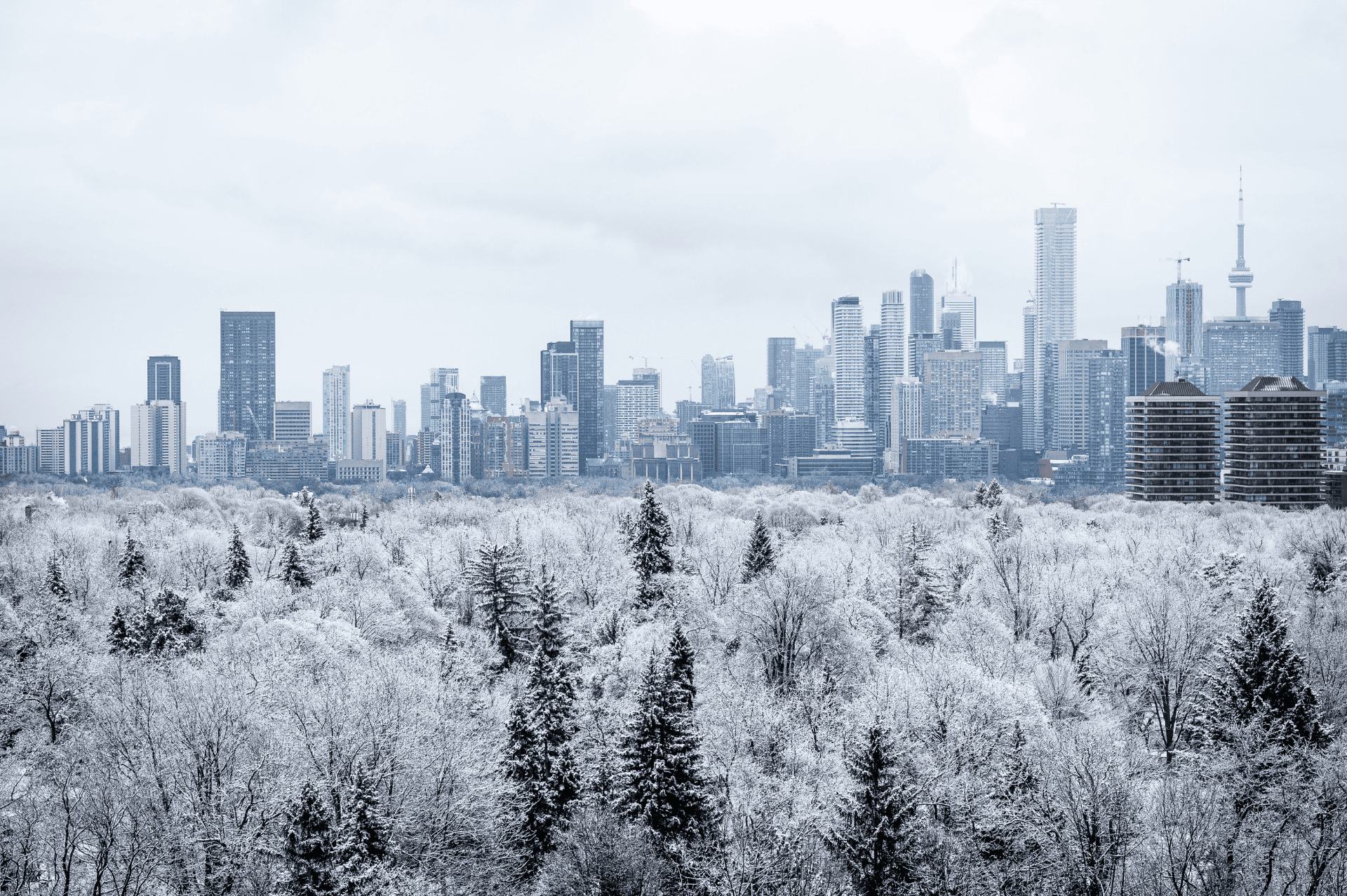
Toronto is a vibrant city celebrated for its global cuisine, championship sports, and diverse communities. While the city pulses with world-class culture, its true heartbeat lies in its unique balance between urban life and natural spaces.
In Toronto, nature isn’t a distant escape. It’s woven into the city’s fabric. Trails run alongside rivers and through neighborhoods and parks across the city — all seamlessly connected through public transit routes to create an urban ecosystem where the outdoors feels effortlessly accessible.
These green corridors are the gateway to experiencing the full essence of the Queen City. Here’s a look at the parks and trails you won’t want to miss on your next visit to Toronto.
1. Toronto Beltline
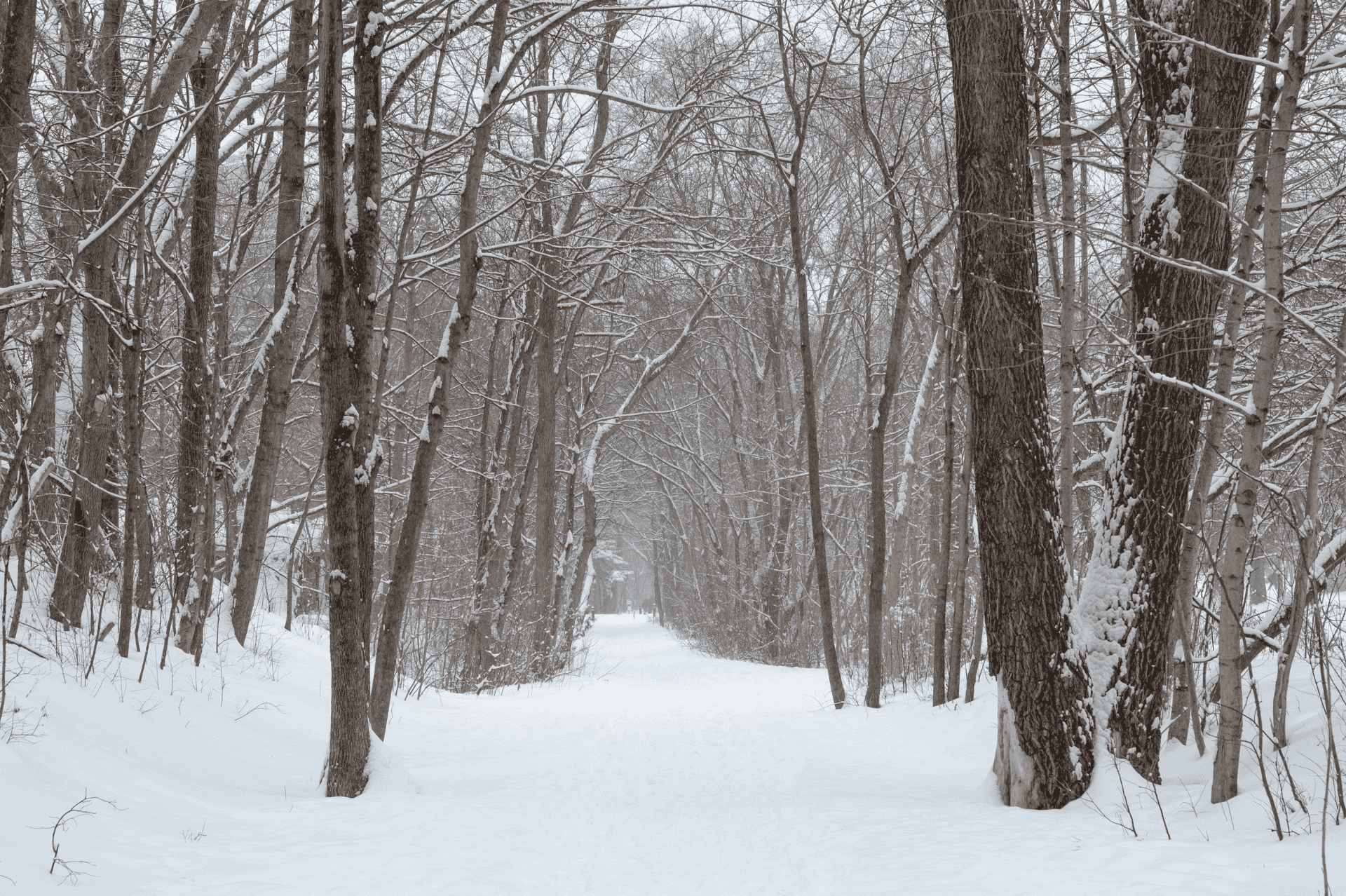
Like many cities in North America, Toronto heavily relied on railway infrastructure for about a century, beginning in the mid-1800s. In the late ’80s and early ’90s, Toronto joined the Rail to Trails movement — converting many abandoned rail lines into public trails, including the Toronto Beltline.
This multiuse pathway follows the historic Toronto Belt Line Railway through the Rosedale, Moore Park, Forest Hill, Chaplin Estates, and Fairbank neighborhoods on the northeast side of the city. The 8-mile trail has three sections, with multiple access points along the route.
If you’re new to the area, opt for the central Kay Gardner Beltline Trail, accessible via the Davisville Station. The most developed of the three sections, this 5.5-mile stretch winds through forested areas and connects to public gardens, murals, and parks.
- Length: Up to 8 miles
- Difficulty: Easy
- Restrooms: Yes, some locations are seasonal from May to October
- Parking: Paid parking at nearby rail stations
- Dog-friendliness: Dogs allowed on leash
- Hours: 24 hours; year-round
Expedition Long Down Parka
- Material: 100% polyamide (recycled)
- Filling: 90% goose down, 10% feather, 100% polyester (recycled)
- Activity: Trekking
- Features: Insulating, durable
- 5 pockets: Hand pocket(s), inner pocket(s)

2. Humber River
As one of two rivers flanking Toronto, the Humber River is part of the city’s largest watershed and is important in supporting native wildlife. Explore the river on the paved Humber River Recreational Trail, which stretches 11.5 miles from the north end of the city to Humber Bay, where the river flows into Lake Ontario.
To enjoy a popular section of the trail, start at the Old Mill Station, just north of King’s Mill Park. Look for impressive ice jams that often form at the Old Mill Bridge in winter. In the summertime, you can usually spot anglers landing trout, pike, and salmon from this bridge. Then, make your way south to the waterfront, where you can enjoy the views of Lake Ontario before crossing the river via the pedestrian-only Humber Bay Arch Bridge.
- Length: 11.5 miles
- Difficulty: Easy
- Restrooms: Yes, some locations are seasonal from May to October
- Parking: Public parking at the trail access point
- Dog-friendliness: Dogs allowed on leash
- Hours: 24 hours a day; year-round
Abisko Winter Stretch Trousers
- Material: 49% polyamide (recycled), 43% polyester, 8% elastane
- Activity: Trekking
- Features: Durable, stretch
- Clothing layer: Outerwear
- 3 pockets: Hand pocket(s), phone pocket
- Waist: High waist
3. High Park
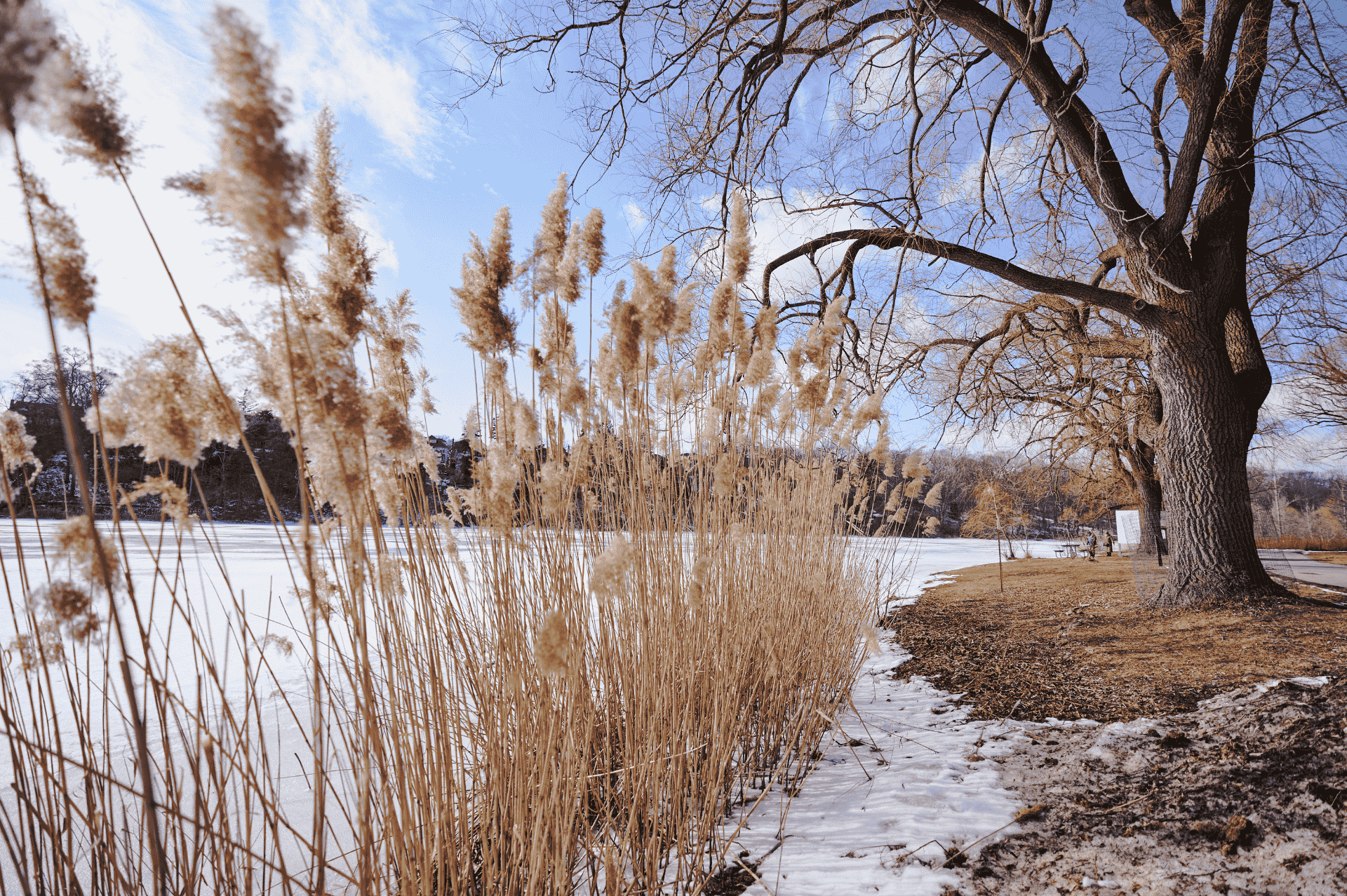
At nearly 400 acres, High Park is the biggest public green space in Toronto. Approximately two-thirds of the park remains in its natural state, including a 56-acre section of rare black oak savannah — the largest remaining ecosystem of its kind in the city.
For an overview of the park, walk the High Park Loop. This 3-mile partially paved trail follows the shoreline of Grenadier Pond on the park perimeter, past the grasslands, and through a forested area in the northeastern corner of the park.
Don’t miss a chance to check out the public art along the trail. Many of the works displayed in the park date back to the International Sculpture Symposium, held here in 1967.
- Length: 3 miles
- Difficulty: Easy
- Restrooms: Yes, some locations are seasonal from May to October
- Parking: On-site at Parkside Drive and High Park Boulevard
- Dog-friendliness: Dogs allowed on leash
- Hours: 24 hours a day; year-round
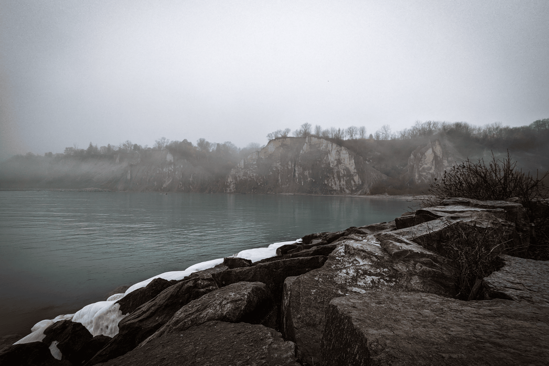
4. Scarborough Bluffs
Located on the eastern side of Toronto, Scarborough Bluffs stretches 9 miles along the shoreline of Lake Ontario. Thousands of years of wind and erosion exposed the 12,000-year-old sedimentary deposit visible here today.
Take in stunning views of the majestic cliffs that plunge into the lake on the Scarborough Bluffs Trail. This 3.5-mile loop hugs the shoreline before leading out on a spit of land past Bluffer’s Park Marina that offers views of the lake. Then, continue to Cathedral Bluffs Lookout. As the highest point on the Scarborough Bluffs, this overlook provides some of the best views along the trail.
- Length: 3-8 miles
- Difficulty: Easy
- Restrooms: Yes
- Parking: Paid lots on site
- Dog-friendliness: Dogs allowed on-leash
- Hours: 24 hours a day; year-round
Skule 28
- Material: 100% polyester 600D (recycled)
- Activity: Everyday outdoor
- Features: Durable
- 7 Pockets: Inside compartment, mesh pocket(s), outside stretch pocket(s), zippered inside pocket(s), zippered outside pocket(s)
- Height: 50 cm
- Width: 29 cm
- Depth: 18 cm
- Laptop size: 15"
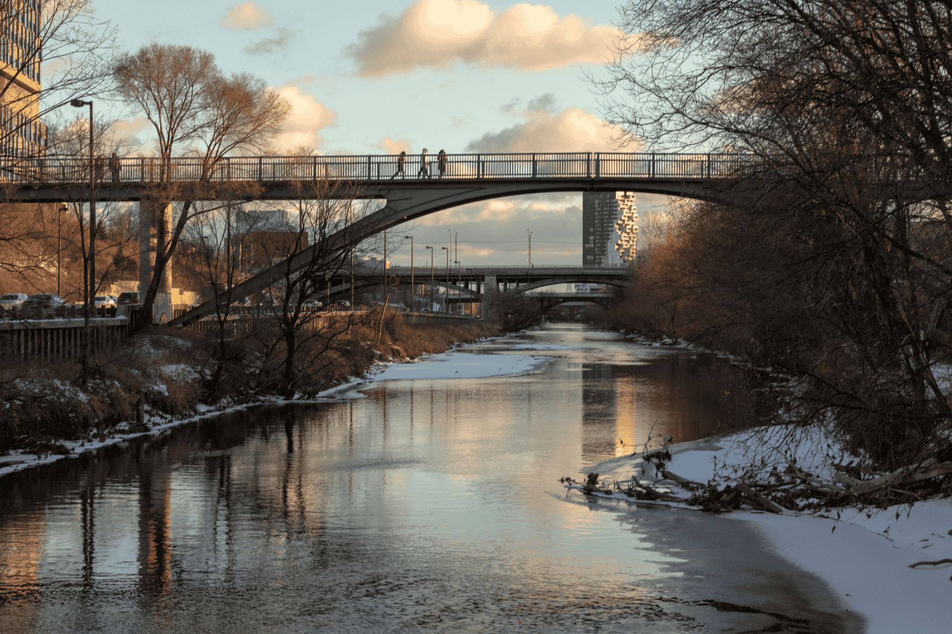
5. Don River
Parallel to the Humber River, the Don River flows on the east side of Toronto. Although the Don River has seen more development than the Humber over the course of Toronto’s history, the river corridor offers a slice of nature amid the hustle and bustle of the city.
Explore the 6-mile, multi-use Don River Trail, which runs alongside the river and connects several city parks. Pass through a mix of landscapes, including forested areas, open fields, and wetlands.
At the south end of the trail, check out Evergreen Brick Works. Once an industrial brick factory, the building now serves as a hub for community events and pop-up markets throughout the year.
- Length: 6 miles
- Difficulty: Easy
- Restrooms: Available at Evergreen Brick Works
- Parking: Street parking is available nearby
- Dog-friendliness: Dogs allowed on leash
- Hours: 24 hours a day; year-round
Övik Lite Fleece Half Zip
- Material: 100% polyester (recycled)
- Activity: Everyday outdoor
- Features: Lightweight
- Clothing layer: First layer, midlayer
- 1 pocket: Chest pocket with zipper
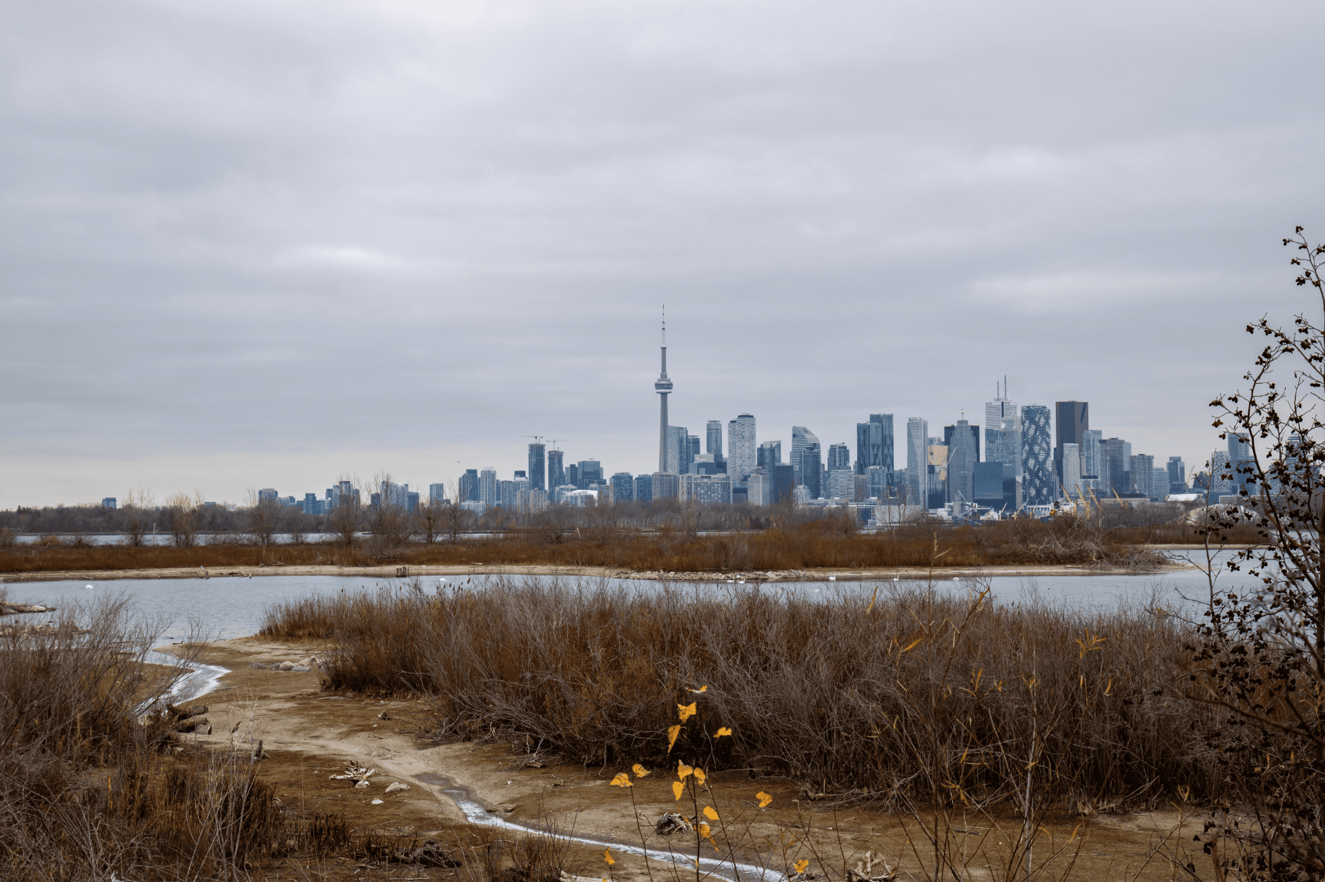
6. Tommy Thompson Park
Step away from the industrial noises ubiquitous with modern living at Tommy Thompson Park on the edge of the city. Known locally as The Spit, this park sits on a small peninsula that juts into Lake Ontario.
To best experience the park, hike the 7.6-mile Leslie Street Spit Trail, which passes through reclaimed natural habitats, including wetlands, forests, and meadows. Once part of an industrial dumping ground, these ecosystems have been carefully rehabilitated and now function as a wildlife preserve that’s home to more than 300 species of bird and other wildlife.
At the tip of the spit, you’ll find the park’s iconic lighthouse and some of the best views. From this unique position, visitors can enjoy views of the Toronto skyline as they look back toward the city.
- Length: 7.6 miles
- Difficulty: Easy to moderate
- Restrooms: Multiple throughout the park
- Parking: Free lot; additional street parking is available
- Dog-friendliness: Dogs not allowed
- Hours: Weekdays 4 to 9 p.m.; weekends and holidays 5:30 a.m. to 9 p.m.
This post is sponsored by Fjällräven.
