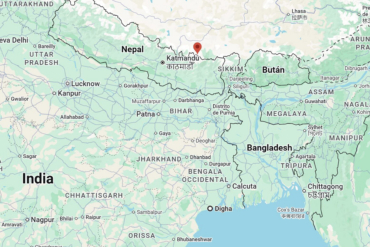
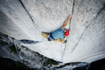
Kings Peak is the highest mountain in Utah, a 13,528-foot pyramid of rock in the state’s remote Uinta Range. To climb to the top, you hike almost 30 miles round-trip, a journey that starts on a well-worn path and ends — hours or days later, depending on your speed — atop a knife-edge ridge that seems to float in the sky. Earlier this month, under blazing sun and blue above, I stood on Kings’ summit with two friends and fellow GearJunkie staffers, T.C. Worley and Pat Petschel, and gazed west. A cliff dropped off a few hundred feet, and the view went on forever. For a moment, we were standing taller than anyone else for miles around.

My group’s journey to the top began 11 hours earlier at a trailhead just above 9,000 feet. We had hiked fast for most of the day, taking stops to eat or shoot video to record the trip. I tracked the trip with a SPOT device, putting down waypoints and a virtual GPS path as we climbed (see interactive map below).
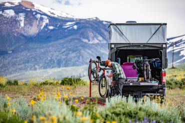
Overall, the theme of the trip was “fast and light,” and our backpacks followed suit. Our gear was skimmed to the very essentials for the climb. In my pack, I carried a tent, sleeping bag, a tiny pad, a shell jacket, and some food. Like any backcountry trip, I attempted to skim as light as possible on Kings, though without compromising on safety in the wilderness.
With a stock of lightweight gear, my 30-liter backpack, the Speed Lite 30 from Deuter, was all I needed for the trip. It weighed less than 20 pounds loaded up. Many hikers and climbers we saw on Kings had packs literally three times the size, burdening loads with over-stuffed panels and tents tied on top.
Beyond simply using lighter gear, an easy but expensive option, hikers can cut weight by eliminating repetitive or unnecessary items. One of our tents, for example, could be set up with trekking poles, allowing us to leave the aluminum stock set of poles behind. (We used to-be-released tents from Sea to Summit and NEMO Equipment.)

At the trailhead, each person in my group packed about a gallon of water for the hike in a hydration bladder. We used purification tablets, not pumps or filters, to clean our water from streams. This saved a pound or more in weight. Our product was from Potable Aqua, the company’s chlorine dioxide tablets, which I have used on trips like this for years.
Clothing is another easy area to cut the load. Plan to hike, climb, sleep, and descend all in the same set of clothes. Synthetic or merino wool clothing for base layers, never cotton, is best. I wore a merino-blend T-shirt from Ibex. I bring a mid-weight shirt or a lightweight “puffy” jacket like the RAB Xenon (first item in this post) for warmth at night and a shell jacket for protection from wind and rain.

On the feet, Timberland’s Cadion 2.0 Mid boots are a great lightweight option if you want to balance foot protection and comfort with speed on the trail. They have a Gore-Tex liner for waterproofness, and the build rides a line between a fast hiking shoe and a full hiking boot — there is good flex in the sole, and each boot weighs about 16 ounces (in mid-range men’s sizes), which is light for a boot of this kind. On the descent of the peak, in some talus, I twisted an ankle slightly and pinched my foot between two sharp stone edges. I was fine after shouting a few choice words, but happy to have had the boots on at that moment for protection instead of the lighter trail runners I sometimes wear for mountain treks.

Food and stoves can be heavy. We took a tiny alcohol-burning stove, the EBY255 Ti DX model from Evernew Inc., which weighs just a few ounces and packs small. It was a simple solution for making hot water and rehydrating our meals in camp. Otherwise, beyond the hot meals, which were “eat from the bag”-style from Mountain House (and were super good!), our food for the hike and the climb was dense, high-calorie items like nuts and energy bars. We ate 100 to 200 calories each hour on the ascent to keep energy up.
At night, our lightweight sleeping bags rode a close line between comfort and cold. I was warm, however, using the Haven Top Bag from Therm-A-Rest, which is rated to 20 degrees. It is a strange design that does not have a bottom (to save on material weight) so you lay right on the pad. Your feet are in the bag, but your back has no bag insulation under it. (We review the Haven Top in depth here.) The funky design nets you a down bag that packs up tiny and weighs just 1 pound, 8 ounces.
Our camp was at 10,900 feet, and it was in the 40s as we slept. A tiny sleeping pad kept me off the ground, and I wore my jacket to bed — an extra layer of insulation that was enough to keep me warm. My camp pad, the Inertia X-Lite from Klymit, is touted as the “world’s lightest camping pad,” as it weighs a miniscule 6.1 ounces. It has a cut-out pattern that looks suspicious (will my hips be pressing into the tent floor as I sleep on my side?) but on Kings it worked surprisingly well. The pad-with-holes kept me suspended off the ground, and I stayed toasty all night.

Beyond all the gear, a hike/climb strategy can play into keeping things light and fast. On Kings, we found a campsite a couple miles from the top and stowed a bulk of our food and gear tied up high in a tree. We then cut off the main trail, avoiding a snaking and roundabout pass, the common route, for a steep chute that aimed straight at Kings’ top.
It was a sharp climb up a scree chute and onto the ridge. A fast final climb, unburdened by extra gear, to the highest point in the state. The off-path route cut about two miles off the trek and positioned us for the summit earlier in the day. We were on top as the sun started to sink in the western sky, hiking off in dusk with headlamps at the ready for the darkening trail back down below.
—Stephen Regenold is founder and editor of www.gearjunkie.com. Connect with Regenold at Facebook.com/TheGearJunkie or on Twitter via @TheGearJunkie.