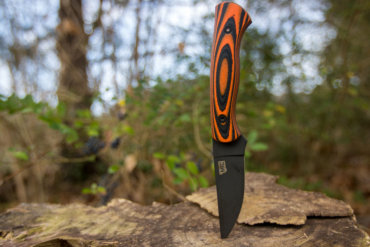
Microtech makes some seriously rugged knives, manufactured in the USA. However, the brand is arguably not as big in the outdoor world as the tactical one. This is largely owed to a majority of its knives being automatic, and thus, not as accessible to the general public.
But in 2023, Microtech launched the MSI (Microtech Standard Issue). It’s not the brand’s first manual folding knife, but it certainly became its most popular. Not only is it the first Microtech knife with the brand’s proprietary version of M390 steel, M390MF, but it’s also the first to carry the re-engineered Ram-Lok.
As a result, the MSI appealed to the outdoor crowd due to its overall practicality and adaptability. Where the bulk of Microtech’s product offering errs toward tactical, the MSI also appeals to the outdoor crowd due to its overall practicality and adaptability.
However, where the brand has made a name for itself through knives like its LUTD and Combat Troodon, Microtech sure as hell knows how to design and execute a dependable and desirable folding knife.
Fast forward to 2026 and Microtech offers the MSI in more than 50 different versions. Where this might seem absurd, even overwhelming, these variations come from customer demand. People love their Microtech knives. So it’s high time to give it a proper review.
In short: While some people might find the Microtech MSI too big for everyday carry, people who spend a lot of time outdoors will appreciate it. It has a burly build but has exceptional balance. Along with its use of premium materials, this knife can tackle any environment and requires minimal maintenance.
- OAL: 8.9"
- Blade length: 3.85"
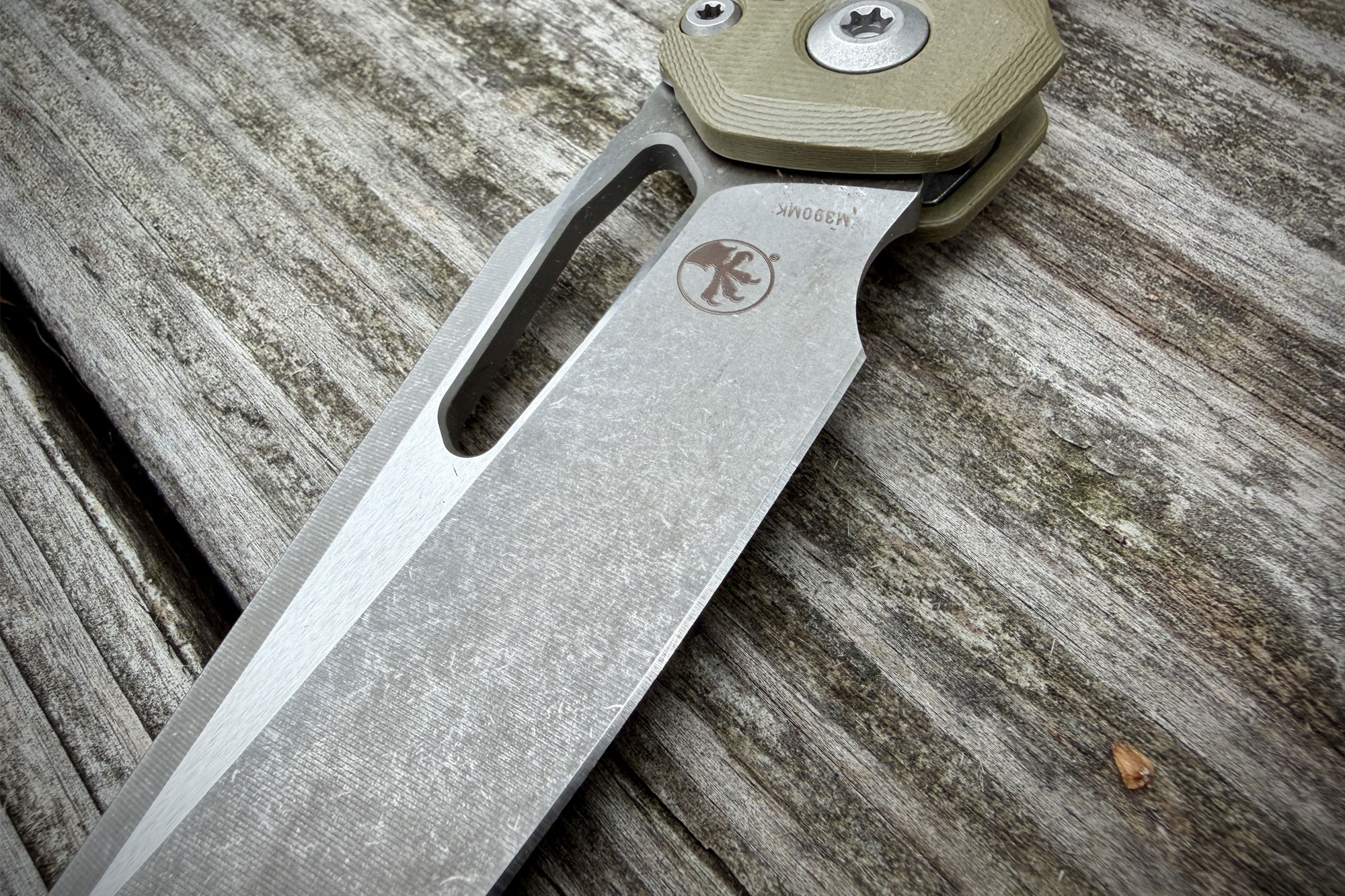
- Blade steel: M390MK
- Blade shape: Sheepsfoot
- Grind: Flat
- Hardness: 60-62
- Lock type: Ram-Lok (Crossbar)
- Opening type: Thumb hole
- Carry: Left or right hand, tip-up
- Weight: 4.70 oz.
- Price: $250
Pros
- M390MK steel performance
- Ram-Lok ease of use and reliability
- Size-to-weight balance
- Robust build
Cons
- Will be deemed too big by people subscribing to general knife size conventions
- With over 50 variants, it may be tough to pick the one you love
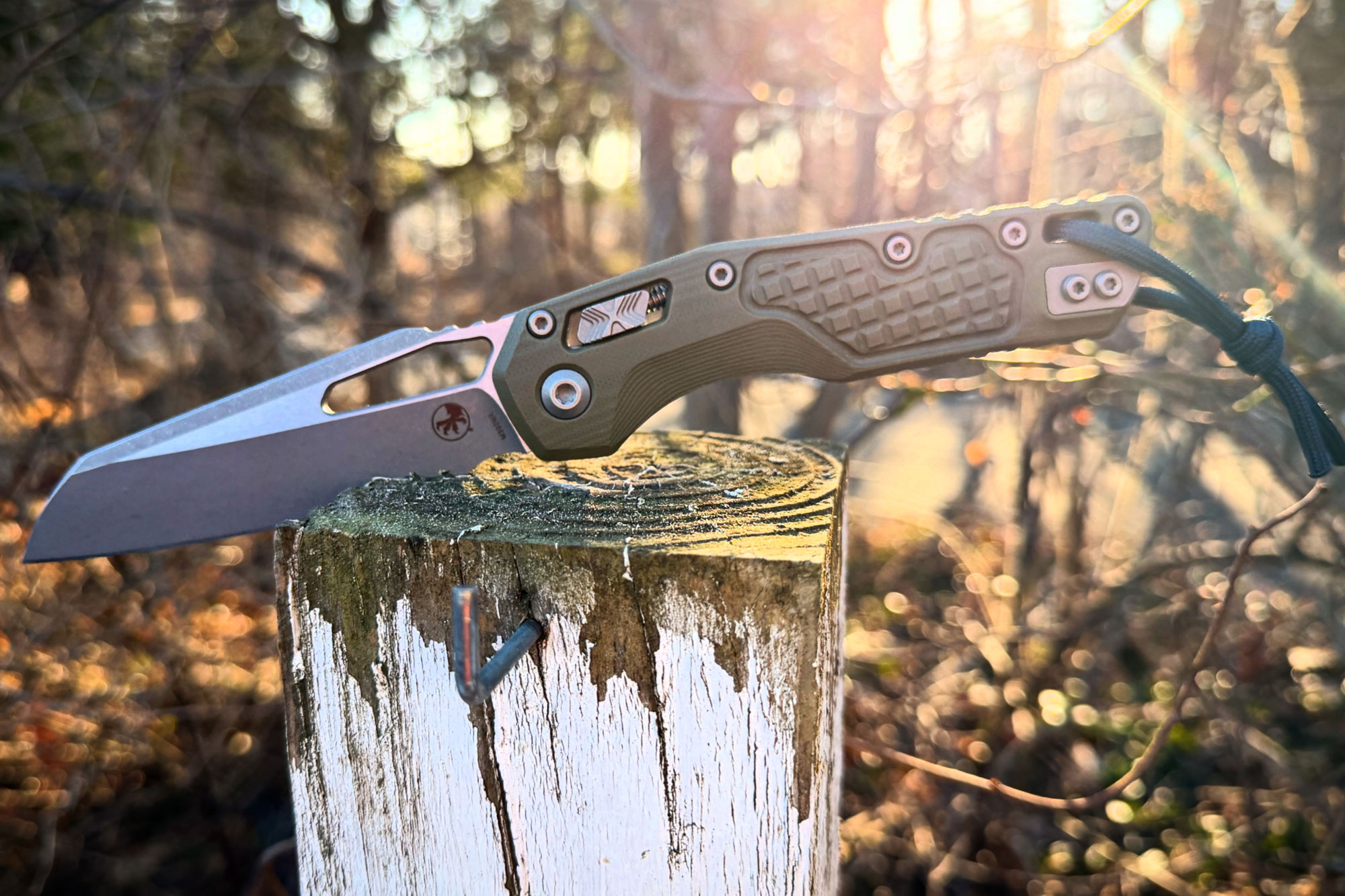
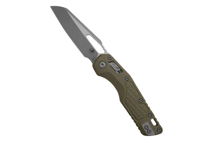
Microtech MSI Folding Knife Review
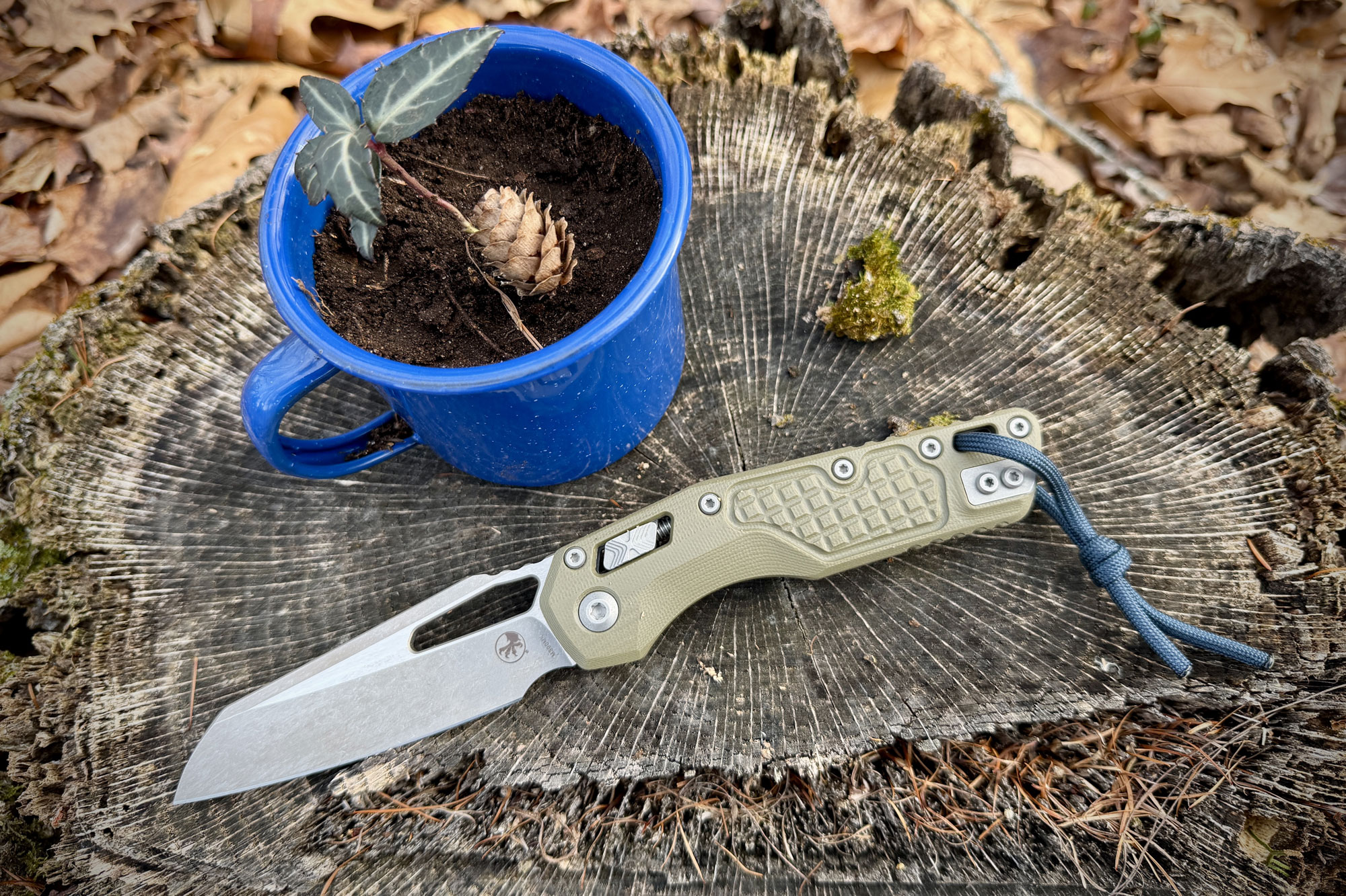
Handle Design
A fully ambidextrous knife, this version of the MSI comes with textured G10 handle scales, which keep the knife nice and grippy, and provide a foundation that is strong and reliable. They are reinforced with stainless-steel partial liners by the pivot for durability.
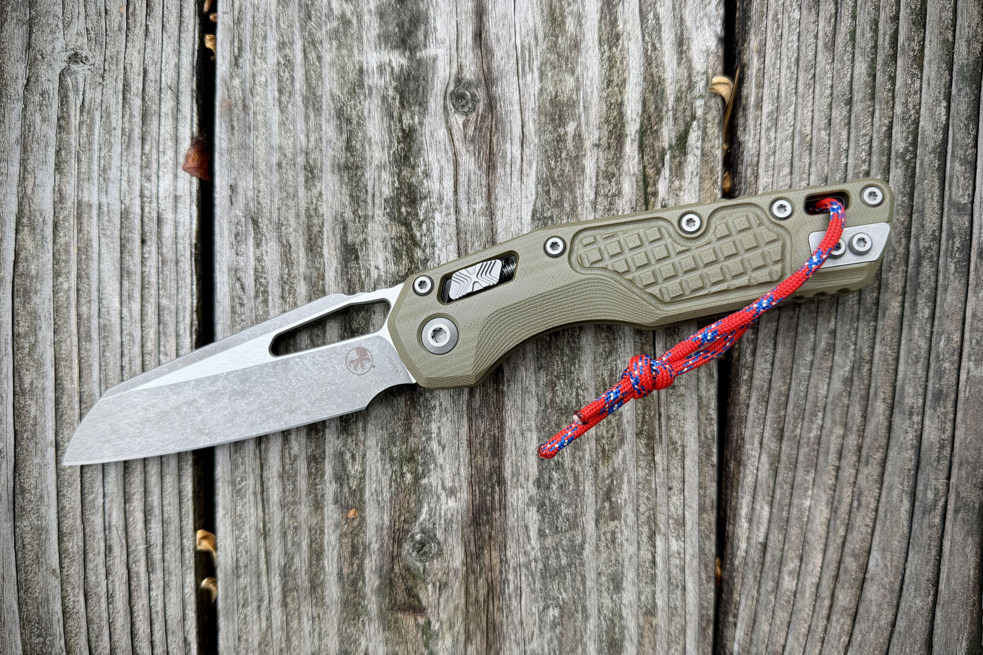
Along with the shape of the handles, MSI put a lot of attention into the touch points, too. There’s an ample finger choil with scalloping, as well as texturing that starts in the middle of the handle scale face and extends toward the butt. This is what’s referred to as a “frag” pattern, and it keeps this large knife from feeling too bulky in your palm. It also helps keep it in place, whether your hands are wet or dry.
Steel
The M390MK blade steel marks a joint effort between Microtech and Bohler, which created the original M390 steel. M390 is known for its corrosion and abrasion resistance. But it’s also known for not being exceptionally tough; instead, it boasts a higher hardness. This means that M390 isn’t great for prying or chopping, but it excels at cutting, slicing, shaving, and drawing.
From what I can tell, Bohler left this aspect unchanged when working with Microtech to make the M390MK. Instead, they boosted both the corrosion resistance and edge retention.
In the end, where M390MK isn’t a new alloy at its root, it’s the purest and highest-performing version of M390 on the market.
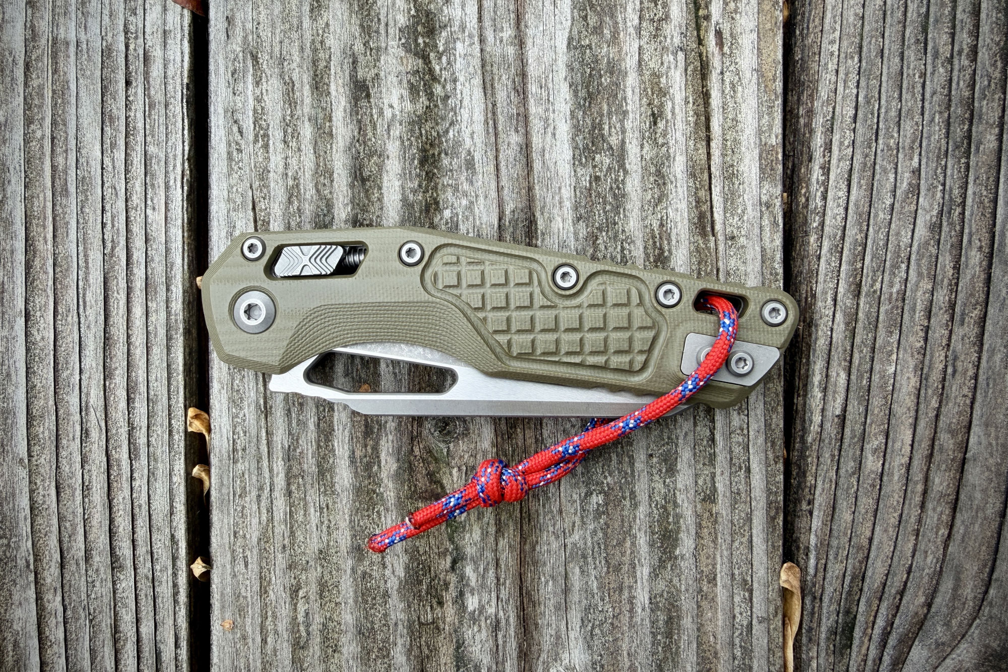
Lock and Clip
In designing this knife, Microtech also designed a new crossbar-style lock mechanism, the Ram-Lok. I’ll go into more depth in the next section about the lock’s abilities, but it’s reported as being the strongest cross-bar style lock on the market.
Rounding out the features of the MSI is a reversible deep-carry pocket clip, a pivot bearing, and a blade finish referred to as “Apocalyptic,” which resembles a more heavy-duty stonewashing. There’s also a large thumb gap in the blade for opening.
Ram-Lok Issues
You may have asked why it took 2 years for me to get my hands on this knife. Well, in late 2023, complaints started to grow about the lock sticking. This has become more of an issue on crossbar-style locks as more manufacturers have implemented them, but it’s not a safety issue.
That said, the lock failing altogether is. Users found that under duress, the Ram-Lok could unlock, potentially leading to serious injury.
Microtech reacted and at the tail end of 2023, it brought the Ram-Lok back to the drawing board.
In April 2024, it released an update to the MSI with an improved version of the Ram-Lok, along with changes to the blade geometry that better accommodated the mechanism.
Since then, there have been no reported issues with the lock failing. Additionally, Microtech has expanded its model range in which the mechanism is featured.
First Impressions
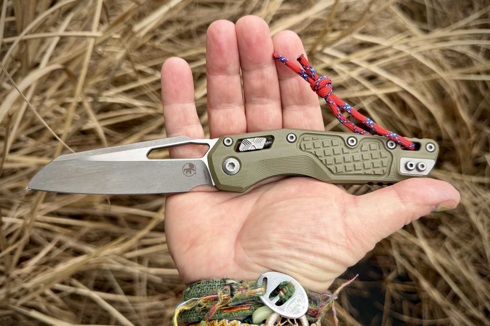
I like my folding pocket knives to come in under 8 inches in total length. The MSI is nearly 9 inches long. In the world of knives, one inch can change how you carry and use a knife.
But the MSI isn’t a bulky knife, and, at only 4.7 ounces, it’s not a heavy knife. That said, it might be too big for most people to consider it an everyday carry knife, or even a backpacking/hiking knife.
Well, I say to heck with convention! I will carry this knife every day and use it everywhere. After just a few hours with it, I was impressed with its build and smooth opening and closing action. Additionally, the Ram-Lok is easier to activate than some of the standard crossbar locks I’ve experienced lately.
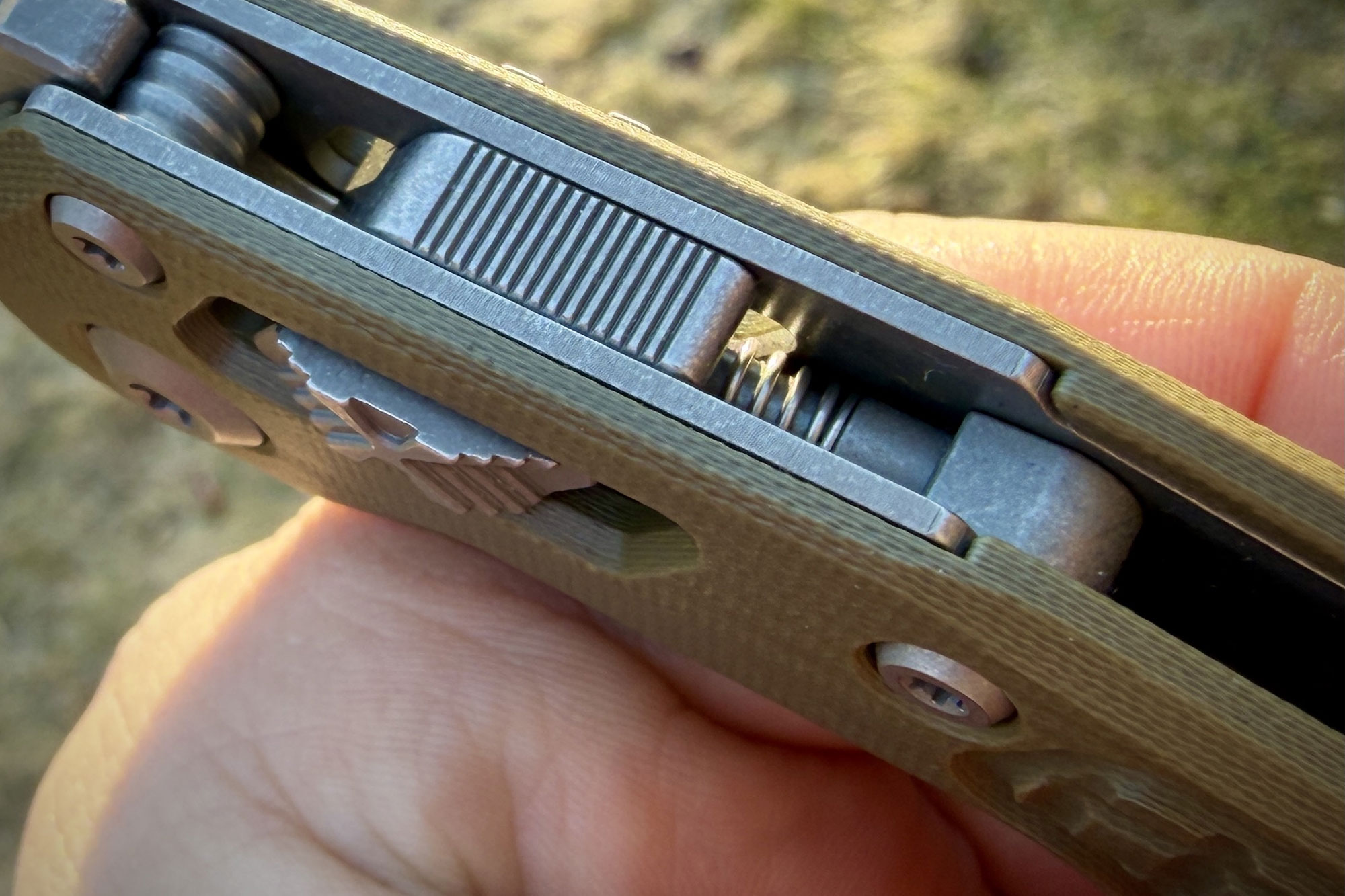
Addressing the elephant in the room, I haven’t had any issues with the Ram-Lok in all the flicking I’ve done with it thus far. There’s no initial lock-up or lock-stick, and zero failure. My only concern is that its spring is exposed, and that could lead to a little extra maintenance here and there.
While most crossbar locks use a flat, Omega-style spring, the spring on the MSI is a coiled pen-style spring. At the very least, I think I’ll need some canned air to blow into it from time to time. The trade-off is that Microtech claims this style of spring is much stronger and therefore more reliable.
In the Field
Even at its larger size, I had a lot of fun using the MSI in the woods, by the river, and digging up spotted wintergreen. It was also a breeze to carry and hardly a burden in my back pocket.
Sure, Tony Marfione, the founder of Microtech, might flinch at the idea of me using one of his prize pupils to dig in the dirt, but here we are. At least I’m not batoning with it like some of the YouTube personalities who claim their Ram-Loks still don’t work.
You don’t baton with a folder in general. Those clowns are just poking the bear — that’s not a review, that’s knife abuse.
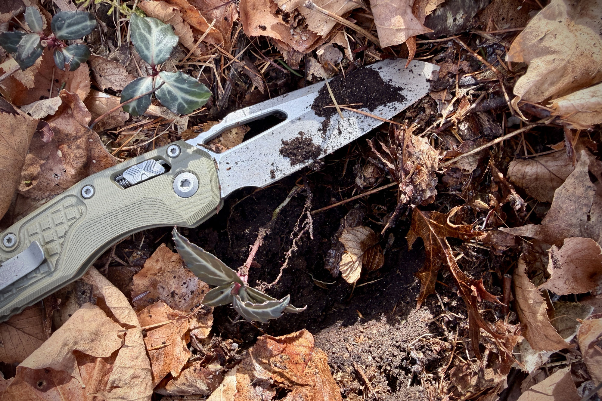
After 2 weeks of cutting cardboard, rope, and meat, and retrieving plants from the frozen ground, the M390MK steel didn’t dull. The efforts Bohler and Microtech put in to purify core M390 steel and create M390MK worked. Supporting that claim is the fact that there are no signs of wear and tear on the blade overall.
Additionally, there’s zero inkling of corrosion, anywhere.
What’s more, the Ram-Lok is a real superstar. Compared to the round button shape of most other cross-bar locks today, the Ram-Lok’s parallelogram-shaped button provides more area for your thumb to pull back. This makes for smooth actuation and enhances both engagement and disengagement.
Also, the spring hasn’t yet gummed up. This may be due in part to the fact that there is no lubrication on the pivot (being that it has ball bearings) and therefore doesn’t attract grit and grime that could migrate to the spring.
The MSI Mini
Late last year, Microtech released a small batch of a smaller version of the MSI, the MSI Mini. With a total length of 7.38 inches, the Mini has the proprietary M390MK steel, aluminum handle scales, Ram-Lok, and a thumb stud instead of a thumb hole. These sold out within a couple of days of release.
Microtech confirmed it will expand the MSI Mini line this year. Understanding that a 9-inch folding knife can be polarizing, there’s no denying how well-built, functional, and dependable the MSI is. In a smaller form, it could find a larger appeal and become a top knife for 2026.
Conclusion: Who’s It For?
With the MSI, Microtech proves that it can build a manual folder for hard use and demanding environments just as well as its well-regarded automatics. As noted, this isn’t the first manual folder, but it has become its most popular.
Furthermore, with prices ranging from $175 to $300, this American-made dynamo isn’t priced too extreme.
I’ve never been one to count ounces, though I am particular about the overall length and blade length of the folding knife I EDC. I broke from those conventions to give the MSI a shot, and I am glad I did.
As it stands, this is the largest folding knife I have ever carried, tested, or reviewed. And where I doubt I’ll be as smitten with other knives this size, the MSI is impressive from every angle.
So, if you’re someone looking for a hard-use knife that can adapt to any environment to get myriad tasks done, the MSI might be just right for you.