The current state of cycling navigation apps: Options. Galore. Plenty of states are expanding commuter cycling infrastructure. The bike industry continues to push gravel bikes as do-it-all options that expand navigable terrain, and it’s somehow fashionable. Bikepacking is even in vogue.
The options for how and where to ride are now incredibly varied, and everyone who puts foot to pedal needs a way to map their rides. More user data and better tech have made navigating through urban and backcountry environments more convenient and accurate than ever.
That said, not every cycling GPS app has the same pros and cons. Many of the best features are only available through premium plans. We are all likely to have more than enough subscription services running.
In short: It’s no surprise that there’s a glut of cycling GPS apps, all boasting different strong suits and approaches to navigating two-wheeled rides. So, we took a peek behind the paywalls and put half a dozen of the most popular platforms through several hundred miles of planning, mapping, and riding across different states to see how they stack up. Read on to find our conclusions.
Ride With GPS
Pros
- Best turn-by-turn navigation
- Generally easy-to-use
- Feature-rich desktop platform
- Most route export file formats
- Jack of all trades
Cons
- Unintuitive navigation UI
- Maps can be a bit cluttered
- Maps can lack points of interest and landmarks if user reports are low
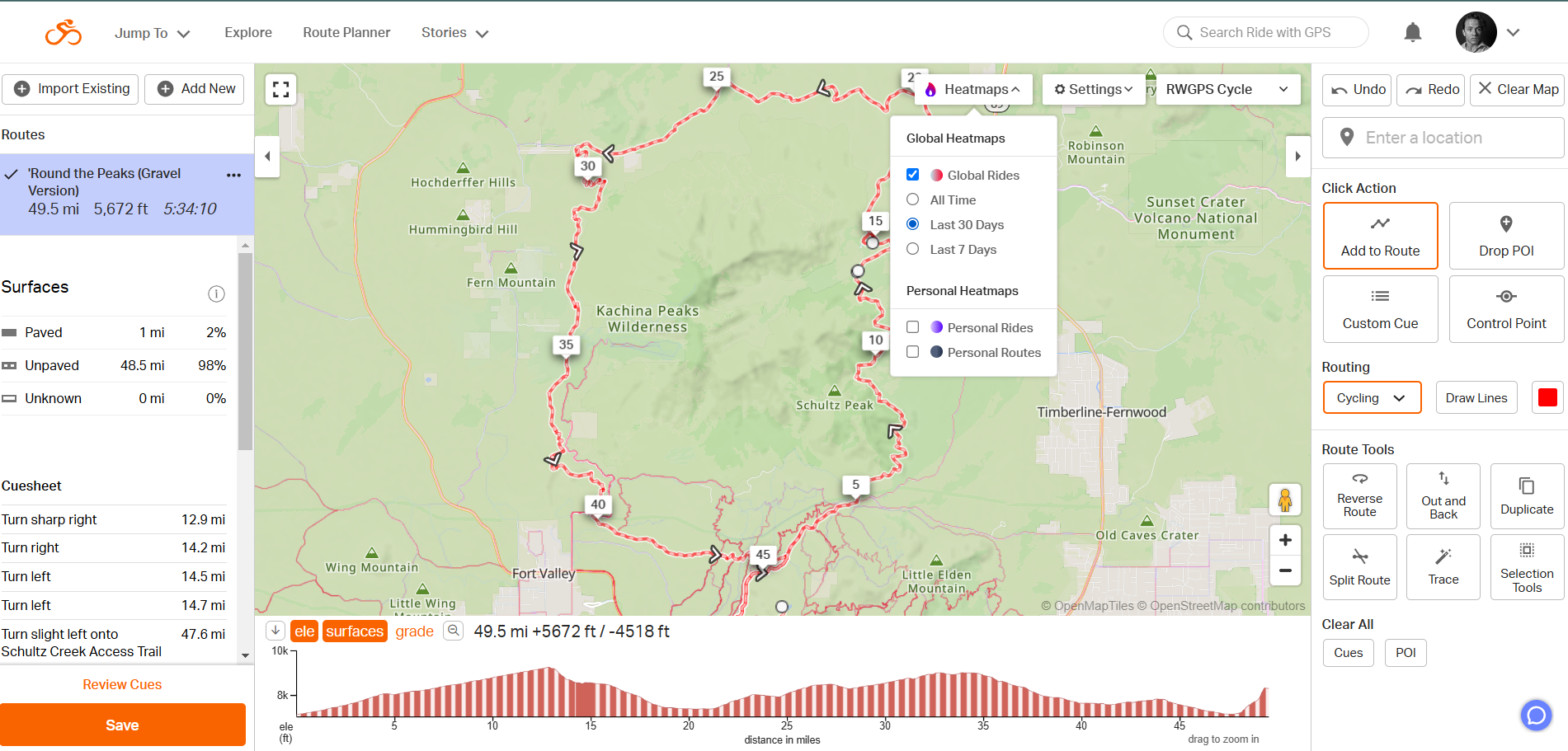
Ride With GPS (RWGPS, $60 annually for Basic and $80 for Premium) was easily the most straightforward do-it-all cycling navigation app on the market. If you’re looking for an app that will allow you to navigate around urban areas without Google Maps, plan out backcountry bikepacking trips, track rides, read reviews of new routes, and see where everyone else is riding — RWGPS will get the job done.
Its navigation was by far the easiest of the bunch to use. I typed in a destination, and it quickly auto-generated a route with turn-by-turn directions. Unlike many other cycling apps, the navigation rerouted in real time and offered arrival time estimates based on previous rides.
For bikepacking and touring trips, RWGPS premium offered intuitive but detailed mapping tools for both mobile and desktop. When it was time to ride, these routes offered turn-by-turn commands and could be exported in more file formats than any other cycling GPS platform.
Another standout feature of RWGPS premium was the heat maps, which are maps of cycling traffic patterns (either your own or from their massive user base). These maps made it easy to see which trails and roads were the most popular, both in general and recently.
RWGPS didn’t excel everywhere. Its navigation had plenty of idiosyncrasies. The regular to-a-point navigation was intertwined with its route recording feature, making it awkward to just ride from one place to another without recording it.
Pre-planned routes, such as bikepacking or touring ones, had a default direction. The only way to easily reverse this was on a computer. Set off on a route in reverse with RWGPS, and you’ll quickly be drowning in less-than-useful “turn around and go the other way” alerts.
Likewise, RWGPS was in the middle of the pack for discovering new trails and annotating geographical features. It offered plenty of filters and maps for viewing trails.
However, it didn’t segregate them visually (e.g., MTB versus gravel or beginner versus intermediate). It also prioritized routes mapped and ridden by users. In less popular areas, lacking a readily available legend, the app offered less general info on trail composition and conditions.
On well-mapped and reported trails, it delivered a wealth of information on campsites, water refill stations, bike shops, reviews, and more. However, without ample user reports, the RWGPS maps often failed to annotate features like dispersed campsites and trail restrictions.
onX Backcountry
Pros
- Tons of public and private land use info
- Paid version shows information on private lands
- Outstanding MTB maps
- Great at differentiating and annotating landmarks and points of interest
Cons
- Unintuitive navigation UI
- Consistently inaccurate speed info
- No turn-by-turn navigation
- Low user base, so not as many established routes
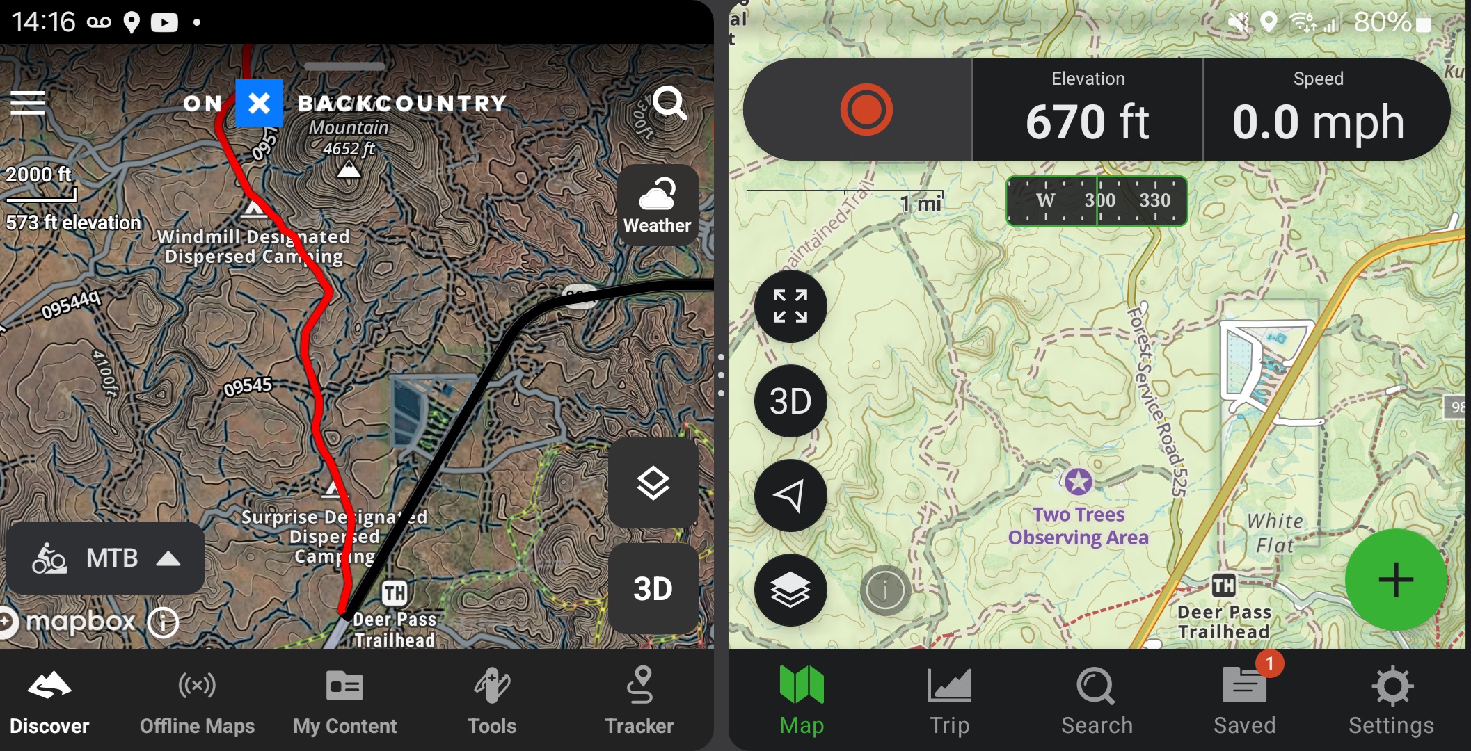
If RWGPS occupied the extreme end of streamlining navigation and route mapping, onX Backcountry ($30 annually for Premium) occupied another extreme: it offered all the information I needed about the land I was traversing.
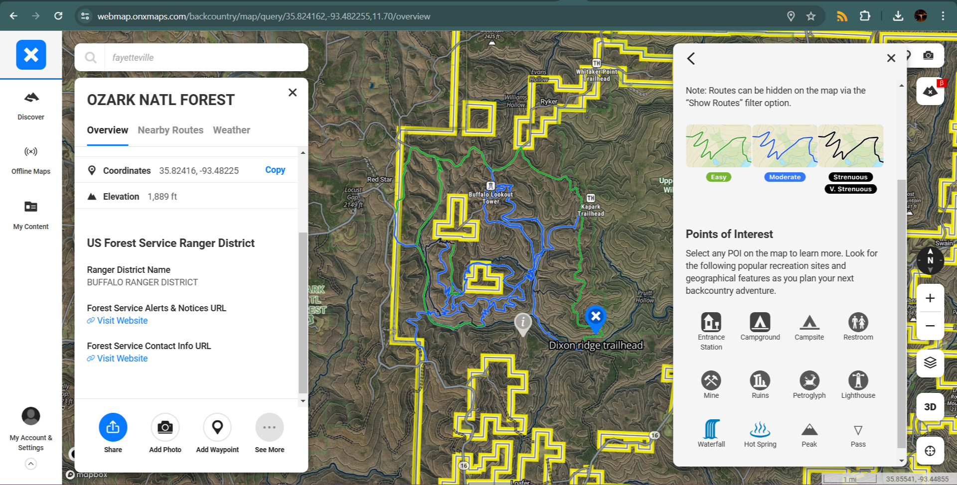
OnX showed the most granular local weather reports and information on what government agency presided over the area of interest. The ($100 annually) Elite plan also offered information on who owns private land parcels as well.
Unlike platforms like RWGPS, which prioritized user-mapped and ridden routes, onX prioritized geographical trails. Its regular map layer made them abundantly clear and easy to follow. Its MTB overlay was fantastic at displaying and immediately categorizing MTB routes into beginner, intermediate, and advanced trails.
That said, with a newer cycling user base, fewer MTB routes have been mapped or ridden by users. Additionally, being MTB-focused, its MTB layer failed to include many paved or gravel trails. This added up to onX displaying more trails more clearly than most cycling navigation apps — but highlighting fewer routes overall.
In our testing, onX routinely did the best at annotating and differentiating between landmarks such as dispersed campgrounds, paid campsites, mines, waterfalls, archeological points of interest, and more. This was aided by one of the clearest and most accessible legends of any mobile mapping app.
However, onX started as a hunting app, and it showed. It didn’t offer turn-by-turn directions. It didn’t auto-generate any cycling routes for commuter cycling. With a narrow MTB-focused layer and the smallest cycling user base, its MTB layer highlighted the fewest trails and user-generated routes. If you want an app that makes planning a bikepacking trip or daily commute as simple as possible, this isn’t it.
If, on the other hand, you want reliable land information and more manual controls, onX was second to none. For the multi-sport-minded, or those looking for a backup app for crafting original routes, onX was it.
It regularly offered the most up-to-date trail conditions and links to land agency sites so I could check current restrictions. Its maps were clear and easy to read. Downloading high-quality offline maps (albeit only in a vertical format) was a breeze.
The wildfire and air quality filters were particularly useful out west. And the offline tracking routinely offered me some of the most accurate and detailed breadcrumb trails of any cycling navigation app.
GAIA GPS/Trailforks
(Photo/Ian Graber-Stiehl)
Pros
- Most customizable map
- Widest array of layers
- Trail grading
- Turn-by-turn navigation
Cons
- No real-time rerouting
- Maps get cluttered easily
During testing, Gaia and Trailforks were a two-for-one special — and they were a damned powerful one at that. While both services were offered separately, they’ve been brought under the same Outside+ for $7.49 monthly. So, for less than $3 per month, I could access Trailforks as a map layer within Gaia Premium.
It was hard to find a task that this dynamic duo couldn’t tackle well. By itself, the Trailforks layer clearly highlighted cycling trails and user-generated routes according to sport (gravel, MTB, road, etc.), graded them by experience level, and offered general information on restrictions, reviews, and average ride stats.
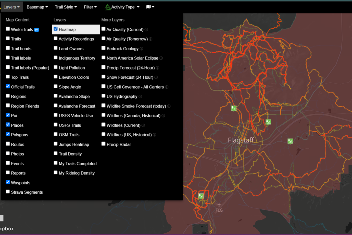
Using Trailforks as a layer instead of a standalone app did make the user experience a bit more complicated. Through Gaia, there was no straightforward way to access Trailfork’s heatmaps. Fortunately, I could still assess these through the Trailfork app, which was part of the bundle. So, no matter what, the added functions Gaia brought to the table were well worth it.
Gaia had by far the most map layers of any platform on this list. Hiking, fishing, overlanding, general outdoor recreation — whatever other hobbies you might have, there was a layer for it in Gaia. This made it easy to customize maps. Downloaded routes, as well, could be customized to include whatever layers I desired.
Of course, all this added utility came with complications. Gaia had the steepest learning curve and most complicated user interface of any app here. Even with all its layers, it occasionally missed dispersed campsites otherwise highlighted by onX. Moreover, while Gaia offered turn-by-turn navigation (which I could reverse) for routes and point-to-point rides alike, it didn’t auto-reroute like RWGPS.
Even so, if you’re the sort of multisport outdoor enthusiast who simply wants one app for everything outside of urban cycling (where there’s always Google Maps), the Gaia and Trailforks bundle got the job done. It hit the sweet spot between onX and RWGPS.
Komoot
Pros
- Straightforward user interface
- Easy to save and exports routes
- Route point-to-point and turn-by-turn navigation
Cons
- Offers the fewest map layers
- Highlights the fewest trails and landmarks
Komoot ($30 annually for worldwide premium features) was all about simplicity and ease of use. The home screen was photo-forward, promoting the most popular and scenic routes in each area.
Tabbing over to the app’s “Routes” page delivered me to a map. I honed in on an area, zoomed in, and hit “Search this area.” Komoot showed me routes, graded by difficulty, and highlighted according to which layers I had active.
Komoot did delineate between trails a bit awkwardly, dividing them into “mountain,” “touring,” “bikepacking,” and “road” cycling categories. The “touring” and “bikepacking” lawyers tended to highlight only long, promoted, mutually exclusive trails. The lack of a “gravel” category felt a bit dated for cycling in 2024. And Komoot highlighted by far the fewest routes of any of the apps tested.
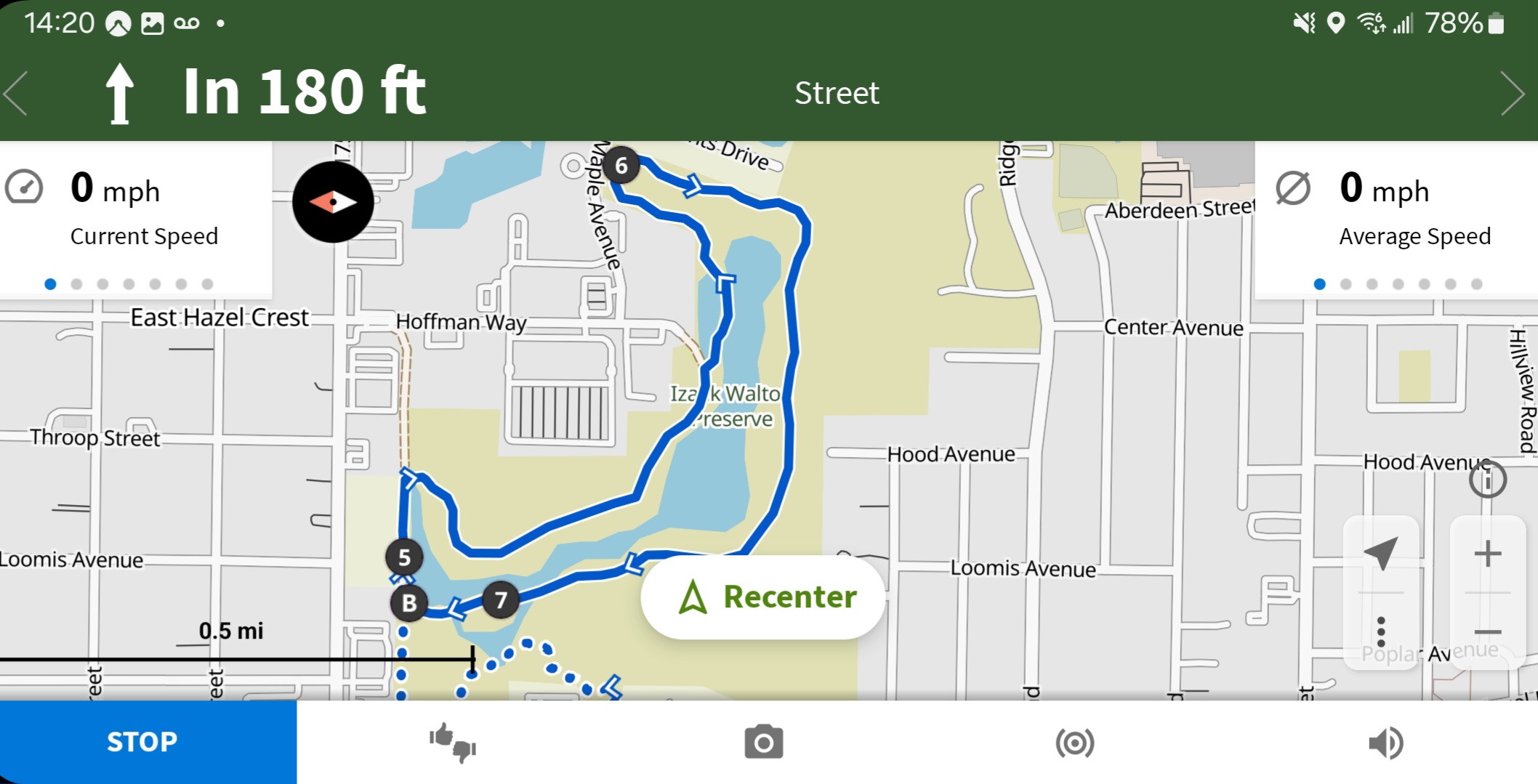
However, the routes highlighted were popular in the area. I could select any of them, and it was a breeze to check weather conditions, download the route, or export GPS data. Komoot also offered simple, clear turn-by-turn navigation — both for established routes and for auto-generated ones between two points.
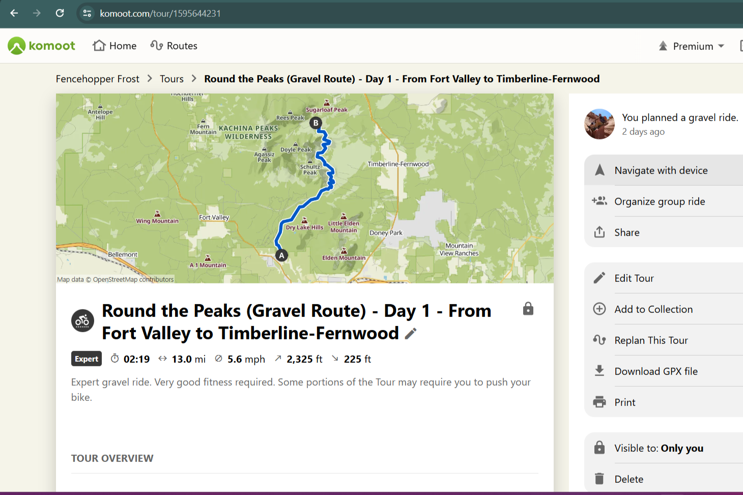
Routes and their turn-by-turn instructions could easily be reversed. When mapping or importing longer routes, Komoot offered the option to automatically divide the routes by daily stretches based on my self-reported fitness and bike type. Pre-established routes also tend to feature photos and reviews that are automatically translated by Google into your language of preference.
Komoot’s navigation isn’t as slick as RWGPS, but its user interface was more straightforward. The app had nowhere near the granular trail and information offered by onX and Gaia. However, it excelled at being extraordinarily easy to use.
Some of the cycling navigation apps in this list might be overwhelming in features and functions, especially for a weekend rider who simply wants to find a fun, skill-appropriate trail to access and pedal along. Even experienced long-distance cyclists who already have more detail-oriented GPS apps can get a lot out of Komoot’s live, shared ride-tracking feature and simple interface.
AllTrails+
Pros
- Straightforward design
- Variety of GPS export file formats
Cons
- No route-mapping feature
- Few map features
- Easy-to-discover trails
AllTrails+ ($36 annually) was the odd one out. It was the only app in the lineup with no manual route-mapping ability. It also didn’t allow for point-to-point navigation. And while it had multiple map layers, they only beat out Komoot in terms of map details like campsites and landmarks.
What AllTrails did have was simple, social approachability. AllTrials was less of a GPS and mapping app, and more of a social platform geared toward discovering, rating, and documenting new routes.
AllTrails was easily the most photo-forward platform here. Its home page offered simple, picturesque, community-oriented previews of routes others had ridden. Much like Komoot, it wasn’t geared toward granular details of trails and the land they’re on, but rather toward displaying photos, reviews, and maps of routes ridden by others.
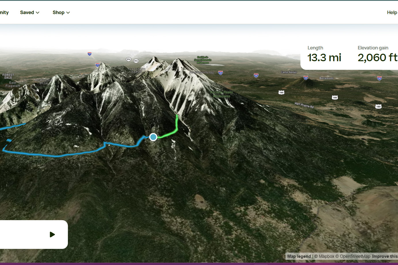
The app operated like a more polished Komoot. Only the types of trails (MTB, road, or touring) selected were shown in a given area. They stayed collapsed until I clicked on a highlighted point, at which point all routes in that area were highlighted. When I selected one, I got weather, length, elevation gain, and all the basic trail info — plus the slick option of a 3D animated preview.
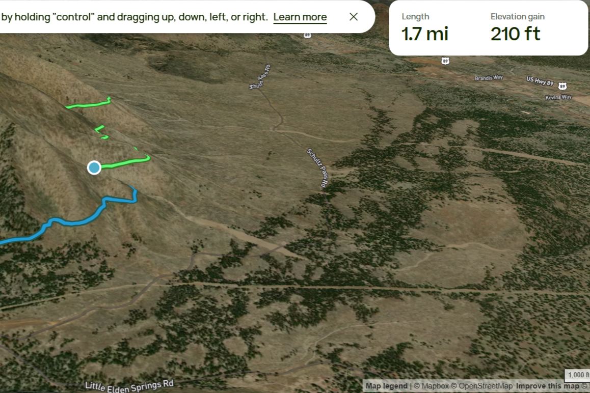
This made for a clean, simple user interface. A longer list of extra layers was available on Komoot and onX such as “scenic driving,” “paddlesports,” “fishing,” and more. However, I leveraged AllTrails for community-informed perspectives on places of interest for other sports.
Going all in on community contributions left AllTrails lacking in mapping tools. I could only import and export routes on a computer. Route were easy to trace with live tracking, but AllTrails didn’t offer turn-by-turn navigation. Likewise, it lacked the ability to alter imported maps, generate original routes (except through recording rides), or see many details about the lands I rode along.
Its maps were straightforward, with useful info on weather, light pollution, air quality, and more. The massive user base provided a glut of reviews and photos of popular routes. The offline maps, route tracking, and integrated features for alerting contacts were all simple and effective. Not to mention, with AllTrails donating 1% of its annual Pro sales to various outdoor charities, they give back to the outdoors they map.
Bottom line: AllTrails didn’t replace dedicated route-mapping platforms. Even so, it did justify its price for a simple, more social approach to trail rides.
Cycling Navigation App Conclusions
There’s a bevy of cycling navigation apps vying to guide your next ride, whether through city streets or backcountry singletrack, but they all nailed different points.
Ride with GPS made a great case for it being your one dedicated cycling app for mapping and navigating every two-wheeled ride. OnX and Gaia (with Trailforks) instead leaned into more multisport utility by putting as much information on the trails and land available in an area as possible, and letting me decide what to do with it. Komoot and AllTrails opted for quick and easy usage with a social bent that made them joyously nontechnical to use.
So, while there is no one cycling navigation app that did it all perfectly, you can rest assured knowing that one of the above will probably work for you — and almost any combination of two of them will cover you completely.
As for me, addict that I am, I’m going to keep using them all simultaneously to map as many routes as I can — and keep wondering why my phone has so little storage space and battery life.
