Update: Full trip report now posted here.
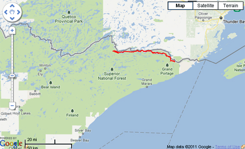
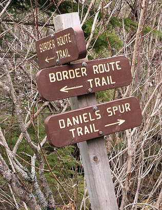
Labor Day weekend is upon us, and though not the literal end of summer, it certainly is a figurative end in my mind. To celebrate, three members of the GearJunkie crew are heading north, way north, to the depths of Minnesota’s North Woods and the Boundary Waters Canoe Area. There, we will lace up our boots (no canoes this time!) and head west to east on the Border Route Trail, a 65-mile hiking path that traverses the BWCA.
The route follows the international border between Minnesota and Ontario, and it is a “rugged wilderness hiking trail,” according to the organization that maintains it, including a path that follows ridge-lines and cliffs wherever feasible. Expansive views across the Boundary Waters Canoe Area are a hallmark of the trip, which takes many groups four or more days to thru-hike.
We’re going to film a video as we hike, and our goal is a fast-and-light style trip to complete the entire trail. We won’t share all the details just yet, but regardless, it’s going to be a crazy trip. We’ll be testing new and prototype equipment, eating on the go, sleeping just a little bit (in bivy bags; no tents); and pushing our limits while also soaking in the glory of the BWCA as we go.
Wish us luck! Hope everyone out there has big plans for the holiday weekend, too. These are the final days of summer 2011 for many of us. Make sure and spend them outside!
Update: Full trip report now posted here.
—Stephen Regenold is founder and editor of www.gearjunkie.com. Connect with Regenold at Facebook.com/TheGearJunkie or on Twitter via @TheGearJunkie.
