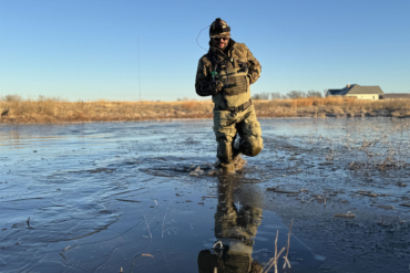
The onX Hunt app is a powerful tool for those who venture far (or not so far) off the beaten track. It will change the way you hunt. Here’s how.
Have you ever wondered what’s over that next mountain ridge but not felt like putting boots to the ground? Or, have you ever sought an easier way to access a public-land oasis surrounded by private land?

The relatively new smartphone app onX Hunt will give you means to do that and other helpful things. Here are several ways onX will prepare you for a more successful hunt.
1. Know Terrain Before You Walk It
The onX Hunt app allows users to see satellite view, topographical, and “hybrid” maps (a combination of satellite view and topographical). When used together, these maps allow for a very real assessment of land you’ve never seen. Want to know what’s over that 500-foot ridge? Well, you’ll have to hike there to know for certain. But the app will give you a very good idea of what lies ahead and whether it’s worth making that hike or not.
Hunting off the cellphone grid? No problem: You can save maps for offline use. Just download them ahead of time (best done with good internet service), and they continue to work far off the grid.
Easily view your maps on your computer with Web Map — ideal for easy big-screen viewing while scouting and dropping waypoints. Waypoints can be used to mark tree stands, honey holes, or where you parked the truck. These will sync from your mobile device to Web Map (and vice versa).

2. Find Secret Access Points
There are thousands of acres of public lands in the United States that are nearly cut off from access due to private land boundaries. But with the onX Hunt app, you can find the smallest right-of-ways. All it takes is a strip of land a few feet wide, and you can cross otherwise private land to reach large areas of public land. These easements are often not well-advertised!
3. Share Waypoints With Hunting Buddies
We’ve all been there: It’s the night before opening day, and you’re discussing your stand location for the morning with your hunting buddy. But how do you put it into words? Well, now you don’t have to. Just share waypoints on the onX Hunt app. Send your locations as texts, and they’ll populate and save to your friend’s maps.

4. Find Your Way Home
It’s so easy to get lost hunting that any tool designed to track yourself helps. When hunting new terrain, use the “Tracking” feature to leave a virtual trail to backtrack later. The track will show up on your map, giving you a large point to intersect. Follow it back as you find familiar landmarks and get un-lost.
5. Locate the Nearest Road
The “roadless areas” function on onX Hunt makes it easy to tell how far you are from the nearest road. By showcasing a heat map of areas far away from roads, it removes the guesswork if you’re trying to get away from the crowds that tend to lurk within a mile of the trailhead.
6. Measure Distances
Want to know how far that ridgeline across the stream is from your current location? Just use the “measure distance” tool on the app and get an exact line distance. It’s not as accurate as using a rangefinder, but to get a ballpark figure for walking or possibly shooting purposes, the line tool is really quick to use. And if you happen to forget your rangefinder at home, it will help you plan for possible shots.
This article is sponsored by onX. Learn more about the onX Hunt app here.