Lush forest greenery, glacier-covered volcanoes, cascading waterfalls, expansive ocean views — does this sound like your type of hiking adventure? Check out the best hikes near Portland, Oregon.
If so, you should add these day hikes near Portland, Oregon, to your to-do list. Within 2 hours’ drive of Portland, you can find hikes with all these views and more. Whether you’re just visiting Portland or have lived there your whole life, the area has something for everyone. And if you don’t feel like driving, Portland also has acres of parks that make you forget you’re in a city.
After living in Portland for almost 20 years and spending a lot of that time exploring the surrounding area, I’ve chosen a few of my favorite nearby hikes. All of these hikes are within a 2-hour drive from the city and are suitable for a day hike. Get your hiking pants on and get out exploring the beautiful Oregon outdoors!
Editor’s note: Due to COVID-19, amenities such as restrooms and visitor centers may be closed. Be sure to check for current closures or restrictions before visiting your local park.
Best Hikes Near Portland
Pittock Mansion

Forest Park contains over 80 miles of trails, right in the city of Portland. A 10-minute drive will get you to this sprawling expanse, where it’s easy to get lost or to get a lot of mileage or elevation gain. Pittock Mansion is a great starting hike to explore the park’s trails, with iconic views of Portland and Mount Hood.
This popular hike begins at Lower Macleay Trailhead. The trail winds through Balch Canyon before meeting up with the Wildwood Trail. The Wildwood Trail is a 30-mile long path that runs the entire length of Forest Park — if you’re inclined to take such a journey. Stay right when you reach Upper Macleay Trail, and then rejoin Wildwood to make a few steep switchbacks up to the Pittock Mansion parking lot.
The cost of admission to Pittock Mansion is $12, but strolling the beautiful gardens is free and well worth it. Check out the views over downtown and have a picnic on the sprawling lawns before hiking down the way you came. You could also continue your hike further into Forest Park or take a different way down.
Location: Forest Park
Distance: 5.7 miles round trip
Elevation gain: 960 feet
Need to know: Dogs allowed on leashes and no permit required
Drive time: 10 minutes from Portland
Dog Mountain

This steep and rewarding hike climbs out of the Columbia Gorge to expansive views at an old fire lookout site. The upper slopes are covered in balsamroot and other wildflowers in the spring, creating a sea of gold, purple, and red that will take your breath away. The views up and down the gorge make you feel like you’re on top of the world.
Begin the hike in a parking lot off Highway 14. This hike is very popular in the spring and summer, and the parking lot is incredibly busy, so plan to arrive before 8 a.m. or after 5 p.m. on weekends. And on weekends between April 18 and June 14, reserve a permit online. It costs $1.50 for the permit to park in the lot.
From the trailhead, you will start climbing immediately, leaving the noise of the highway behind. The trail switchbacks until you reach a junction that gives you two options: “difficult” and “more difficult.” Both options are about the same in terms of required effort — the more difficult old trail is an older, shorter trail with fewer switchbacks.
The two options meet back up and continue to climb a rocky trail to open meadows and views in either direction. At the top a grove of trees provides some shelter — the top of Dog Mountain can be quite windy. After you enjoy the views, head back down to the shelter of the forest.
Location: Columbia River Gorge
Distance: 6.9 miles round trip
Elevation gain: 2,800 feet
Need to know: Dogs allowed on leashes and Northwest Forest Pass required (also permits required from April 18 to June 14)
Drive time: 1 hour from Portland
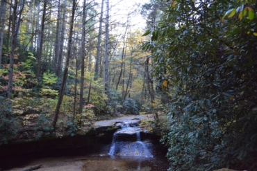
Dry Creek Falls

The hike to this cascading waterfall is one of the best hikes in the Columbia River Gorge. Starting at the Bridge of the Gods Trailhead, follow the Pacific Crest Trail (PCT) as it parallels I-84. Cross under an overpass and stay right on a gravel road for about 100 yards. Take the PCT/Gorge Trail #400 on the left. The trails winds east and into the woods.
Meander your way through a typical Northwest forest landscape full of big-leaf maples, Douglas firs, and lots of ferns. This area was impacted by the 2017 Eagle Creek Fire, but the canopy remains intact. Look for signs of new growth and fire-scarred trees as you hike.
You will arrive at a junction where the PCT continues over a wooden bridge. Turn right here and head up a dirt road to the falls. The falls are a spectacular, 75-foot-tall single stream of water, tumbling over moss-covered basalt pillars.
Location: Columbia River Gorge
Distance: 4.4 miles round trip
Elevation gain: 725 feet
Need to know: Dogs allowed on leashes and NW Forest Pass required at the trailhead
Drive time: 45 minutes from Portland
Neahkahnie Mountain Trail

Neahkahnie Mountain provides some great coastal views while still giving you the challenge of climbing up a mountain. From the top, you look down on Manzanita, Neahkahnie beach, and the mouth of Nehalem Bay.
Because the Oregon Coast Trail crosses Neahkahnie Mountain, there are actually two ways to get to the viewpoint at the top. The trail from the south is shorter and preferred by families or anyone wanting a shorter hike. The trail from the North Neahkahnie Trailhead is a couple of miles longer and crosses through more interesting and varied terrain.
You will enjoy views of the ocean, coastal cliffs, and forests as you climb high above the beaches. This is one of the best hikes near Portland for expansive ocean views.
Location: Neahkahnie Mountain
Distance: 5 miles round trip (from Northern Trailhead), 3 miles round trip (from Southern Trailhead)
Elevation gain: 1,450 feet (north), 850 (south)
Need to know: Dogs allowed on leashes and no permit needed for parking
Drive time: 1.5 hours from Portland
McNeil Point

This beautiful hike gets you up close and personal with Wy’East (Mount Hood). It’s one of the best hikes near Portland for alpine views. The hike reaches a stone shelter that was originally built to be part of the Timberline Trail. After beginning construction, trail builders realized that the route was too challenging. The rock shelter remains and is now part of the attraction of the McNeil Point hike.
Begin at Top Spur Trailhead and follow the Top Spur Trail for about half a mile before reaching the Pacific Crest Trail. Turn right and immediately arrive at a four-way junction. You can go either left on the Timberline Trail, which shaves off about 0.6 miles, or straight on the Timberline Trail, which gives the best views with a traverse around Bald Mountain. Enjoy the views and watch for a signed cutoff on the left, which will take you back to the other fork of the trail.
Continue up past steep alpine meadows and small lakes (tarns), with expansive views along the way. Follow signs to arrive at McNeil Point about 5 miles into the hike, with views of Lost Lake below, Mount St. Helens and Mount Rainier to the north, and Mount Hood standing tall above you. From here, there are a variety of trails to extend your hike if you aren’t tired yet!
Location: Mount Hood National Forest
Distance: 10.4 miles round trip
Elevation gain: 2,200 feet
Need to know: Dogs allowed on leashes and NW Forest Pass required at the trailhead
Drive time: 1.5 hours from Portland
Tamanawas Falls

On this hike, you will stroll through a dense forest before emerging in an open glade, complete with a cascading curtain of water falling over a 110-foot basalt cliff. This is one of the best hikes near Portland for families or beginners and can be hiked pretty much year-round.
Start your hike at the Tamanawas Trailhead on the side of Highway 35. The trail passes over Hood River on a log bridge before climbing away from the highway. You will enjoy a variety of foliage, both evergreen and deciduous, as you follow Cold Spring Creek up toward the falls.
Once you arrive, it’s possible to walk into an opening behind the falls if you’re careful. Just be sure to use caution when scrambling up the slippery and loose talus below the falls.
Location: Mount Hood National Forest
Distance: 3.4 miles round trip
Elevation gain: 560 feet
Need to know: Dogs allowed on leashes and NW Forest Pass required from May 15 to October 31
Drive time: 1.5 hours from Portland
Saddle Mountain

Note: This park is closed for summer 2020 due to COVID-19. Check the park’s website for status updates.
The hike up to the top of Saddle Mountain is memorable for the views spanning from the mountains to the ocean on a clear day. This is a great day hike destination or a stop along the way to the beach for the weekend.
Begin at the Saddle Mountain Trailhead, off of Highway 26. You will pass several campsites before heading into a forest full of alder and salmonberries. As you climb up several switchbacks, watch the forest change to Douglas firs and western hemlocks.
After a while, you will emerge out of the forest to meadows and the side of a steep, rocky slope. In the spring, these meadows are full of wildflowers. Keep following the ridge until you reach the summit, a concrete pad that used to be the site of a fire lookout.
Location: Saddle Mountain State Natural Area
Distance: 5 miles round trip
Elevation gain: 1,900 feet
Need to know: Dogs allowed on leashes and no pass required for parking at the trailhead
Drive time: 1.5 hours from Portland


