Ski maps are generally quite basic visual representations of a resort. With a little imagination, you can navigate from point to point, although sometimes it’s hard to tell what the terrain will really be like until you’re staring down the barrel of a double-diamond chute.
Fatmap is a whole different animal. The iPhone app calls itself the “most detailed 3D ski map” and we’d be hard pressed to disagree.
Some of its features are available in other apps, but Fatmaps has utility for trip planning that go beyond what we’ve seen on other ski “tracking” apps.
Fatmap has functions for inbounds and backcountry skiing, but unfortunately for now it’s only available for a few resorts and classic areas in Europe (such as Chamonix, below).
It seems likely that this app will expand to cover much more terrain, or other developers will hop in with maps of North America, South America and beyond with similar apps.
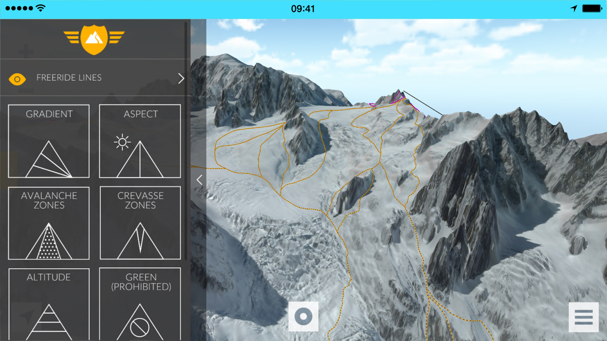
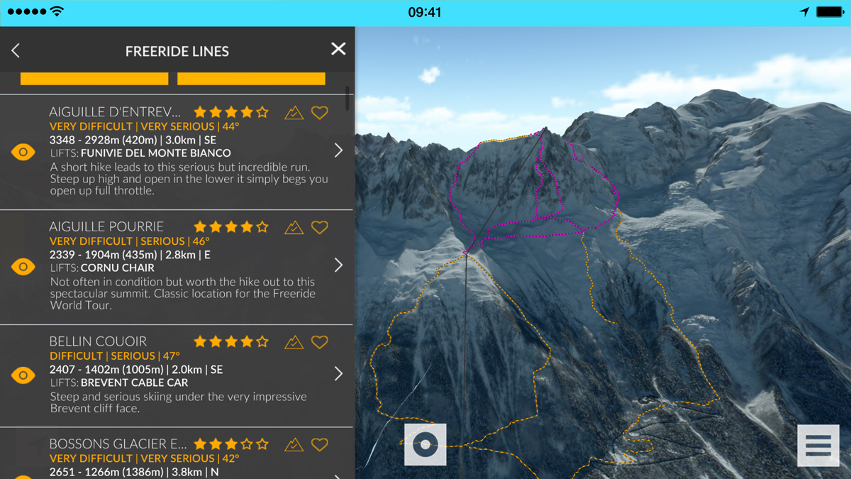
This version looks useful for both riding and trip planning. Many classic and hidden off-piste lines are mapped, detailed and rated.
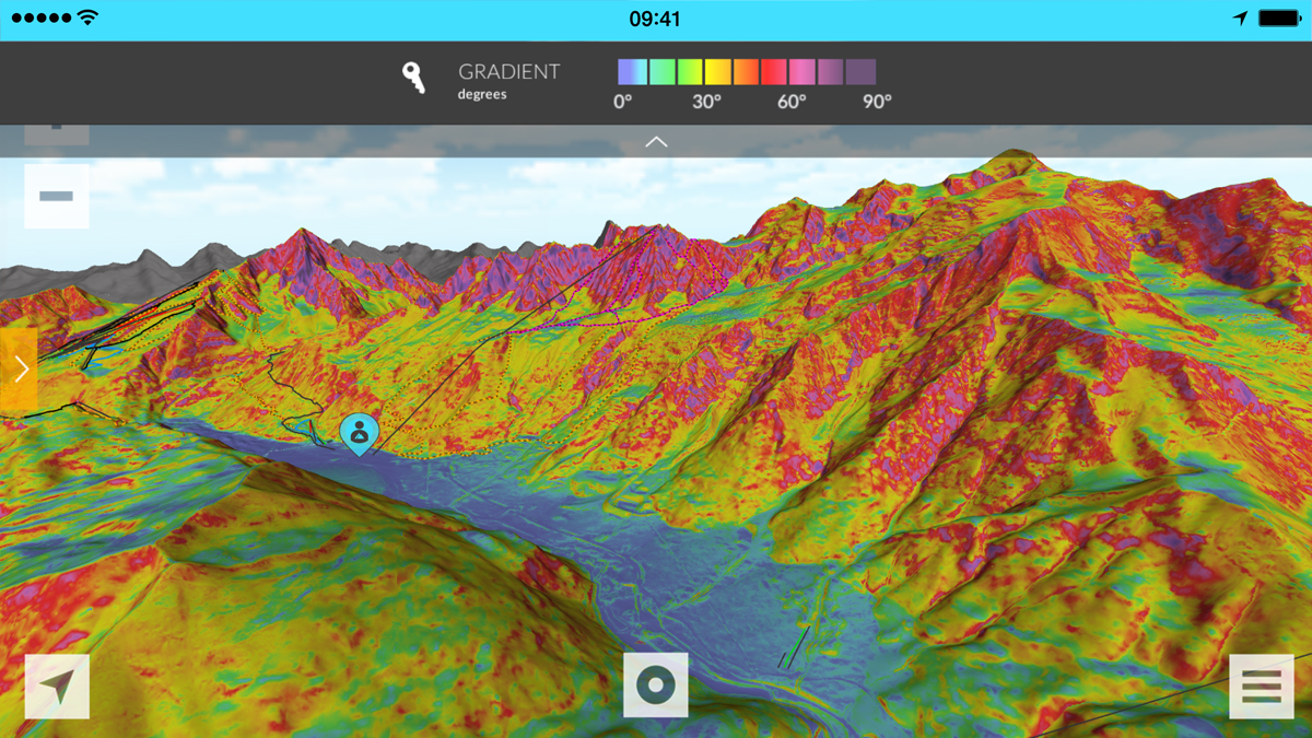
Avalanche zones and gradients are included in the mapping. By clearly showing the key gradient ranges defined by the Munter Reduction Method, this tool can help evaluate the risks given the current snow and environmental conditions.
Even crevasse zones are mapped.
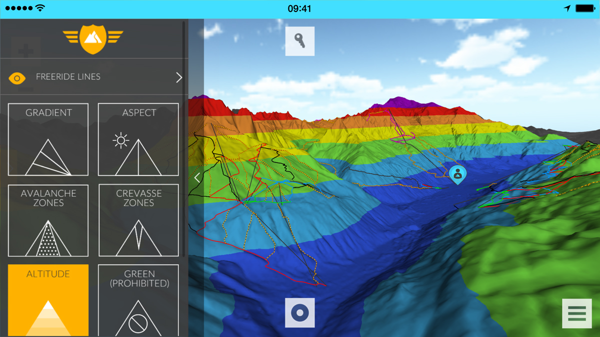
Altitude segmentation helps users determine quality of the snow, weather conditions and avalanche risks for given terrain.
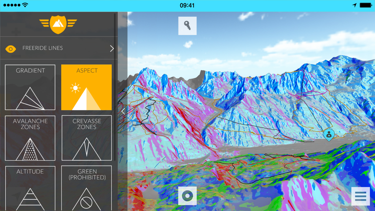
Slope aspect (north, south, east or west) is another factor in determining snow quality and stability. The app shows it clearly.
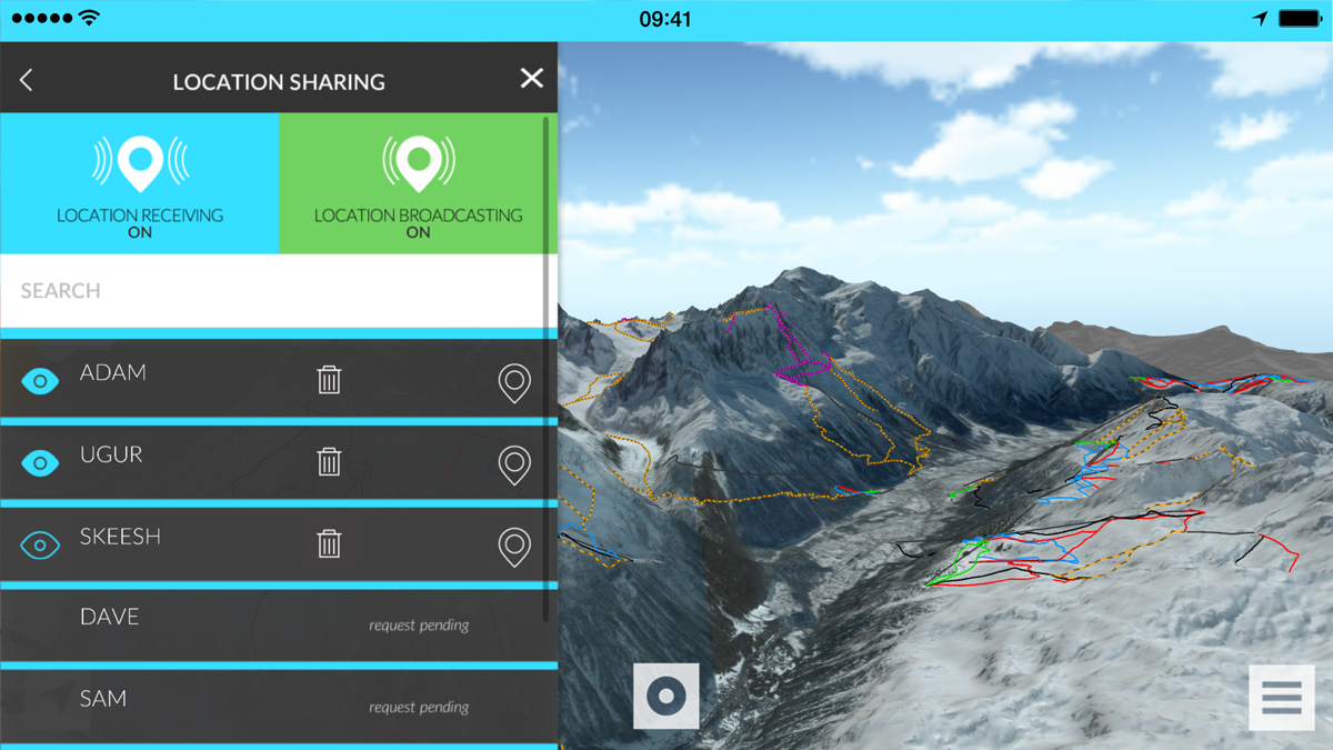
Working with the GPS on your phone, Fatmap locates buddies on the map. Location sharing and ID can help you find that lost buddy.
3D fly-throughs allow you to see your whole line before running it, which could be helpful for dicy cliff sections.
Each run is mapped in high resolution 3D with descriptions, slope gradient information, user ratings, and comments.
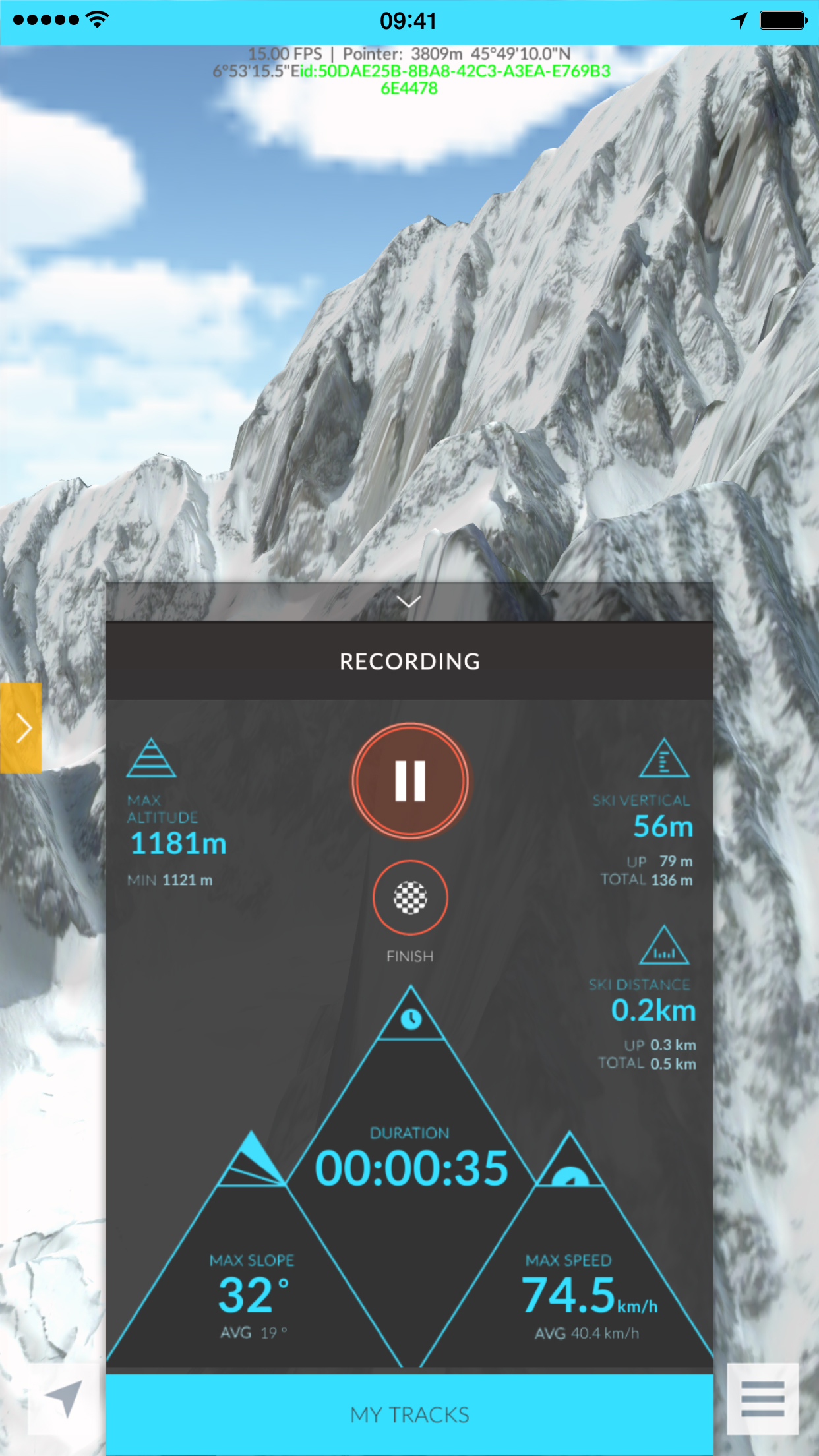
Finally, the app records your tracks, vertical descent, speed, and distance travelled to be shared online.
“The real innovation behind Fatmap is the level of detail we’re able to provide on a mobile device,” said spokesman Adam Robinson. “We work with a two-meter elevation grid, meaning we have a point on the ground every two meters. We believe that this level of detail plus the information we’re able to provide about the terrain will help skiers and snowboarders explore further in a safe way.”