With the booming popularity of drones for videography, cities, states and the FAA have had a tough time forming regulations to keep up with the rapidly evolving technology.
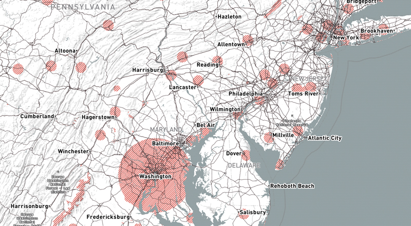
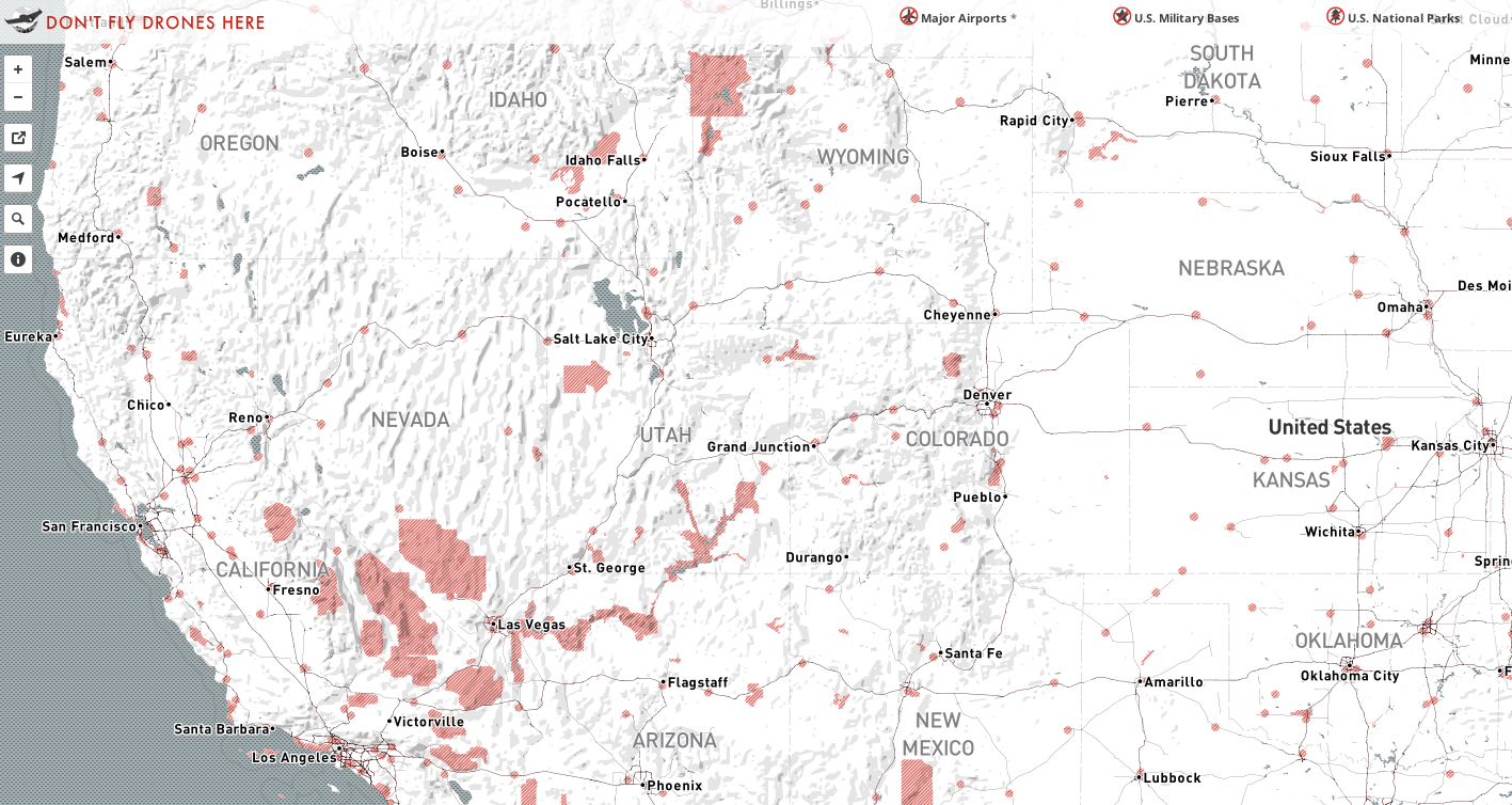
Fortunately, the internet moves a lot faster than bureaucracy. While tons of details remain to be ironed-out when it comes to stunts like flying drones through fireworks displays, this drone no-fly zone map provides a general guideline on where drones are a no-no using data from the National Park Service (no drones in National Parks) and U.S. Military Data.
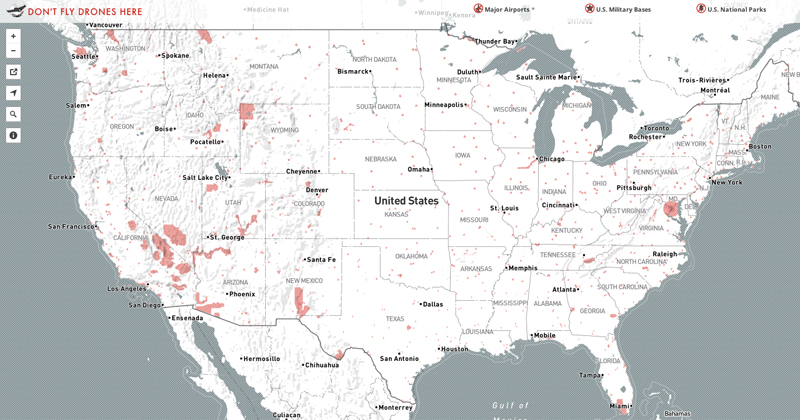
No surprise, big cities like Washington D.C. and New York are off limits. So are some vast stretches of wilderness and obvious places like near airports or military sites like New Mexico’s White Sands Missile Range.