With nature adventures in every direction, San Francisco is a treasure trove for outdoor enthusiasts. While the national parks of the nearby Sierra Nevada often overshadow the local preserves, you don’t need to leave the Bay Area to access a wide variety of ecosystems and trails.
From the Marin headlands to the north to the marsh wetlands of the South Bay, and the Santa Cruz Mountains of the peninsula to the drier peak of Mount Diablo, San Francisco is a perfect launch point to quickly become immersed in nature. Within a short drive or via public transportation, you can be on the trail and hiking in no time.
Whether you are planning a weekend visit to the City by the Bay, or a resident looking to make a spontaneous day trip, here are seven Bay Area hikes to consider that are well worth your time.
1. Muir Woods: Canopy View Loop
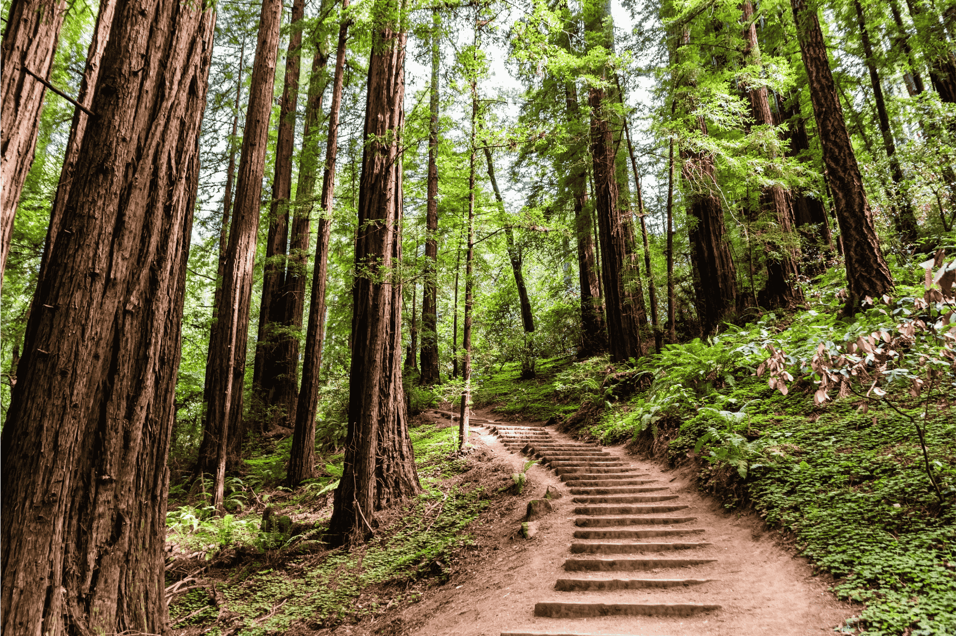
Just a 20-minute drive north of the Golden Gate Bridge, you can escape into a redwood wonderland. The Canopy View Trail in Muir Woods ascends a tranquil canyon with a flowing creek surrounded by old-growth coast redwoods. The park has been a national monument since 1908 and a longtime favorite getaway of San Francisco residents for a day hike.
To complete the loop, ascend the Canopy Trail and connect to the Lost Trail and Fern Creek Trail.
- Length: 3 miles, 530 feet elevation gain
- Difficulty: Moderate
- Restrooms: Yes, at trailhead
- Parking: Parking at trailhead; entrance fee is $15 per person 16 years and over, free for people 15 years and younger
- Dog friendliness: No dogs allowed
- Hours: 8 a.m. to sunset
Expedition X-Lätt Jacket
- Material: 100% polyamide (recycled)
- Filling: 100% polyester
- Activity: Trekking
- Features: Insulating, Packable, Packs into self, Lightweight, Water resistant, Wind resistant
- Clothing layer: Outerwear, Insulating layer
- 3 pockets: Hand pocket(s), Inner pocket(s)
2. Lands End
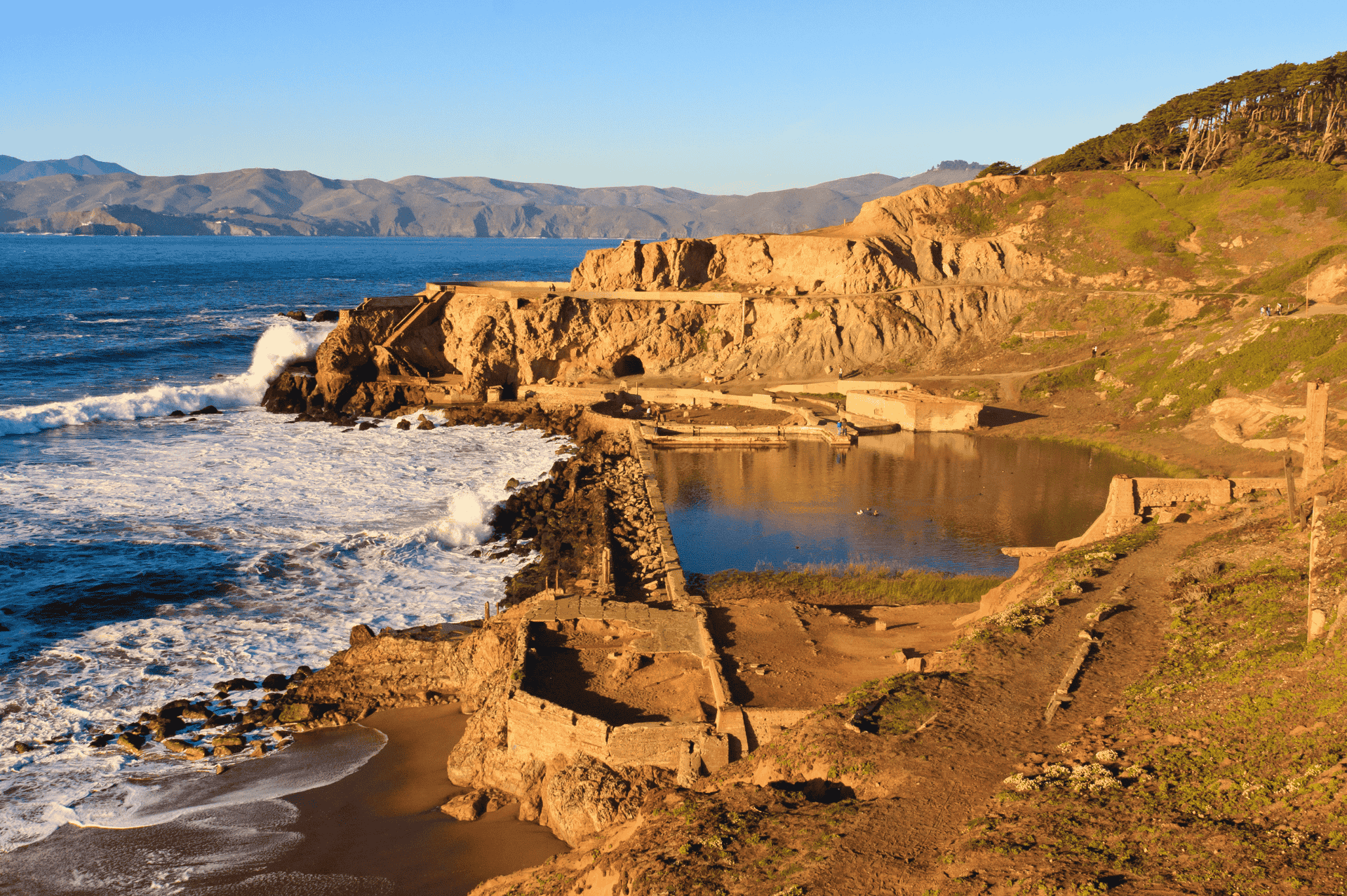
Located on the western shore of the city of San Francisco, Lands End is a scenic and simple getaway for San Franciscans seeking a break from the bustle of city life. Easily accessible via the 38 Muni bus, Lands End provides stunning views of the Pacific Ocean and Golden Gate Bridge.
You’ll find wildlife like cormorants and seals, the ruins of Sutro Baths (which burned down in a 1966 fire), and the remains of Mile Rocks Lighthouse jutting out from the choppy sea.
The Coastal Trail is a 2.9-mile out-and-back hike that provides several viewpoints and the option to descend to the water’s edge at Mile Rock Beach.
- Length: 2.9 miles
- Difficulty: Easy
- Restrooms: Yes, at all three parking lots in the park
- Parking: Free
- Dog friendliness: Allowed on leash, beware of coyote activity
- Hours: Accessible 24 hours; parking lots open sunrise to sunset
3. Marin Headlands: Hawk Hill
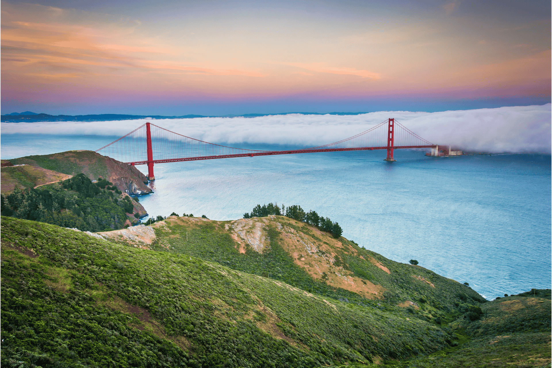
Hawk Hill, located in the Marin Headlands, offers one of the most breathtaking views of the Golden Gate Bridge and San Francisco skyline. It is a great spot for observing migrating birds of prey like hawks, eagles, falcons, and vultures.
In addition to its unparalleled views of the city, Hawk Hill showcases the area’s military history, as it features an artillery battery constructed during WWII to protect the bay’s entrance. The military buildings that once existed on the hill have since been removed, but you can still see the remnants of their concrete foundations.
- Length: 1 mile
- Difficulty: Easy
- Restrooms: At parking lot
- Parking: Free at trailhead
- Dog friendliness: Dogs allowed on leash
- Hours: Accessible 24 hours
Vidda Pro Ventilated Trousers
- Material: G-1000: 65% polyester (recycled), 35% cotton (organic)
- Activity: Trekking
- Features: Adaptable with Greenland Wax, Breathable, Durable, Water-resistant, Wind-resistant, Stretch, Ventilation
- Reinforcement areas: Knees
- Clothing layer: Outerwear
- 6 pockets: 3 or more large leg pockets with buttoned flaps, 1 knife pocket, 2 hand pockets
- Waist: High waist
4. Purisima Creek Trail
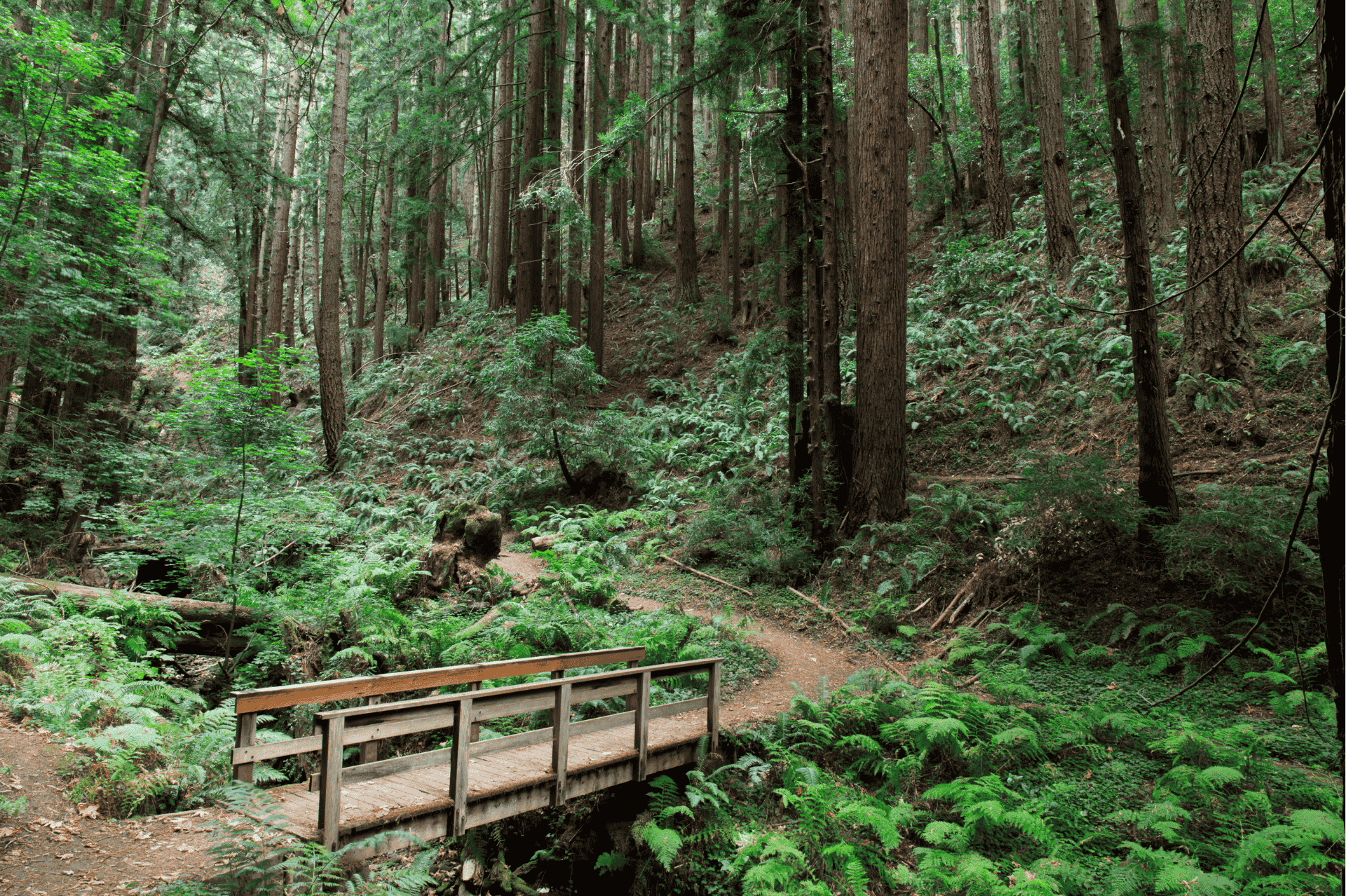
If you’re looking for a redwood nature escape south of the City, the 5,412-acre Purisima Creek Redwoods Open Space Preserve is an excellent option. While hiking through Purisima Creek Canyon on the west slopes of the Santa Cruz Mountains, visitors can marvel at towering coast redwoods, lush ferns, and plentiful banana slugs as the trail crosses several moss-covered wood bridges over the rushing creek.
Most of the coast redwood trees in the preserve are second-growth forests — around 100 years old — after the original giants were logged in the late 1800s. Yet the new forest is returning to its old form and regaining its timeless beauty.
The 8.6-mile round-trip hike from the Purisima Creek trailhead to the Redwood trailhead is a great option to see much of what the reserve has to offer. However, there are many possibilities for connecting other trails and loops if you want a shorter or longer hike.
- Length: 8.6 miles, 1,840 feet elevation gain
- Difficulty: Hard
- Restrooms: At Skyline Blvd. parking lot, Purisima Creek parking lot, and Redwood parking lot
- Parking: Three parking lots around the park — North Ridge, Redwood, and Purisima Creek
- Dog friendliness: No dogs allowed
- Hours: Open a half-hour before sunrise until a half-hour after sunset
5. Mori Point Loop
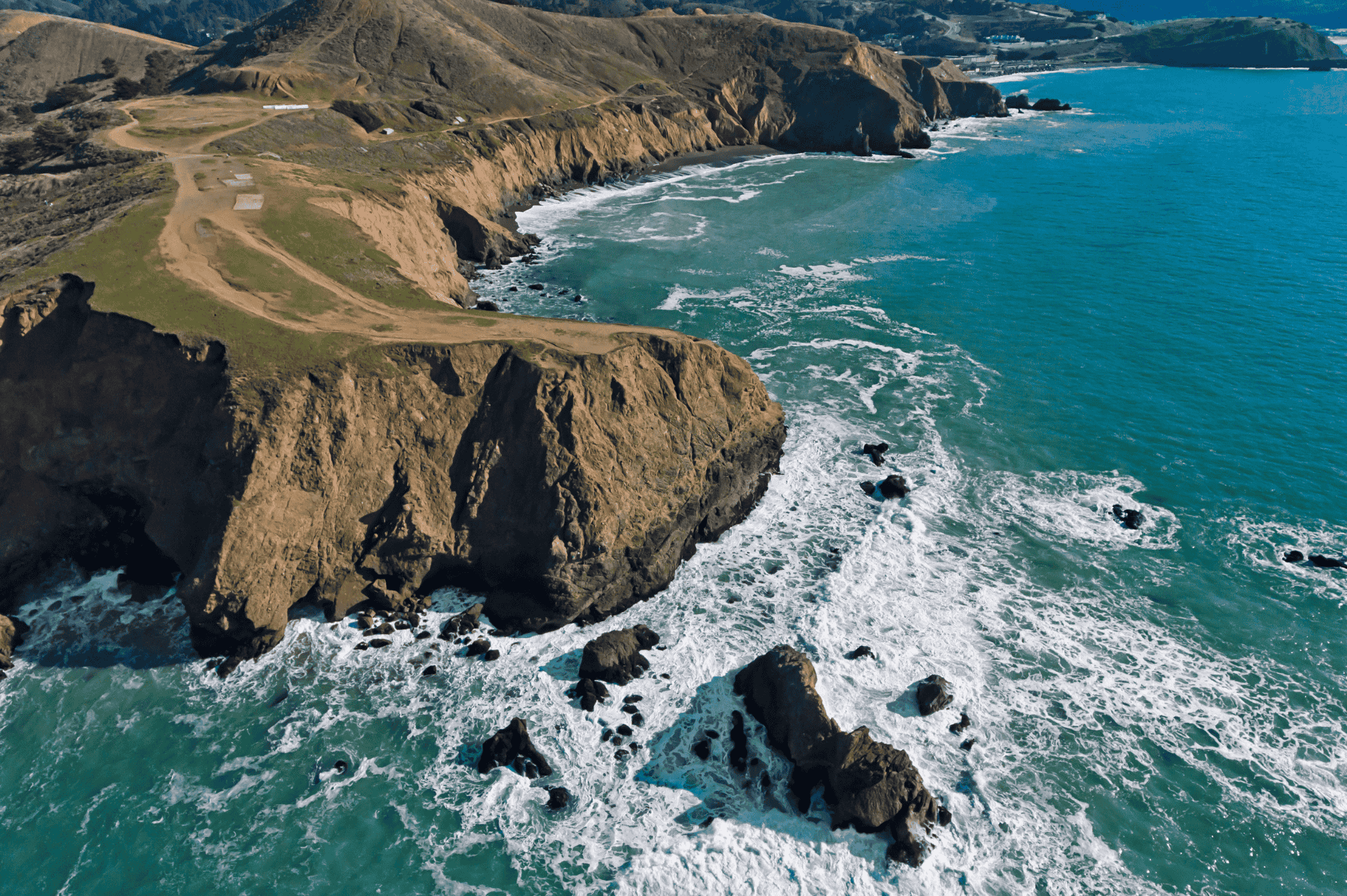
In the town of Pacifica, where the concrete of San Francisco gives way to rolling coastal hills, Mori Point is a nature preserve with sweeping ocean views and fresh Pacific Ocean air. It’s a great place to watch a sunset or look for whales, with views stretching to the Golden Gate Bridge and beyond on a clear day.
The Mori Point loop trail starts from the trailhead off Highway 1 and heads to the vista overlooking the ocean. However, the open space features six other trails that can be connected as you please.
Tip: If you want to get to Mori Point without a car, take the 110 bus from the Daly City BART station and get off at Highway 1 and Westport Dr.
- Length: 3.2 miles; 298 feet elevation gain
- Difficulty: Easy
- Restrooms: Yes, at Mori Point parking lot off Highway 1
- Parking: Parking on Mori Point Road or Bradford Way
- Dog friendliness: Dogs allowed on leash
- Hours: Accessible 24 hours
Abisko Grid Fleece Hoodie
- Material: 100% polyester (recycled)
- Activity: Trekking
- Features: Insulating
- Clothing layer: Mid layer
- 3 pockets: Chest pocket(s) with zipper, Hand pocket(s)
6. Mount Diablo
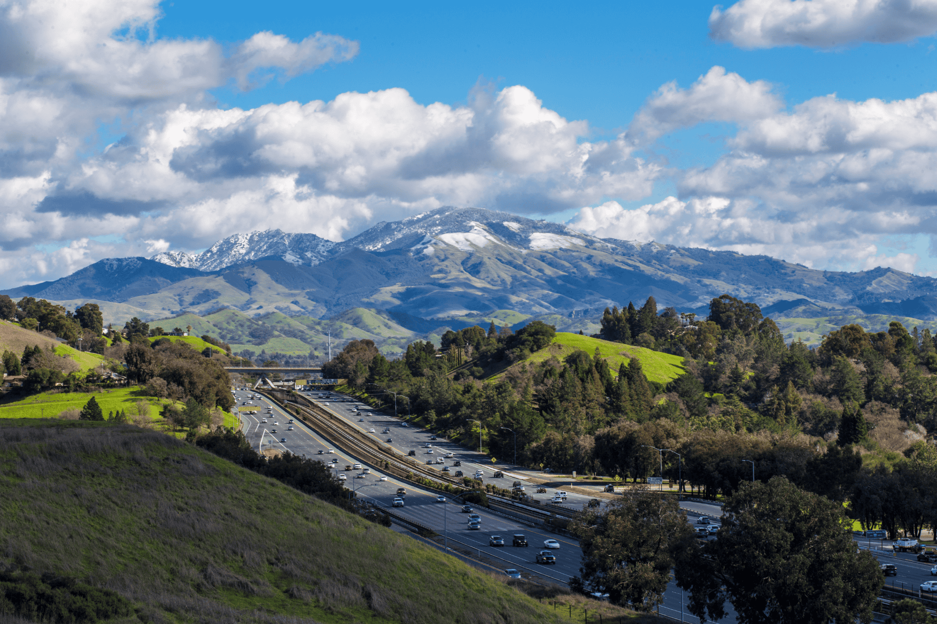
Perhaps the best view of the entire Bay Area is from Mount Diablo in the East Bay. From the summit of the peak 3,849 feet above sea level, you can catch views that stretch west to the Farallon Islands, south to Loma Prieta, east to the Sierra Nevada, and — on an exceptionally clear day — north to Mt. Lassen in the Cascade Range.
While it’s possible to drive to the top of Mt. Diablo, that’s no fun! Why not enjoy nature on the mountain’s slopes, break a sweat, and hike to the top? The distance and elevation gain may vary depending on where you park, but if you start around Curry Point, it will be roughly a 7.3-mile round-trip hike.
With 20,000 acres to explore in Mount Diablo State Park, heading to the summit is by no means the only option — 350,000 visitors come each year to explore the park’s various trails and peaks.
- Length: 7.3 miles, 2,139 feet elevation gain
- Difficulty: Hard
- Restrooms: At Summit Visitors Center and several camps that you pass on the way
- Parking: Vehicle entrance fee can range from $6 to $10 depending on the park entrance
- Dog friendliness: Dogs allowed on leash
- Hours: Gates open 8 a.m. and close at sunset
Kånken Outlong
- Material: Vinylon F: 100% vinylal
- Activity: Everyday Outdoor
- Features: Durable
- 6 pockets: Inside compartment, Open side pocket(s), Zippered inside pocket(s), Zippered outside pocket(s)
- Height: 42 cm
- Width: 41 cm
- Depth: 21 cm
7. Alviso Marina County Park
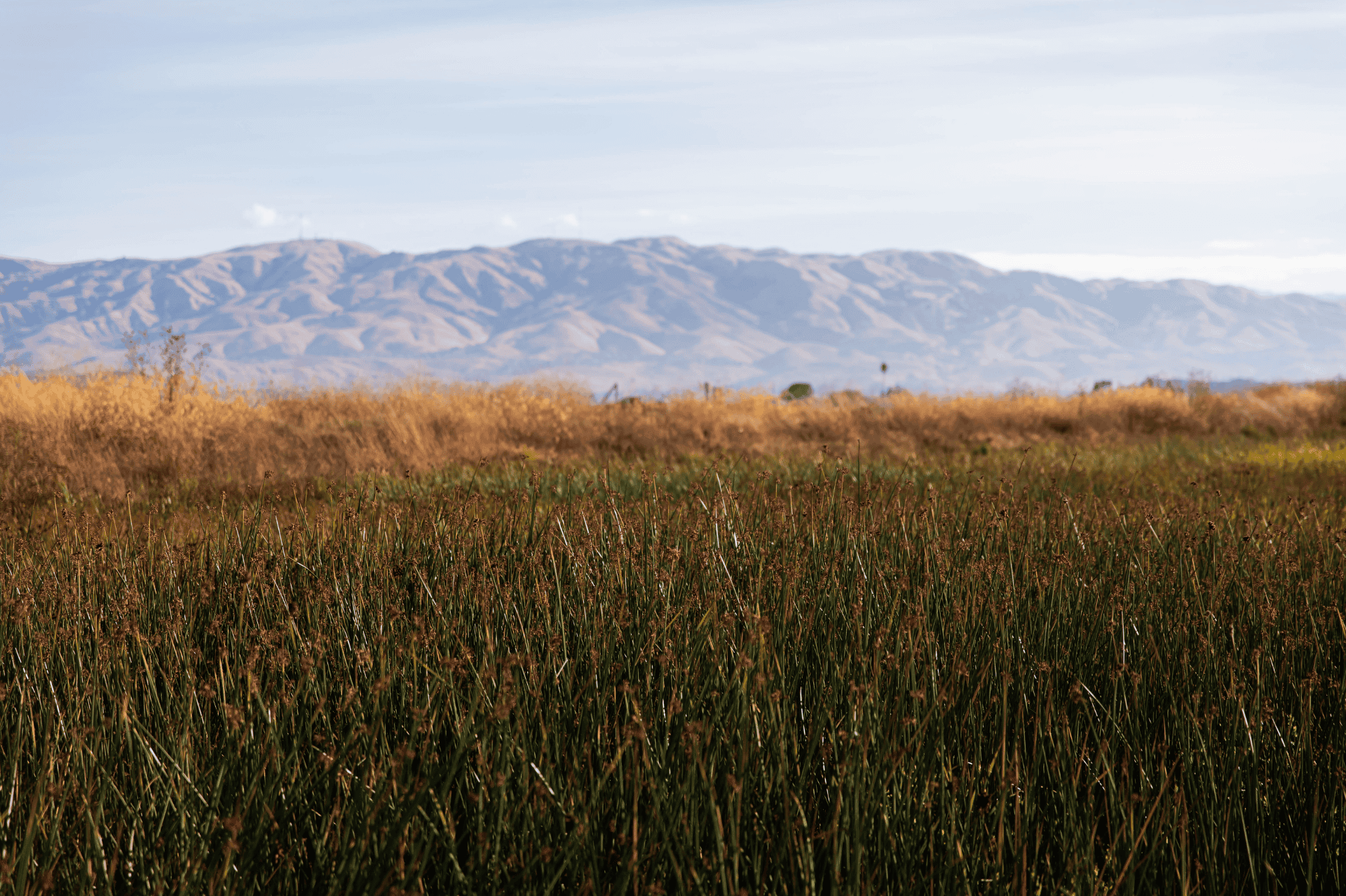
Alviso Marina County Park provides a quick nature getaway for South Bay residents. The Alviso Slough Trail completes a 9-mile loop through the park’s vast marshes and wetlands that serve as a refuge for many species of birds.
The hike is flat, as it hugs the water’s edge with panoramic views of the mountains that surround Silicon Valley. One unique feature that draws visitors is the salt deposits from the old mining industry, which turn certain pools into a mesmerizing reddish color.
Tip: Save some gas and take the 59 bus from Santa Clara to arrive at the park.
- Length: 9 miles
- Difficulty: Moderate
- Restrooms: Yes, at parking lot
- Parking: Free at trailhead
- Dog friendliness: Dogs are allowed only in the picnic areas and pathways, but not on the trails
- Hours: 8 a.m. to sunset
This post is sponsored by Fjällräven.


