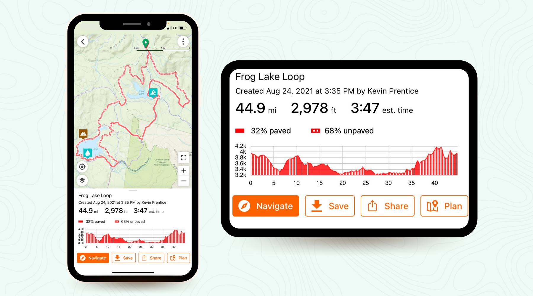
Bike route map-and-planner app Ride with GPS helps you get from A to B on the bike. Now, it helps you figure out what the route between the two will be like — down to its texture. Meet Surface Types.
The newest tool in Ride with GPS’s kit, Surface Types, goes live today. Aptly named, the feature displays changes in surface types over the course of a chosen route. If there’s a gravel screed somewhere on your road route, you’ll know it. If you’re in the backcountry and the trail turns to pavement, you’ll know that, too.

Surface Types is the latest tool in the Ride with GPS route planning kit, which already includes a heatmap overlay, satellite maps, and street view. The feature adds an exclusive layer of route-planning security, and it’s available to riders with a broad array of devices, from iOS and Android to Garmin and Wahoo.
“Our mission is to help users go on better rides, more often,” said Zack Ham, Ride with GPS founder. “Knowing the surface type doesn’t just help route planners, it provides a better riding experience for everyone, and encourages folks to discover more places to ride.”
That being said, the feature appears rudimentary for the time being. In addition to “unknown,” it specifies two simple terrain types: paved and unpaved. Paved includes everything from chip seal on up. The unpaved category looks a lot broader: gravel, cobblestones, dirt, and developed or undeveloped trails.
However, Surface Types should get more accurate over time, thanks to user input. Ride with GPS invites riders to update terrain status in their local area through its Route Planning function. The brand admits the app’s existing surface data is incomplete and acknowledges that nobody knows bike routes like those who ride them every day.
Finally, Surface Types folds into each of the app’s displays, including the elevation profile and distance screen. Honestly, this might be its most direct utility. If you’re expecting a hilly road ride, it could really help to know whether one of the hills was actually gravel or worse.
Ride with GPS, and its new Surface Types feature, works across a wide array of devices. Check it out on the company’s website or in the App Store or Google Play.

