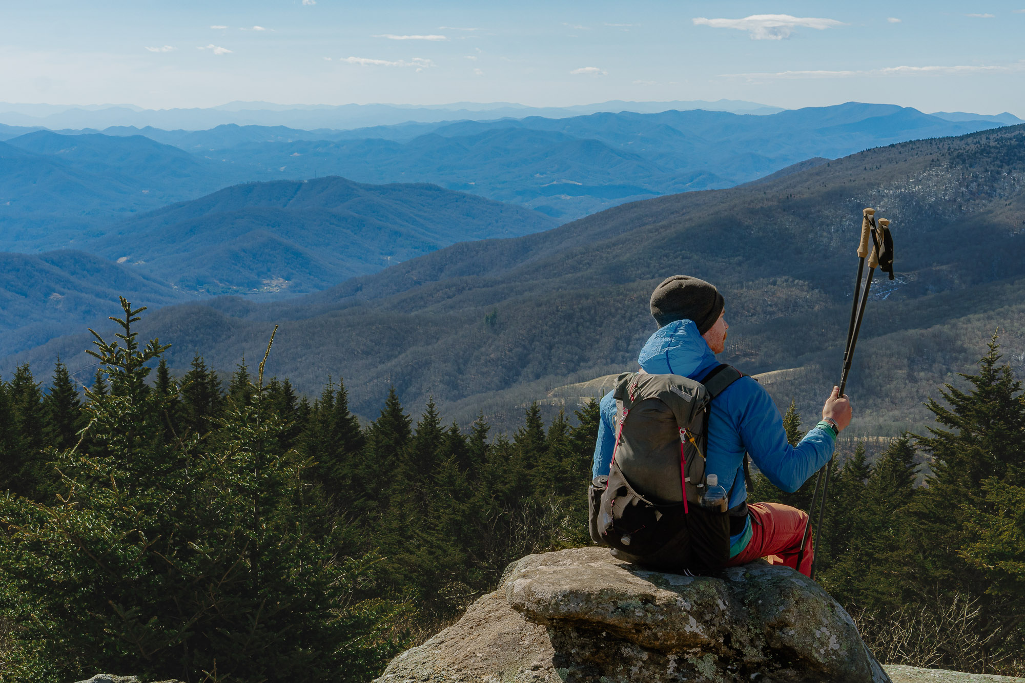
Decorated adventure race duo and Bend, Ore., residents Jason and Chelsey Magness give us the lowdown on some of their favorite trails near their hometown.
Bend, Ore., has more than its fair share of ultraclassic hikes. Situated on the eastern edge of the Cascade range, the town is perfectly positioned to allow residents easy access to a multitude of natural environments. From forested high alpine, lava-covered high desert, and the scenic waterfalls and canyons of the Deschutes River Basin, there’s much to admire.
Add the thriving outdoor culture — infinite craft beer, eclectic food trucks, riverside concerts, pedestrian-friendly downtown, amazing used gear stores, and moderate climate — and it’s no wonder Bend has become an outdoor adventure destination.
Presented by
The landscape is what first attracted me and my wife to Bend more than a decade ago, and we’ve spent that time exploring all the classics. As professional adventure racers, we can heartily recommend every one of the classic trails, with one caveat: Increasing (and deserved) popularity has led to increased crowds.

So we want to offer something a little different. In our training, we’ve explored our fair share of the more obscure trails and have been especially drawn to those we’ve found that include optional add-on adventures.
As multisport athletes, we like to mix up our hike or trail run with a little “bonus content.” Best yet, you’re more than likely to have these trails all to yourself!

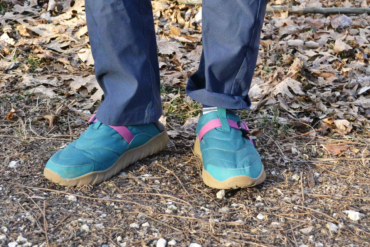
Don’t forget the importance of having the right gear for these hikes — including Columbia’s new Facet Collection. This collection focuses on the important aspects of a technical hiking shoe and combines it with a running-inspired fit and athletic midsole. Footwear like this can be crucial in your enjoyment of any number of hikes or outdoor pursuits.
Shop the Facet CollectionBend, Oregon: Best Hikes Without the Crowds
Oregon Badlands Rock Trail
If you’re seeking solitude, the Oregon Badlands is a great winter area just 20 miles southeast of Bend. It often stays snow-free (or at least minimal coverage) for most of the year, even when the nearby Cascades are covered in a thick blanket of white.

The Badlands also gets a lot of sun, often making it quite pleasant on winter afternoons. The entire trail system boasts over 50 miles with barely any elevation gain. But there are plenty of unique geological features to keep things interesting.
All of the Badlands is actually a “rootless shield volcano.” So as you hike along, you’ll see lots of evidence of the volcanic history in the forms of lava outcrops. As you’d expect from the high desert, there is little to no water out here, so come prepared.
Our favorite feature is known as The Castle — a series of narrow passageways through a basalt uplift. This creates a maze with sheer 10- to 25-foot walls.
For the rock climber, this offers a nearly perfect bouldering area: lots of easy to moderate routes on mostly solid rock with a generally soft and sandy landing. And you’ll find many more similar areas (also with climbing) scattered throughout the trail network.
Our perfect day here includes a nice 3-mile run on a wide, flat trail where we’ll get some speed training in. Then the sandy sections give some extra calf work. Once at The Castle, we spend an hour or so exploring narrow passageways. Here, we’ll each try to climb 10 easy routes before we continue the loop and run back.
- Travel Time From Bend: 25 minutes
- Total Hiking Distance: 8 miles
- Difficulty: Easy
- Elevation Gain: Minimal
- Highlights: Ancient juniper, volcanic pressure ridges, unique bouldering
Horse Butte Trail
Located just southeast of Bend, this 10-mile loop trail is our go-to from fall through spring. It receives a lot of sun and has unending views of the mountains.
From the Horse Butte trailhead, it gently climbs up until you reach the rim of a small plateau. The trail is mostly narrow singletrack surrounded by sparse scrub and juniper, with plenty of short sections of semitechnical lava rock. It’s also open for mountain biking, but the short vegetation makes it very easy to see approaching bikers. So there’s very little chance of a “surprise” biker-hiker collision.
About halfway through the loop sits Boyd Cave, a classic central Oregon lava tube one can explore for nearly a mile underground! Keep in mind that the temps stay pretty constant in the cave, which means it will be refreshingly cool in the cave during a hot summer day — you may even want a light jacket!
If you’re planning to explore the cave (highly recommended), please bring a headlamp. A cellphone “flashlight” will not cut it.
We love to head out there on a cold, crisp winter morning after a light dusting of snow. Warm up by hiking the first half of the trail, crunching along the frozen ground.
Once we arrive at the cave, we head down and enjoy the warmth of the earth. That’s right — because the cave keeps a near-constant temperature (around 45 degrees Fahrenheit), what feels cool in the summer feels warm in the winter!
After some exploration, we head out and enjoy a beautiful (mostly gently downhill) trail run back to the car. The only real challenge is that the views to the west make it hard to keep your eyes on the trail!
- Travel Time From Bend: 15 minutes
- Total Hiking Distance: 8 miles
- Difficulty: Moderate
- Elevation Gain: 600′
- Highlights: Beautiful, wide-open views of the Cascades, lava tube exploration
Six Lakes Trail
This year, the U.S. Forest Service implemented a new permit reservation and fee system that limited access to many of the region’s most popular hikes in designated wilderness areas. The Six Lakes trail provides a nice option because it’s still free and has no daily user limit. This makes it not only a great destination but also a perfect fallback if you’re planning on the classic South Sister or Soda Springs/Green Lakes trails.
The trail name is a bit deceiving, as it only includes Blow Lake and Doris Lake. But it does connect into trails that pass many more.
The trail gently climbs through a beautiful alpine tree environment, eventually connecting to the Pacific Crest deep within the Three Sisters Wilderness. The lakes mark the highlight of this hike, with waters clear and warm enough to swim in.
Mosquitos can be bothersome in the late spring/early summer, but we’ve never had any problem after the beginning of August. The water here is clean, making it the perfect outing to bring portable water filtration. There are also lakeside hammock spots, so you can throw a packable option in your pocket even if you’re going ultralight.
The first part of the trail (to Blow Lake) is somewhat popular, so you’ll encounter a few other hikers and runners. But once you venture past that, you’ll likely be alone.
Our beta creates a big loop using the Six Lakes Trail, Senoj Trail, and then return by running north on the dirt road that parallels the paved scenic Highway 46 until you reach the Six Lakes trailhead again.
Swim-run adventure: When the late summer temps stretch toward triple digits, we love doing the loop as a 13-mile swim-run! There are four lakes total: Blow, Doris, Senoj, and Lucky. We travel light with just a filter bottle and fanny pack for snacks and goggles.
Arriving at each lake, we do a quick swim across and back. The longest of these is Doris (400 m each way), but the other three are in the 200m range. It makes for a perfect cooldown. We can fill water too, and we dry off (and heat up) again just in time for the next swim!

This is a splash-about adventure, so expect to wear shoes that can take the abuse. Columbia’s Facet Collection sports the brand’s patented OutDry membrane, paired with a seamless mesh construction to add both waterproofing and breathability.
The longest leg (along the dirt road) back to the car can be avoided if you have two cars or bikes that you can drop at the Lucky Lake trailhead. Done this way, it’s only 9 miles!
- Travel Time From Bend: 35 minutes
- Total Hiking Distance: 5-13 miles
- Difficulty: Easy to moderate
- Elevation Gain: 400’ (5 miles out and back), 1,800’ (13-mile loop)
- Highlights: Pristine alpine lakes, warm(ish) water, few people
Paulina Lakeshore Trail
This one is a summer and winter favorite. It has a lot of options, diverse landscapes, and is definitely worth repeat visits to explore the many surrounding trails.
The Paulina Lakeshore Trail lies within the Newberry National Volcanic Monument. It centers around twin caldera lakes (Paulina and East Lake), similar to the nearby Crater Lake National Park, but with a fraction of the visitors.
Trails circumnavigate each of the lakes individually, as well as the rim as a whole. The terrain is varied and includes some incredible jet-black obsidian lava fields. There are dramatic views everywhere, with nearby Paulina Falls (just west of the trailhead) and jagged Paulina Peak (southeast of the trailhead), making for great side trips. There’s also a rustic lodge at the trailhead open year-round, which makes it a great place for pre-hike coffee and post-hike burgers.
Best of all, this area has natural lakeside hot springs. Both Paulina Lake and East Lake possess their own thermal pools, but the Paulina Lakeshore Trail is the only way to circumnavigate one of the lakes completely near the shore.
The trail is relatively flat and easy, with an infinite number of enticing swimming spots and a really cool quarter-mile section that passes directly through the Inter-Lake Lava flow. There is a short signed spur trail on the northeast side of the lake that will take you to the hot pools, which are minimally built up with some logs to help them hold shape.
You will find them literally right on the edge of the lake, so you can spend the day jumping back and forth into the cool and hot water. The temperature can vary from comfortably warm to too hot, but it’s easy to add lake water. Many users bring a small spade to dig out the sandy bottom of the pools to keep them well-formed.
The entire loop encompasses about 7 miles, but you can access the hot springs (and pass through the lava section) in a shorter out-and-back hike by parking at the Little Crater trailhead/day-use area.
In the winter, things get a bit more interesting. Once enough snow comes, the road closes 3 miles before the lodge/trailhead. But there are numerous maintained ski, snowshoe, and snowmachine trails that head from the winter parking area straight to the trailhead. And if you like hot springs in summer, wait ’til you sink into the warm, steamy solitude you’ll find once the lakes are blanketed in snow!
We love to drive up early and start via headlamp with a snowshoe (or fat bike ride) up toward the trailhead. We make sure to take a short detour to check out the Paulina Falls in their icy splendor, and then make a stop at the lodge for a light breakfast and coffee.
Lodge tip: A+ for coffee/hot chocolate mix with whipped cream! Once we caffeinate, we head out on foot/snowshoe/ski (depending on conditions) to the main event!
No biking is allowed on the trail, but if you did use fat bikes for the approach, you can continue riding snowmobile trails to the Little Crater trailhead and hike from there. Once at the springs (look for the steam if the lake is covered with snow), strip down and enjoy skinny dipping in a winter wonderland!
- Travel Time From Bend: 40 minutes
- Total Hiking Distance: 7.5 miles
- Difficulty: Easy to moderate
- Elevation Gain: 400′
- Highlights: Spectacular geologic setting, obsidian lava flows, natural hot springs, nearby waterfalls

Go Prepared
Bend offers a number of variable outdoor adventure opportunities ranging from short and simple to grueling and technical. It’s important to adequately prepare for the adventure ahead.
Researching your route before starting, packing food, water, and even an extra change of clothes can be critical. And don’t forget to take care of your feet. Pick footwear that can hold up to the demands of the trail — like Columbia’s new Facet Collection. Offering multiple styles and options, the Facet lineup is a versatile, all-terrain option for hitting the trails.
Shop the Facet CollectionThis article is sponsored by Columbia. Find out more about the new Facet Collection here.

