A wildfire threatens your home, community, or the campsite you plan to visit this weekend. Is it really in harms way? A new app aims to share the most current information with a simple click.
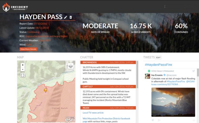
The Incident Dashboard monitors critical facts about current wildfires with maps, images, containment levels, rate of spread, communication between firefighters, and a Twitter scroll fed through active fires’ hashtags in real. Information comes from firefighters and citizens near the blaze for a first-of-its kind alert network that can be used by anyone.
It aims to become a valuable new tool for those living in areas regularly threatened by wildfire.
Wildfires: A Real Risk
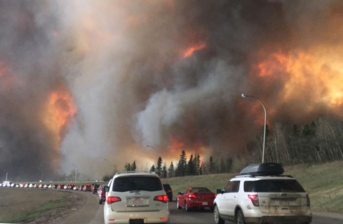
As drought persists across the West and parts of Canada, wildfires have become a daily threat to hundreds of thousands of people. From May to July this summer, the Fort McMurray wildfire in Alberta made headlines as it destroyed 1.5 million acres and 2,400 homes, making it the worst disaster in Canadian history.
In the U.S., nearly 34 million people are living in “Exceptional Drought,” with dozens of wildfires blazing across parched forests and grasslands.
“We’re seeing more and more impact on the public than ever before,” said Sam Lanier, co-founder of Incident Dashboard and the FireWhat? mapping resource it uses.
According to Lanier, his app is the first of its kind to use crowd-sourced data from firefighters and the public to create a realtime news feed of active and recently contained fires.
While the app is free for firefighters, everyone else can download and use it for $6 per year. As a user, you can sign up to receive mobile notifications of fires near you, and contribute to the conversation by uploading images and Tweeting current conditions.
A New Fire Warning System
Emergency services currently use reverse 9-1-1 calls to warn residents within an affected area of danger. As more and more individuals transition away from landlines, alert protocols have become less effective, Lanier said.
App Tracks Fires
The app has two views — a map and a dashboard. The map shows an overview of fires, contained fires, and current fire perimeters. Users can toggle map views to show streets, topography, infrared, relief, satellite images, and more.
The dashboard is a user’s detailed information source where they can access realtime updates, weather information, and critical fire data.
Those who face the risk of wildfire can add this to their preparedness toolbox for a fairly small investment. Check out the Incident Dashboard to try it for free.

