This map from NOAA displays weather averages dating back to the 1980s to predict snowfall. While different than a forecast, the map still helps to get into the holiday spirit.
Yearning for the sound of sleigh bells and the sight of snow-covered treetops? If so, check this interactive map to see what this Christmas might have in store.
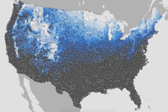
The National Oceanic and Atmospheric Administration (NOAA) put together a map that displays the climatological probability of at least one inch of snow being on the ground on December 25th.
To make the map, NOAA gathered “climate normals” from 1981 to 2010. From more than 9,800 weather stations, it measured temperature, precipitation, snowfall, heating and cooling degree days, frost/freeze dates, and growing degree days.
NOAA White Christmas Map
On a scale from dark gray (no snow) to blue (some snow) to white (near-certain snowfall), NOAA plotted hundreds of points across the U.S. that display snowfall probability. Southern states show mostly gray, whereas mountain and northern states bloom in bright colors.
NOAA notes that its predictions are based on historical probability rather than current weather forecasts. For instance, most of Idaho, Maine, Minnesota, Wyoming, and Montana usually has a white Christmas, but current weather patterns will dictate actual snowfall.