U.K.-based Satmap Systems Ltd. has a goal to make “paper maps” viewable on a GPS screen. In a partnership this month with National Geographic, the company’s Active 10 handheld GPS device can now display all major National Geographic topographic map titles, including the TOPO! and Adventure map series as well as NG’s Trails Illustrated maps.
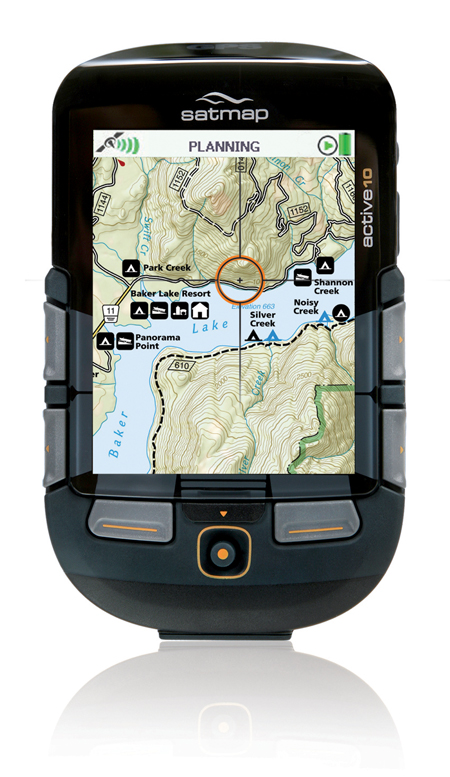
The Active 10 TREK GPS package comes preloaded with small-scale maps of the United States and the world. To get the detailed Nat Geo maps, you purchase SD cards and plug them into the Active 10 device. The device displays the maps as they would be seen on paper — in high-quality, color representation with all original cartographic details included.
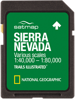
More than a dozen TOPO! maps are available now, including Arizona, California, Colorado, Idaho, the Mid-Atlantic region, Montana, and other areas. Three Trails Illustrated maps are a part of the initial offering — California’s Sierra Nevada, the Southern Appalachians, and America’s “Greatest National Parks” map.
The Active 10 TREK device is a premium product with a large color screen and a rugged build. Bonus: Anyone who’s fumbled with a touch screen while wearing gloves will appreciate the fact that you can operate this unit with one hand (and without removing your gloves).
The Active GPS device costs $369.99. The National Geographic SD Map Cards are $99.99 apiece.
—Stephen Krcmar lives in Mammoth Lakes, Calif.


