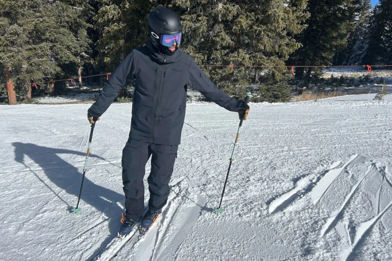
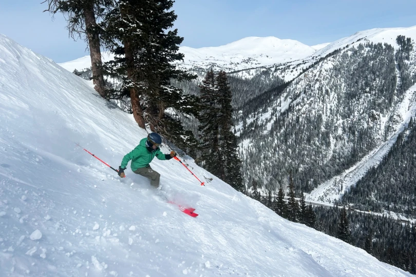
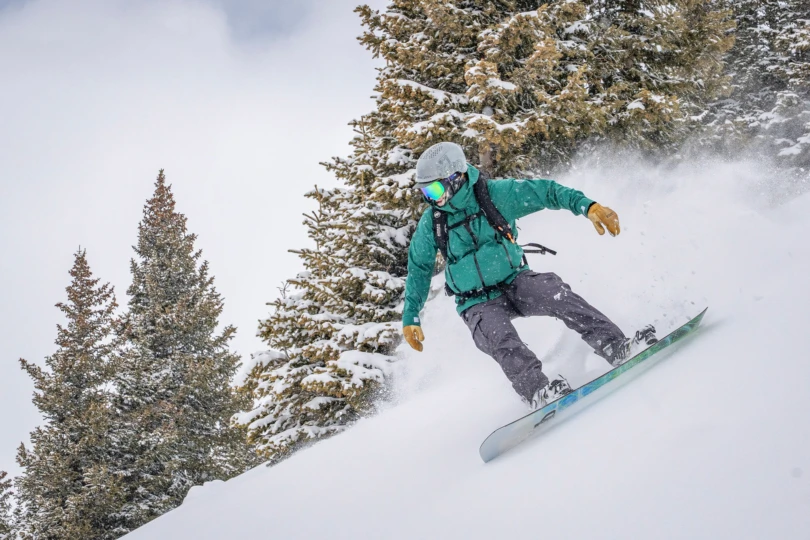
There’s this one distinct section of my favorite touring zone that confounds most layering strategies. It’s about an hour into the tour and nearly 2,000 vertical feet into the climbing when the forest yields to an icy wind-battered ridgeline that bends up even steeper. The topography creates a frigid micro-climate of wind and tundra. Yet I consistently overheat in a hardshell as I trudge upward.
As I approached it in Norrøna’s Lofoten Flex1 Jacket and Pants, I had the inkling that I might have found the solution — a softshell jacket and pants combo breathable enough for a steep skin track but burly enough for the harsh winter gusts. The combo clicked. I was able to push through the section to the powder stash without drenching the jacket from the inside.
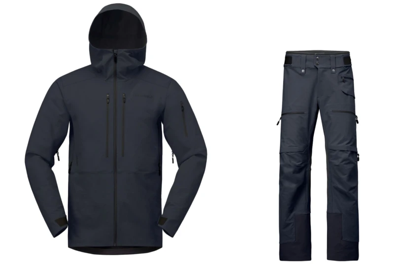
The Lofoten Flex1 Jacket and Pants are a long-overdue softshell entry for the Norwegian brand, known for its ultra-protective ski apparel. The Jacket is a long, slender, yet versatile softshell. The pants lean toward utilitarian and movement-oriented without compromising the aesthetic cut.
This kit kept my body temperature in harmony through many days in complicated early-season weather conditions. Norrøna finally gave the backcountry skiing softshell diehards what they’ve been requesting for years: a more breathable version of their iconic Lofoten outerwear. But like most softshells, there were a few instances where the kit just wasn’t the right tool for the job.
In short: The new Lofoten Flex1 Jacket and Pants carry forward the line’s legacy with a long, aesthetic cut and fit that feels tailored. The softshell fabric substantially boosts breathability for the skin track and the long days under the sun, in the resort or out. In classic Norrøna fashion, the feature set is both dialed and minimalist, with options to boost the kit’s weather protection. But breathability always comes with a tradeoff.
Compare the Lofoten Flex1 Jacket and Pants to those on GearJunkie’s guides to the Best Ski Jackets and the Best Ski Pants.
- Fit: Athletic
- Insulation: None
- Shell: Flex1 (polyester, nylon, elastane), waterproof shoulder, knee, and seat panels
- Weight: 912g (pants), 880g (jacket)
- Sustainability features: >50% recycled, Bluesign approved
Pros
- Excellent fit and mobility
- Solid breathability
- Top tier feature set
- Very durable
Cons
- Not particularly waterproof
- Fixed powder skirt
Norrona Lofoten Flex1 Jacket and Pants Review
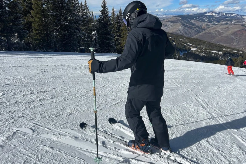
Norrona’s Lofoten line has been a staple for the brand for over 20 years. But if there’s one thing the brand is known for, it’s wet weather protection. Its Norwegian homeland is one of the wettest places on Earth.
GORE-TEX is great for when you need bombproof weather protection. Water and wind don’t get past it, and it’s just breathable enough to resist getting clammy on the inside.
Still, though, it routinely feels like overkill on sunny days in Colorado’s backcountry. It’s easy to get hot fast when you’re hammering up the skin track. It was a pleasant surprise (and somewhat of a bombshell) when Norrøna announced a softshell version of its iconic Lofoten outerwear: the Lofoten Flex1 Jacket and Lofoten Flex1 Pants.
Lofoten Flex1 Jacket Details & Fit
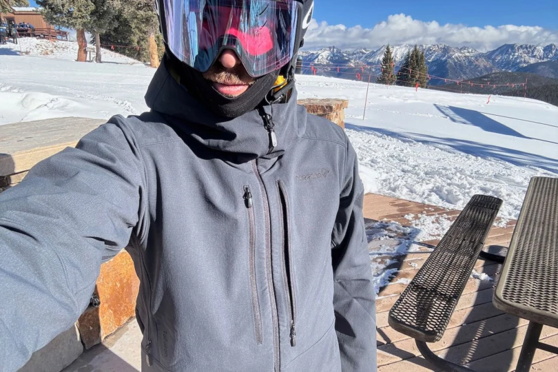


The highlight of the Lofoten Flex1 jacket is the fit. True to the Lofoten reputation, the Jacket is decidedly long and relatively slim-fitting. It has a freeride shape without being outrageously stylish. It’s refreshingly modern and simultaneously timeless.
The bottom hem drops to my upper thighs. The sleeves are extra long and have articulated elbows, so they don’t creep up my wrist when I reach for a long pole plant or raise my hand above my head. It adds protection to the jacket’s boundaries, which was most welcome on gusty ridgelines.
At 6’1”, the large jacket fit about perfectly for skiing. It was slim enough to wear with just a sun hoodie underneath, but I had enough room to layer medium and heavy-duty midlayers underneath.
Most importantly for ski touring, the exterior profile was relatively slim. It accommodated over-the-shell insulation, such as Patagonia’s Das Light Hoody. In my opinion, good ski touring outerwear must seamlessly accommodate both.
The Lofoten Flex1’s details are simple in the best possible way. The jacket offers just two external chest pockets and one shoulder pocket for a ski pass. A well-designed helmet-compatible hood and big underarm vent zippers round it out.
Lofoten Flex1 Pants Details & Fit
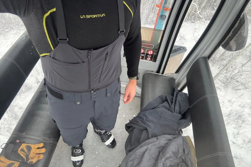


The Lofoten Flex1 Pants follow the Jacket’s minimalist lead, offering first and foremost an outstanding fit and shape. Loose fitting but not baggy, while still being somewhat slim. They have an aesthetic freeride shape that would complement most skiers’ styles.
The size large was, in fact, a tiny bit big on my 33-inch waist. Velcro fasteners were up to the task of providing some level of pants security, even if I wouldn’t trust them to keep my pants up alone.
Thankfully, Norrona opted for a belt-and-suspenders approach — beefy belt loops accommodate my favorite webbing belt, and a zipper attachment for a sold-separately zip-in bib ($69) transforms the pants into much more protective soft-shell bib snowpants. The bibs simply zip into the teeth around the circumference of the pants’ waist.
With the bib deployed, I was able to forgo a belt and rely on the Velcro waist-tightening tabs on each hip. It kept the pants’ mobility excellent and kept the pants’ joints from migrating up and down during ski touring strides. The bib’s upper provides a tight seal to the body. Not a snowflake was able to creep in during the test period, even while flopping around in the powder.


Pants Pockets & Cuffs
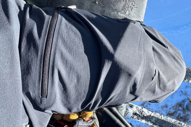
The pockets are similarly streamlined. These ski pants offer two big zippered thigh pockets (plenty big for a phone) and one zippered hip pocket that can accommodate an avalanche beacon.
The pants’ cuffs default to a ski boot-accommodating flare that can be buttoned in for a slightly slimmer fit. It’s a distinction that lands it more in the freeride side of the pants spectrum. Those searching for more of a mountaineering pant that won’t snag on crampons should look elsewhere for pant cuffs that default to narrow but zip open to accommodate ski boots. Norrona’s own Lyngen Flex1 Light pants are a great example.
The pant cuffs deviate from the softshell theme with hardshell reinforced ankles. The design both defends against ski edge slices and upward creeping wetness from the snow. They’re burly enough that they’re still in great shape after the test period despite a repeated thrashing from my skis’ edges and a painfully complicated early-season bushwhack.
Breathability
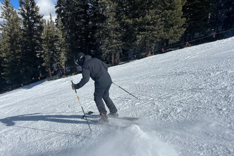


As I trudged uphill fully covered in the Lofoten softshell kit, I wasn’t disappointed. And that’s saying something because I’m an exceptionally warm person. Usually, I have no problem sweating through layers. And believe me, I found the limit of the Lofoten’s breathability. Still, I was pleasantly surprised by how long it took to overheat. The fabric breathes well.
Once I started to get warm, I zipped open the generous underarm vents and the long mesh-backed thigh vents to extend the range. But the fabric is still burly. It doesn’t breathe anything like a sun hoody, microgrid fleece, or ultralight windbreaker.
That said, the Flex1 fabric felt distinctly more breathable than your typical three-layer hardshell fabric on the uphills. The hot, wet air close to my body was able to escape instead of turning my pits, back, and legs into a swamp. It kept me feeling dry, day after day, whether I was ski touring or resort skiing. That’s not typically the case when I’m clad head to toe in even the most breathable hardshell fabrics.
Flex1 Fabric Waterproofing
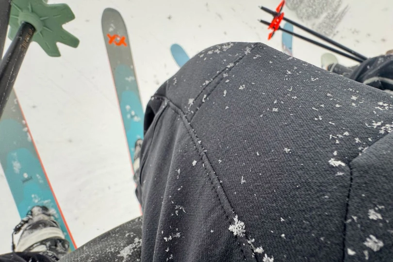


Norrøna’s proprietary Flex1 softshell fabric is a blend of polyester, nylon, and elastane. It aims to strike a balance between breathability, protection, and stretch. The fabric’s DWR-treated exterior is burly to the touch. The interior is brushed, so it feels slightly softer against the skin.
The flip side of breathability is protection. I quickly noticed on a chilly, early-season resort day that icy cold air can penetrate the soft-shell fabric. As that chilly wind deteriorated into a full-blown snowstorm, I weathered the blizzard draped in the Lofoten Flex1 kit. It did a fantastic job at deflecting cold, dry snow.
But as the snowflakes thickened, plump with liquid, the Flex1 fabric proved penetrable. It’s not waterproof like GORE-TEX. My thighs and chest got damp after a while while riding the chairlift.
That’s not particularly surprising. The protection versus breathability conundrum is one that all product designers face when using a softshell fabric. The Lofoten’s Flex1 fabric falls on the protective side of the softshell spectrum, even if it can eventually succumb to saturation.
But Norrøna’s designers got ahead of it. Both the pants and jacket feature waterproof panels in the knees, seat, and shoulders. Those zones stayed mostly dry. But more importantly, I was able to poke around in snow pits, kneel, and sit on my skis for a snack without soaking my outerwear.
One of the most overlooked benefits of softshells for skiing is stretch. The Flex1 fabric is very stretchy, which vastly improves the kit’s mobility compared to its hardshell competitors. I enjoyed the stretch most acutely on the skin track, where tiny constrictions can add up after thousands of strides.
Thankfully, the Lofoten Flex1 Pants not only articulated well but also stretched at the extremes of each stride, rather than constricting the movement.
Resort vs. Backcountry: Where Does It Thrive?
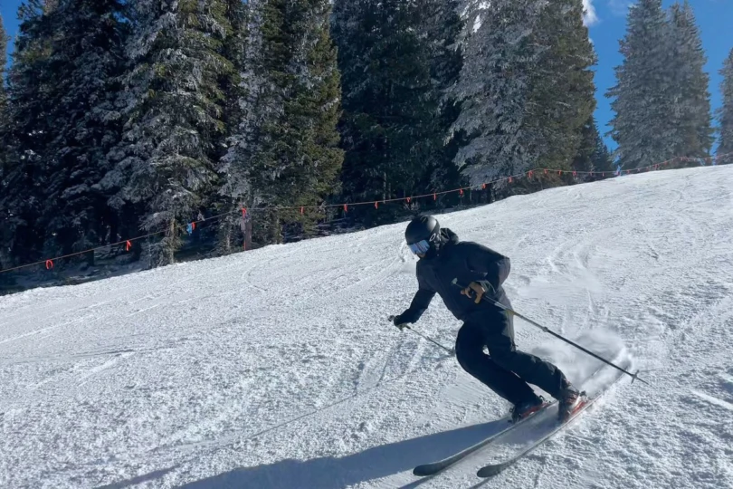


I was impressed with the Lofoten Flex1 Jacket and Pants’ versatility in the front country and backcountry after weeks of testing. In all honesty, I had originally pegged the softshell kit as a backcountry specialist that wouldn’t venture with me inbounds very often.
But other than protection in serious wet blizzard conditions, the Flex1 kit actually made a lot of sense for inbounds skiing in most conditions. For one, the softshell material is distinctly thicker, and therefore slightly more insulating, than a thin hardshell. I swapped between light wool baselayers and none at all.
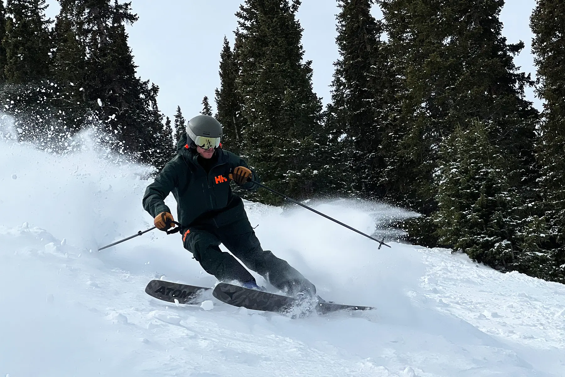
As mentioned, it’s also stretchy. That mobility makes a big difference for dynamic skiers who lean deeply into turns and ski fast and loose in moguls. The cut lends itself to basically any layering architecture that the temperatures could demand. The optional bib adds a layer of protection on par with my go-to resort bibs. It’s basically impossible for snow to get in my pants when that thing is zipped in.
The Lofoten Flex1 kit simultaneously has the breathability and mobility that I’m looking for in the backcountry. So sidecountry and hike-to resort terrain, logically, is covered too. It’s an outerwear kit that has more bases covered than you might expect from softshell.
Room for Improvement: Powder Skirt
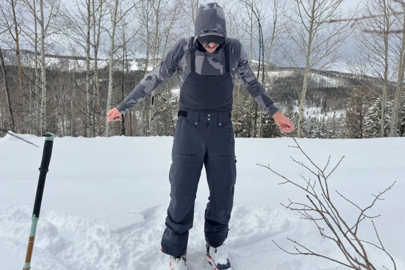


Unlike many ski jackets (including the Lofoten GORE-TEX Jacket), this ski jacket includes a fixed “Snap-away” powder skirt. It snaps to the matching pants’ belt loops to create an ultra-protective barrier from the light and fluffy. It works as advertised.
But I’m decidedly anti-powder skirt. For one, they’re annoying at baseline, and I find that they ride higher than I’d want them. Also, they’re superfluous when you’re wearing bibs like the Flex1 Pants’ zip-in bib. And staying warm in the backcountry is inevitably about the layer shuffle. You’re constantly adjusting layers to achieve the ideal temperature balance. Buttoning and unbuttoning the powder skirt is cumbersome.
That’s a long way of saying that I wish the powder skirt were removable like with most other jackets. But it’s far from a dealbreaker. I simply cut it out with a pair of scissors and never looked back.
Norrona Lofoten Flex1 Jacket & Pants: Conclusion
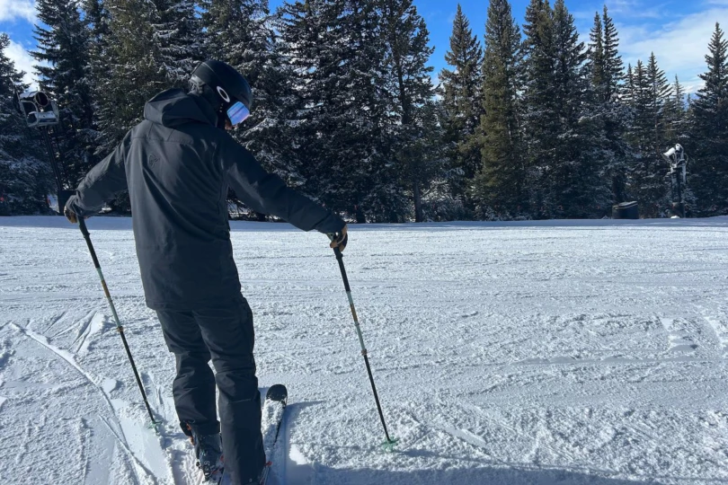


Norrøna’s gift to the softshell connoisseurs, the Lofoten Flex1 Jacket and Pants, were exceptionally capable in the mixed weather and skiing conditions that I encountered during the test period.
But here’s the thing: The softshell material isn’t all that different from other top midweight softshells on the market. That’s not a bad thing. It has a super-durable exterior that fends off dry snow and very light precipitation. A brushed interior is soft against the skin and adds just a tiny bit of warmth compared to a hardshell. Most importantly, it’s adequately breathable without absolutely surrendering to frigid wind gusts.
What sticks out about the Lofoten Flex1 Jacket and Pants is the attention to fit and mobility. I loved the long, slim cut, the attention to movement-oriented gusseting, and the protective features sprinkled throughout. The attachable bib was a huge bonus. The pockets and details were dialed for ski touring.
The Lofoten Flex1 Jacket and Pants are a stellar companion on all but the wettest days in-bounds or outside the resort gates with the right layering strategy. Skiers that don’t venture into the backcountry, and therefore don’t need the extra breathability, would enjoy slightly more protection from the GORE-TEX version of the Lofoten or my personal favorite resort-oriented hardshell, the Tamok.
Still, backcountry skiers or those hiking to extreme terrain or sidecountry gates looking specifically for a freeride-oriented softshell kit could hardly do better than the Lofoten Flex1 Jacket and Pants. The people asked, and Norrøna delivered.
