
The best hikes in Yosemite wind through valleys, climb up granite faces to waterfall views, and traverse alpine meadows through some of the most spectacular scenery in the lower 48.
Yosemite National Park should be a top destination for anyone who loves the outdoors, whether you prefer hiking, climbing, camping, or photography. There are over 100 trails in the park, with something for every type of hiker.
Your idea of a perfect hike might involve strolling through a grove of giant Sequoias and having a picnic. Or perhaps you’d rather hike to the top of a mountain with expansive views. Whatever your preference, Yosemite has a trail to fit the bill.
After researching for hours and consulting with experienced Yosemite hikers, we have compiled a concise guide of the best hikes in Yosemite. This guide will get you started planning your Yosemite trip, whether it be 2 weeks long or a single afternoon. Pack your 10 hiking essentials and hit the trail!
Best Hikes in Yosemite National Park
Easy Hikes
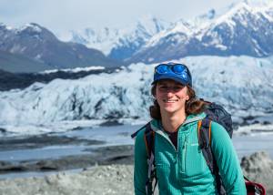
Lower Yosemite Falls
")
Even if you only have an hour as you drive through the park on the way to your next destination, this short leg-stretcher is worth the quick hike. Yosemite Falls is one of the most iconic views in the park, visible from pretty much anywhere in Yosemite Valley.
You will be able to see the falls from the trailhead, but the short walk through the woods is worthwhile for an even better view. The falls are most spectacular in the spring due to the runoff from melting snow. The trail is usually busy due to its proximity to Yosemite Village, but if you don’t mind a few neighbors, this is a great short outing.
If you stay out late enough, you could even catch a glimpse of the “moonbows” — rainbows created by the mist from the falls and the light of the moon.
How to get there: Access via Yosemite Valley
Distance: 0.5 miles round trip from the trailhead or 1.5 miles round trip from Yosemite Village
Difficulty: Easy
Elevation gain: Minimal elevation gain
Need to know: Restrooms at the trailhead; trail is wheelchair accessible
Glacier Point

Glacier Point is one of the iconic views that comes to mind when you think about Yosemite National Park. The expansive views of the valley, and specifically Half Dome, are arguably some of the best in California. This, of course, means that everyone and their father will be at the lookout trying to get the best spot for photos.
It’s still worth it to make the drive out to the viewpoint, especially if you’re in the park for an extended trip. The hike itself is short, more of a walk to a viewpoint. However, the whole half-mile trail is spectacular, so make sure to take the time to enjoy it.
Sunset is the best time to visit, as the light will be shining on Half Dome instead of in your face. The trail is short, paved, and exposed, so make sure to stay on the path behind the barriers.
How to get there: Drive to the end of Glacier Point Road
Distance: 1 mile round trip
Difficulty: Easy
Elevation gain: Minimal gain
Need to know: Pit toilets in the parking lot; trail is mostly wheelchair accessible — some unpaved portions
Mariposa Grove of Giant Sequoias

Whether you’re looking for a 7-mile hike in the woods or a short trip to see some of the biggest trees in the world, Mariposa Grove is a great hike. There is limited parking at the trailhead, but most people park about 2 miles away at the southern park entrance. Shuttle busses run every 10-20 minutes to the grove (except during summer 2021 due to COVID-19 restrictions). The lower grove tends to be more crowded than the upper grove, so plan accordingly.
The first tree you pass as you enter the grove is the Fallen Monarch. This massive dead tree is about 15 feet wide at its base. The trail to see the Grizzly Giant, the largest of the Yosemite Giant Sequoias, is slightly uphill. This 30-foot wide tree is estimated to be about 1,800 years old. As you wander through the grove, imagine the lives that these astonishing trees have lived.
How to get there: Drive or take the park shuttle to the Mariposa Grove Welcome Plaza
Distance: 0.3 miles up to 7 miles round trip depending on the route
Difficulty: Easy
Elevation gain: Varies from very little to 1,200 feet for the 7-mile loop
Need to know: Toilets at the parking area and at the trailhead
Lembert Dome Trail

This short but not trivial hike is a great precursor to Half Dome. If you couldn’t get Half Dome permits or if you don’t want to hike in line with hundreds of other people, this is a great alternative. Due to its location off Tioga Road and the ability to choose your path up the granite face, Lembert Dome is a good option to get away from the crowds.
You will climb for about 0.75 miles before turning left at a signed junction to head up the dome. Make sure to wear hiking shoes with good traction, as you will be hiking up the glacier-carved rock itself! Once you arrive at the top, enjoy the stunning views of Tuolumne Meadows, the Cathedral Range, and the surrounding peaks.
Be sure to avoid this hike during thunderstorms. Check the weather before heading out and keep your eye on any gathering clouds.
How to get there: Off Tioga Road
Distance: 2.8 miles round trip
Difficulty: Easy-ish
Elevation gain: 900 feet
Need to know: Pit toilets available at the parking lot, restrooms at Tuolumne Meadows Visitor Center (1 mile away)
Moderate Hikes
Cathedral Lakes Trail

Although busy for the Tuolumne Meadows area, this hike is a perfect opportunity to get out of Yosemite Valley and away from the thick of the crowds. The first 3 miles follow the John Muir Trail through wildflowers and across a few streams (depending on the season).
At the trail junction, you can choose to turn off for Lower Cathedral Lake (0.5 miles to the lake) or continue to Upper Cathedral Lake. Although there will probably be people around, the lakes have plenty of space to disperse and hang out. Have a snack, a swim, or sunbathe on the rocks before heading back down.
How to get there: Off Tioga Road, 9 miles west of the Tioga Pass entrance
Distance: 8 miles round trip to see both Upper and Lower Cathedral Lake (7 miles round trip for either one)
Difficulty: Moderate
Elevation gain: 1,200 feet
Need to know: Typically portapotties at the trailhead, restrooms about half a mile east at the Tuolumne Meadows Visitor Center
Mist Trail to Vernal & Nevada Falls

The Mist Trail is an iconic Yosemite destination, featuring some of the park’s most spectacular waterfalls. Visit during peak runoff from April to June for the most impressive views. Because it’s such a popular trail, it’s a good idea to get an early start or to head out in the evening (don’t forget your headlamp!) to avoid the crowds.
It’s about 3 miles to reach the top of Vernal Falls via a 600-step granite staircase. You won’t be able to reach the top of the falls without getting soaked, so prepare for the mist by wearing a raincoat or visit on a hot day. Watch your step as you make your way to the top, as the stairs can be slippery due to the water!
Keep going another 1.5 miles up rocky switchbacks to reach the top of Nevada Falls. The crowds should thin out a bit as you go. and you will have views the entire way. At the top, head right to cross over the top of the falls for a unique perspective looking down the rushing water falling 594 feet down the cliff.
You can then choose to head back down the way you came, or take the John Muir Trail for expansive views of Liberty Cap behind Nevada Falls for a different route back to the trailhead.
Note for 2021: The stairs to the top of Vernal Falls are a one-way route to reduce traffic, so anyone going up must come down the John Muir Trail from Clark Point. See the NPS website for more current COVID-19-related closures.
How to get there: Parking can be found at the trailhead just east of Curry Village or take the shuttle from eastern Yosemite Valley
Distance: 2.5 miles round trip to the top of Vernal Falls, 5 miles round trip to the top of Nevada Falls, and 7 miles round trip if returning via the John Muir Trail
Difficulty: Moderate
Elevation gain: 1,000 feet to the top of Vernal Falls; 1,900 feet to the top of Nevada Falls
Need to know: Restrooms located at Curry Village or at the first bridge overlook of Vernal Falls, top of Vernal Falls, and top of Nevada Falls
Difficult Hikes
The Pohono Trail

If you only have one day, have a lot of stamina for a big outing, and want to see a little bit of everything in the park, the Pohono Trail is your hike. This scenic voyage along the South Rim of Yosemite Valley takes you between two of the most classic views in the park: Tunnel View and Glacier Point.
The rest of the hike winds around the valley, taking you past Inspiration, Taft, Crocker, Stanford, and Dewey points. You’ll also get views of El Capitan, Sentinel and Cathedral rocks, and Nevada, Yosemite, Vernal, and Bridalveil falls.
Whichever end you start from, you’ll have about a mile of strenuous uphill hiking to begin. If you go from Glacier Point to Tunnel View, it gets easier after that, but if you’re hiking the other direction, there’s another uphill section from Bridalveil Creek to Taft Point. The trail will be busy near the trailheads, but the crowds will thin out in the middle miles.
The most challenging part of this hike is the logistics. Make sure to have two cars, one at each trailhead, or take the Glacier Point tour bus up to Glacier Point and hike an extra 3 miles back to Bridalveil Falls Trailhead (take the Old Stagecoach Road instead of the main road) to catch the shuttle.
How to get there: Take Highway 41 south from Yosemite Valley to Tunnel View 2 miles past Bridalveil Falls Trailhead, or take Glacier Point Road 9 miles from Yosemite Valley
Distance: 13 miles one way
Difficulty: Difficult
Elevation gain: 3,700 feet including Sentinel Dome; 3,400 feet without it
Need to know: Pit toilets at Glacier Point; restrooms at Bridalveil Falls Trailhead
Half Dome

If you want to push yourself outside your comfort zone and get to the top of a nearly 9,000-foot tall granite dome, the hike up Half Dome is an unforgettable adventure. Following the metal cables up the slick rock face may make your palms sweat, but the views from the top and the experience of trusting yourself (and your shoes!) make the whole experience worthwhile.
This is not a casual day hike, however. It takes planning and preparation. The park has implemented a lottery permit system to help with the overcrowding that used to make the cable section quite dangerous. You can only climb Half Dome from late May until October when the cables are in place. Permits become available in March, with 225 permits available to reserve in advance and 50 permits available the day of (if you’re feeling lucky).
Avoid Half Dome when it’s stormy, as rain can make the route slippery, and lightning can be deadly when on top of a granite dome. Make sure to wear well-fitting footwear with plenty of traction and bring enough water (recommended one gallon per person). Start early, have a predesignated turnaround time, and bring a headlamp just in case.
How to get there: Trailhead located on the east end of Yosemite Valley, from Curry Village follow signs for the trailhead or park at Curry Village
Distance: 14.2 miles round trip via Mist Trail, 16.5 miles round trip via John Muir Trail
Difficulty: Difficult
Elevation gain: 4,800 feet from Yosemite Valley
Need to know: Restrooms at Happy Isles, across the river from the trailhead and along the Mist Trail
John Muir Trail/Nuumu Poyo Thru-Hike

If you’re looking for something to daydream about or want to do a long backpacking trip in Yosemite National Park, the John Muir Trail is something to consider. The trail stretches from Yosemite Valley to the top of Mount Whitney (the tallest mountain in the lower 48). Along the way, the JMT crosses 220 miles of High Sierra wonderland.
Originally known as the Nuumu Poyo, the People’s Trail, by the Indigenous Paiute people, the trail belonged to a network of trade routes used by local tribes for hundreds of years. Later, it was named after John Muir, who believed the area to be unaffected by the Indigenous people who lived there despite their careful management of the area.
If you’re planning to only hike the Yosemite National Park portion of the JMT, you’re in for a total hike of 58 miles and will need to get a wilderness permit. You could tackle this in about a week depending on how far you want to hike each day.
This route starts at Happy Isles and goes all the way to the eastern border of the park. It passes Nevada and Vernal falls, Cathedral Lakes, and Tuolumne Meadows, to leave the park at Red Meadows. You can choose to take side trips up Half Dome or Clouds Rest, as well as many other trails and peaks along the way.
How to get there: Begin in Happy Isles at Currey Village in Yosemite Valley
Distance: 211 miles long
Difficulty: Very difficult
Elevation gain: 46,000-foot gain
Need to know: More information on the full JMT can be found here
Cloud’s Rest

The top of Clouds Rest is over 1,000 feet higher than the summit of Half Dome. Though reaching this towering highpoint requires a strenuous all-day effort, the sweeping 360-degree views of Yosemite Valley fully justify the effort. At 9,931 feet, Clouds Rest holds immense and transformative beauty.
For the highly motivated and ultra-fit hiker, Clouds Rest can be approached from far below on the valley floor. This variation requires 6,000 feet of elevation gain and a 20+ mile round trip. A significantly easier 14 mile round trip to the summit begins at The Sunrise Trailhead at the south end of Tenaya Lake. While this option makes for a shorter hike, it is still very strenuous, especially during the steep switchbacks between miles 2 and 3.
From the Sunrise Trailhead, the path begins by crossing Tenaya Creek as well-marked signage guides you toward Clouds Rest. The first 1.5 miles are mostly flat, pleasant, and relatively casual. The trail begins to gain elevation in steep bursts of burly uphill. As the summit ridge comes into view, precipitous slopes drop off into the valley below on either side of the path. Though the exposed section of trail is non-technical, it is important to go at your own pace and take every step with care. Once at the summit, try to imagine the slow flow of massive glaciers carving out the valley like a knife through butter.
How to get there: Most hikers begin at the Sunrise Trailhead off of Tioga Road
Distance: 13 miles to Clouds Rest and back
Difficulty: Difficult
Elevation gain: 2,000 feet of elevation gain
Need to know: Parts of the trail can be wet in the early spring
Tips for Hiking in Yosemite National Park
- Before you leave on your trip, check out the park’s website for current conditions and closures.
- Until September 30, 2021 (or until public health concerns improve), Yosemite National Park is accessible by reservation only. Reservations can be purchased up to one month in advance through recreation.gov. Each private vehicle entering the park will need a separate reservation.
- Overnight permits for camping or other lodging are purchased separately. If you have an overnight permit, you don’t need a day-use permit.
- Shuttle service will not be available in Yosemite during the 2021 season. This includes shuttles in Yosemite Valley, Mariposa Grove, and Tuolumne Meadows. Keep this in mind when planning hikes that might otherwise depend on shuttles.
- Dogs are not allowed on any trails in Yosemite National Park.


