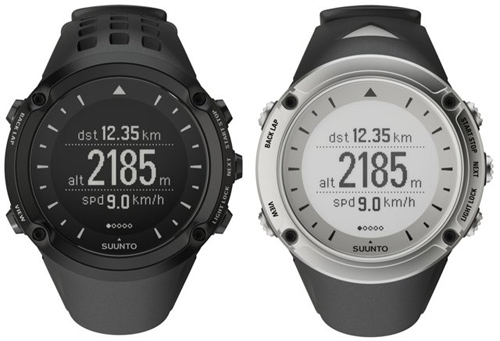
Suunto’s new Ambit, billed as “the GPS for explorers,” is the industry’s most expensive GPS watch. At $500, its hardware and software are well built, it’s good looking, and it has features other watches can’t match.
This month, we took it outside for a test. First thing: This is a good-looking machine on par with anything Garmin or other big boys make. The Ambit also is one of the only watches of its type that doesn’t look like it’s built only for communicating with satellites in outer space (even though that’s exactly what’s going on!).
The watch offers some unique features. The best new feature may be the accuracy of the speed data. The Ambit combines its GPS data with its accelerometer data, which leads to a more accurate reading of actual speed.
You get quicker response to speed changes, as well as a continuous speed-reading even during periods when the GPS signal is temporarily lost. Suunto calls this technology FUSEDSPEED, and it’s an industry first to our knowledge. Smart.
Another thing, this is a burly watch — the Ambit gives confidence that I am not going to have to worry about it if I fall, get it wet, or drop it. The display is well recessed beneath a bumper, it’s water-resistant to 300 feet, and Suunto has a solid build reputation with GearJunkie and beyond, so the confidence it inspires is well-founded.
The charging cable and heart-rate strap are similarly well-built, both better than anything else on the market I’ve seen.
The Movescount software is intuitive. I used Suunto’s software to analyze my workout data. The software links and uploads data from watch to the computer quick and easy.
I didn’t read any instructions or watch any YouTube videos to get myself quickly elbow deep in maps and graphs of my workouts in the woods. This is a marked advantage Suunto has over its competitors.
Waypoint and route navigation empowers users to download routes for the watch’s mapping feature. A user can load GPS waypoints from the watch for use later on a computer to look at routes. That’s one scenario.
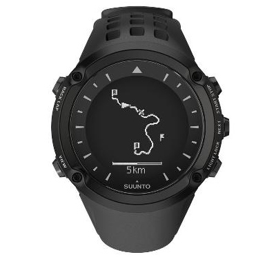
I tested the mapping features by creating a route on my computer and then uploading it to the watch. It was a fast and simple process. Outdoors on the trail, the watch then guided me through the route I made by using a combination of its compass and GPS technology.
The mapping features worked fine for a watch face, but the low-res screen made the experience feel a bit rudimentary, like playing Tetris on my graphing calculator during math class in school. The map features are great for an explorer trying to follow a trail or find a location that is not well marked, but they are limited to pretty basic cartographical tasks.
Another feature that makes this watch shine is its monster battery life. It will record GPS data for up to 60 hours — the longest on the market for this product type by about 300%.
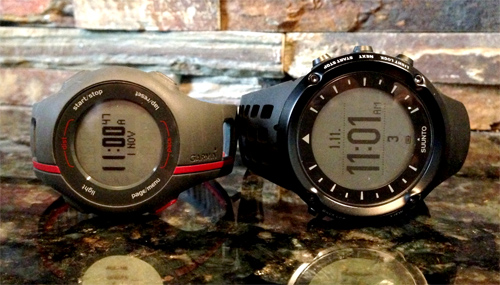
Be warned, getting 60 hours of GPS usage drops the capture rate down to once per minute, so your single-track mountain biking or other fast and curvy routes won’t be accurate. But the watch will last 15 hours capturing data once per second, so beyond longer trips I don’t anticipate many events or adventures in which this watch will fall short.
The Ambit has a “3D compass,” meaning it works even if it’s tilted, a first I understand. It was highly accurate in our test. Suunto was founded by Finnish orienteer Tuomas Vohlonen in 1936. As a competitive orienteer, I appreciate the company’s continued adherence to its roots.
Even being the map geek I am there are times where I forget my analog compass, and instead I can use the Ambit ad hoc when I need a bearing.
The Ambit is a great product for its intended audience: ultra-runners, backcountry explorers, climbers, adventure racers, and related endurance athletes.
It impressed me more as I used it. The little things like its look and feel, the fact the software is both intuitive and stable, and the wilderness explorer features (GPS and mapping) lend me the same confidence that I get from a Swiss Army Knife in my pocket.
Here’s what I didn’t like. . . continued on next page

