Mountain guide Jeff Banks was ski touring in Italy’s Ortler Range near Sölden on a slope with other guides and clients in April 2010. Banks’ mentor and his clients were on the same slope 5 minutes ahead of him and his team when the snow under Banks’ feet fractured. He and his clients fell 1,800 vertical feet over three cliff bands, somehow living to tell the tale.
That was the moment that Banks committed to finding a better way to predict what terrain is prone to slide on any given day. He teamed up with a tech developer and created Aspect Avy. The avalanche risk management app is designed to be usable by anyone who travels by any means in avalanche terrain. And it’s one that Banks believes could help prevent backcountry avalanche deaths across the board.
“As a mountain guide, I am privileged to have the best training our country offers,” said Banks, who is both IFMGA and UIAMG certified. “That near-death experience led me to question why I — and many other guides who were on the same slope on the same day — made the mistake of skiing unsafe terrain.”
In short: Aspect Avy is an avalanche risk management tool that does everything other apps like onX and CalTopo do, and more. It offers training, dynamic snow and weather status updates, information on snowpack history, data on recent avalanche events, predictions for avy run-out zones, and user data input, and sets the bar for acceptable risk higher, in order to help its users stay safer. It is not available for all regions (yet). But it has already been endorsed by the U.S. Special Forces and numerous guide services that will use Aspect Avy to train thousands of Avy 1 students this season.
Editor’s note: When we tested Aspect Avy, it was very much still in its beta phase. Not all functions or features of the app were available to use in the field, and we have yet to test them.
The Road to Aspect Avy

The European “Snow Card” is an avy danger prediction system that’s popular in the Alps. Banks said it does a good job predicting avalanches. But it doesn’t do a good enough job, in his eyes. For instance, it doesn’t correlate the user’s location to the danger. So, as Banks started to develop Aspect Avy, a key element was live tracking. That incorporates user location and LiDAR maps, which map terrain in 3m blocks.
Banks wanted to help everyone — not just guides — incorporate avalanche reporting from respected avalanche forecasters into their decision-making.
He also wanted to factor in what has always been a wild card, and often a lethal one: old snow. According to Banks, dangerous snowfall that occurred earlier in the season and which has been buried by more recent snowpack plays a role in 85% of avalanche-related deaths.
Finally, he wanted to build an algorithm that would take into account slope angle and weather data in an easy-to-use app to help snow travelers manage risk safely.
This app has back-tested its algorithm against historical avalanche deaths both nationally and in Colorado. The developers wanted to see if Aspect Avy could have notified victims that they were in a high-danger area. So they applied the app brain to the past 8 years of national data, and the past 11 years of Colorado data.
They found that 100% of those deaths occurred in zones Aspect Avy would have designated as “no-go” the day the avalanche occurred. Had those victims been using the app, they might have made different choices about where to ski. These findings have been verified by multiple independent auditors.
Aspect Avy App Review
Real-Time Avalanche Risk Management
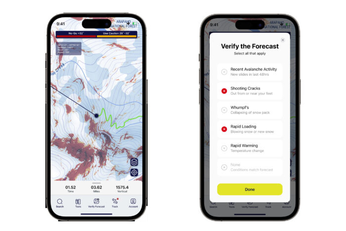
It sounds too good to be true, but it seems that Banks and his team may have succeeded. Aspect Avy combines dynamically changing slope angle shading with the daily weather and avalanche forecasts, as well as historical snow data, with your on-site, on-mountain input, to visualize and rate avalanche danger.
Aspect Avy also has pinpoint weather, easy-to-read distance scales, and a navigation mapping tool, similar to other apps. Downloaded maps still work when your phone is in airplane mode or out of service.
The result is an app that provides localized, and extremely detailed avalanche information to users and which sets a higher bar for acceptable risk than other comparable apps. But Banks clarifies that Aspect Avy isn’t a navigation app. It’s a risk management tool app that relieves decision fatigue and helps get backcountry users home safely.
The app is available on the Apple App Store or on WeFunder now for $50 annually (with first month free) or $400 for a lifetime subscription (that includes four one-year buddy subscriptions).
What Sets Aspect Avy apart?
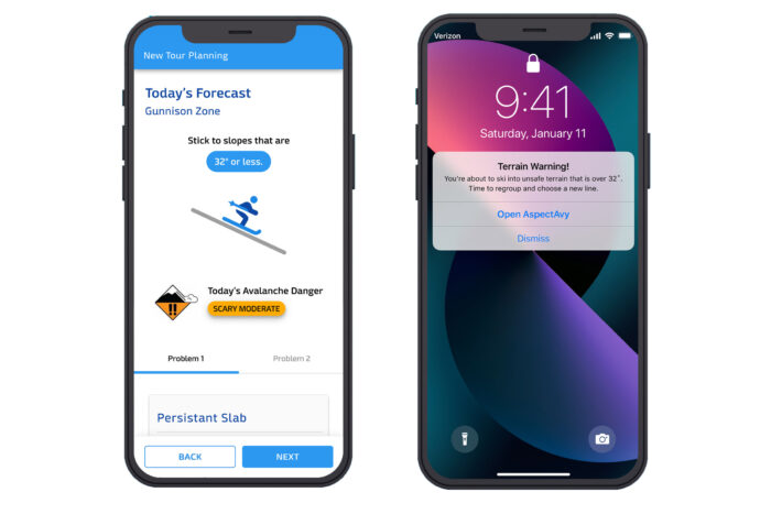
Aspect Avy does several things that other comparable avalanche terrain apps don’t. For starters, the algorithm interprets data and outputs risk level. It displays a LiDAR map featuring slope angle shading to 3m — blocks about the size of a king-size bed. The app dynamically updates risk levels based on objective activity in the mountains to keep you out of high-risk areas.
It shows your location on the map so you can make good decisions about how to navigate low-danger, no-go, and scary-moderate terrain where there is old, rotten snow under a moderate rating snowfall.
Uniquely, Aspect Avy can also build on users’ training by coaching them through backcountry travel; from trailhead safety checks to drop-in decision-making.
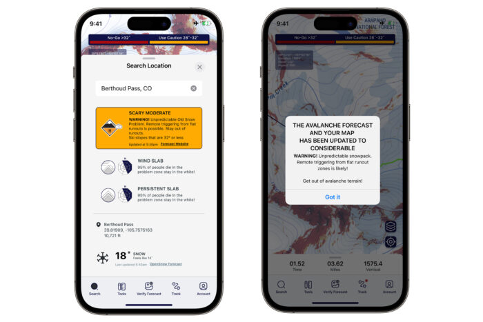
This is the only app that predicts avy runout zones, helping keep everyone in your party safe, even if they’ve already skied their line.
“Are we in a runout zone? I struggle with that as a mountain guide,” said Banks. “If we’re on the valley floor not even the pros know.”
But Aspect Avy will. By aiming your phone at the top of the start zone you can determine the runout risk. If the angle measurement is under 23 degrees, you’re at low risk. Using an algorithmic formula for predicting that, the app has a 95% confidence interval that you won’t be hit by a slide. The remaining 5% only happens during high/extreme avalanche danger. On those days, Banks said it’s best to just stay home.
The run-out prediction feature also assists snowshoers or sledders who may not be aware of any danger to choose a safer route. It links directly to the latest avalanche forecast for the area where you’re recreating.
Aspect Avy: In the Field
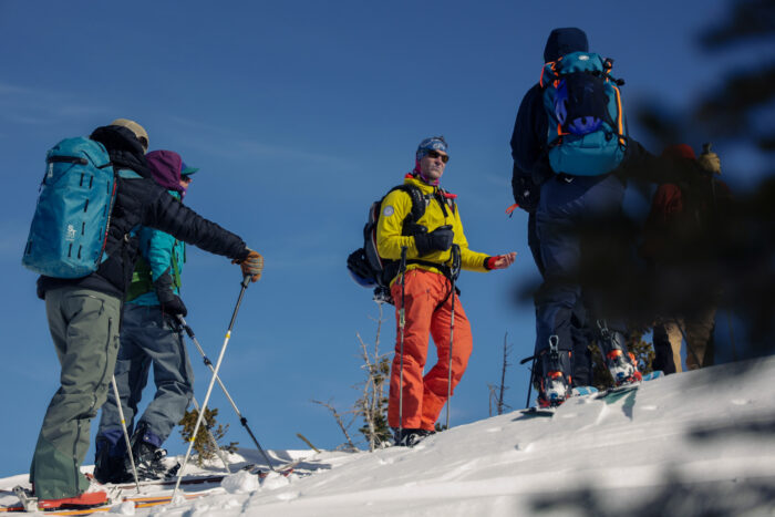
I had the opportunity to use the app for a day on a backcountry ski mission to Scarps Ridge on Mt. Emmons, just outside Crested Butte, Colo. It was a bluebird day with plenty of no-go zones and visible sloughing.
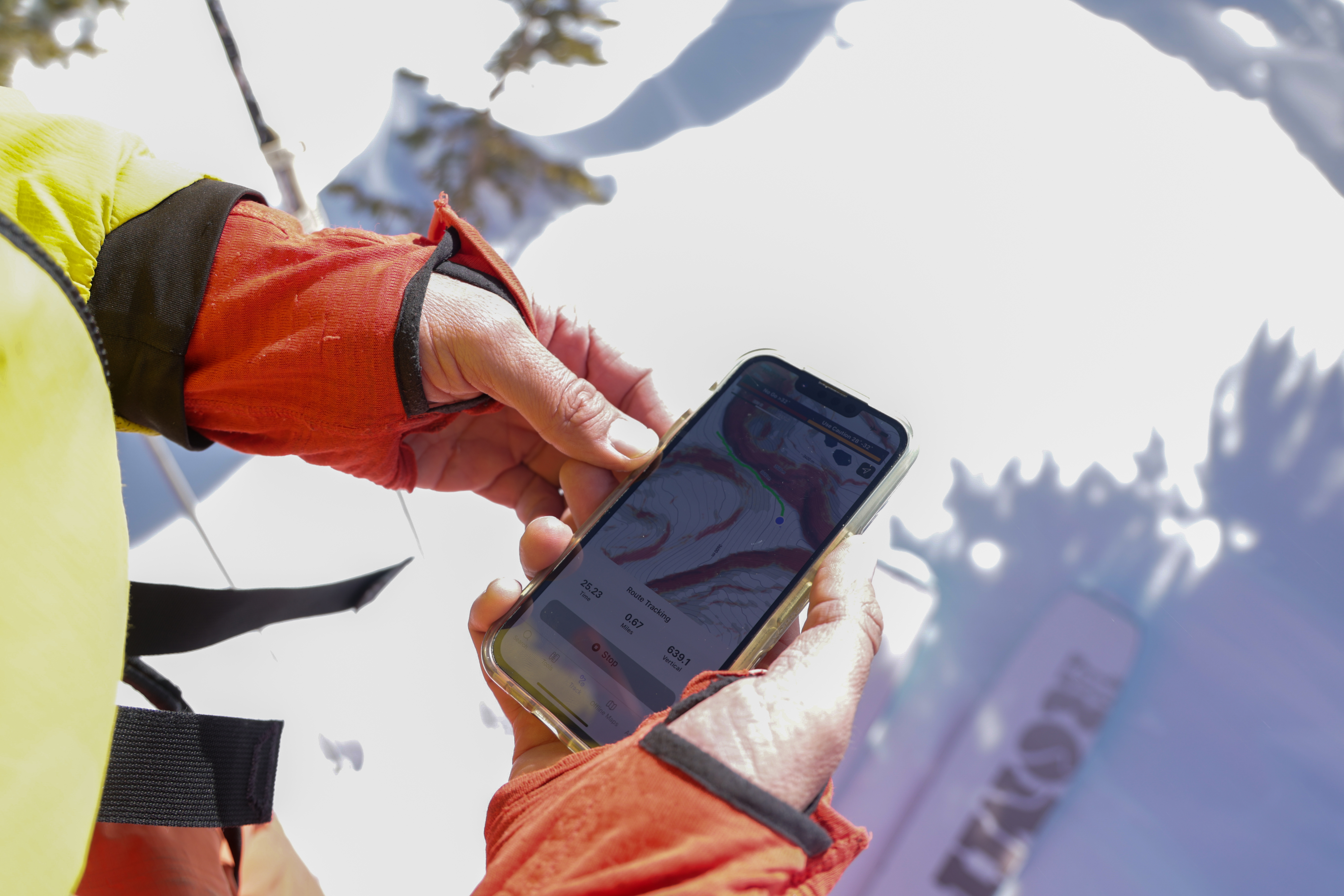
I skied with Banks and other journalists, and we used the app to navigate our 5-ish-mile route. The app pointed us away from some slopes we may have otherwise skied. The zoom capability with Aspect Avy’s 3-square-meter mapping proved to be more detailed than onS’s when compared side-by-side. We used the route planning function to chart our course. As we made our way, the app tracked our progress, showing us where we’d been and how far we’d come.
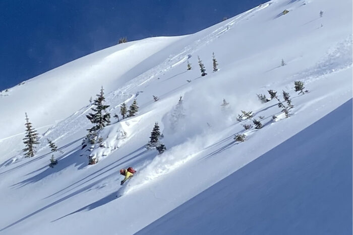
By the end of the tour, we’d had a great day with plenty of powdery turns and no accidents — a successful backcountry excursion, by all accounts. Because the app was still in beta at that time, not all features were available for testing. But the ones that were worked as promised.
How to Use Aspect Avy
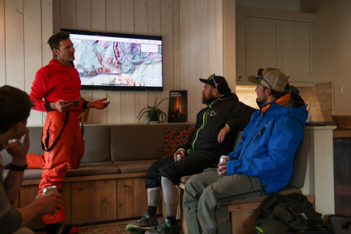
For a location where you plan to travel through or near avalanche terrain, you have to download that area’s maps before leaving cell or internet service. In the field, Aspect Avy’s preloaded maps pop up on the phone quickly, and the app is stable. Banks says the app has never made his phone crash and in testing, no one had any issues pulling up preloaded maps.
The color-coded danger ratings Aspect Avy uses on its maps are equated to relatable risks. Red is a risk level equivalent to base jumping. Orange is “considerable,” which means that human-triggered avalanches are likely and that the user should measure the slope angle. And clear is a risk level equivalent to driving a car. It’s up to users to take that info and decide the level of risk they’re willing to accept.
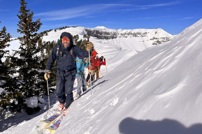
For Banks, one of the biggest challenges and highest priorities in developing Aspect Avy was to make it relevant to and usable by anyone who travels in avalanche terrain. He wanted this to be useful for anyone from dog walkers to snowshoes to hardcore backcountry skiers and professional guides.
“This is a powerful tool to leverage your knowledge and training,” said Banks. “It doesn’t replace an avy course or a beacon shovel probe.”
For now, because it requires good avalanche reporting as well as LiDAR mapping to work, Aspect Avy is U.S. only. Currently, this is the only country where LiDAR is fully mapped. Switzerland and Norway expect to have LiDAR in December, and Banks plans on incorporating those countries into the app soon.
User Input
The app also allows any user to add observations of their environment like whumping, cracks, and slides. Add an observation, and the app will update its predictions on your phone only. In the future, observations may be shared with other users, according to Banks. By the end of 2024, he said, Aspect Avy expects to have processed enough input from app users to figure out whether to incorporate that data across users and how.
Room for Improvement
As mentioned, Aspect Avy only works in locations with reliable avalanche forecasts and LiDAR mapping. I can’t use it in Vermont where I live because there is no avy forecast here. And it won’t currently work in Canada, most of Europe, New Zealand, or Japan. But I will be able to use it in the White Mountains near Vermont and when I travel out West to ski.
Aspect Avy is experimenting with what info to include. Its most basic feature, which is showing where avalanches could occur, is its strongest feature. The jury is out on whether checklists and training modules will enhance the app’s effectiveness or distract people from what’s most important.
And, this app can only help you if you’re willing to shell out the $50 on the Apple App Store or on WeFunder. At less than the cost of dinner, it would seem a no-brainer, and about the cheapest life insurance you can buy. But not everyone thinks that way.
Aspect Avy: Conclusion
To date, Angela Hawse, President of the American Mountain Guide’s Association, the U.S. Special Forces, Joel Gratz, founder of OpenSnow.com, have all endorsed the app. And guide services throughout the Western U.S. who will use this app to teach more than 3,000 Avy 1 students this coming winter.
“What drives us is we don’t want to lose any more friends to avalanches,” says Banks. “We continue to look for investment to help us get this app into the hands of more people.”
The magic of this app is that it’s built around the user experience. Forecasters are really good at doing the forecast, and forecasts are foundational to this app. But most forecasts aren’t easy to interpret by an undereducated audience. This app takes critical forecasting data, combines it with old snow data, and translates all that info into an easy-to-understand picture that people can use in the backcountry to make decisions to keep themselves and their friends safe.
It’s an app with as much relevance for people skirting the edges of avy terrain as it does for dog walkers or professional mountain guides.
“This is a tool that helps me leverage my knowledge and experience,” says Banks. “And it’s one that helps me sleep at night knowing I’m making data-backed decisions.”
“Avy gear is reactive,” said Banks. You spend $1,500 or more for a beacon, shovel, and probe. Why not spend an extra $50 on an app that proactively protects you as well? If closely consulted to avoid risk, Aspect Avy has a very high chance of keeping you from getting into an avalanche in the first place.
You can preorder the app now for $50 on the Apple App Store or on WeFunder.
Check Price on the Apple App Store Check Price on WeFunder