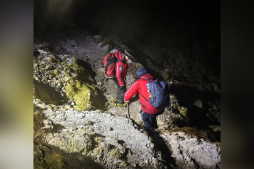
One Southern Colorado search-and-rescue (SAR) organization consolidated 6 years of mapping data to determine a common thread between accidents on 14ers.
When, where, and why do most accidents happen in the mountains? Conceivably, SAR agencies want every possible detail. One Colorado organization orchestrated an extensive data research initiative to find out.
Custer County SAR worked with Denver-based student Kim Jones Thomas for 6 years to gather data in the Crestone group mountains. The Pueblo, Colo., range’s five 14ers are popular among hikers and climbers, but they’re also notoriously dangerous.
Custer County SAR regularly carries out rescue missions there, per Colorado Public Radio, and deaths are not uncommon.

In Thomas’ project, she mapped 72 months’ worth of SAR missions and consolidated a lot of data into one interactive map. The map shows where fatalities, rescues, and other kinds of missions happened and includes other information about each situation. Details include how many people were in the mountaineering group and what they were doing on the mountain.
Thomas’ findings? Incidents often clustered around specific areas, usually when climbers were descending from summits. In fact, rescues called in on the way down proved to be more than double the number of those made during ascents.
The Top Is Not the End
Explaining the phenomenon, Thomas pointed to a foundational mountain axiom: Whenever you get to the top, your trip’s only halfway over.
“[W]hile you celebrate that you made the summit, you still have to get home,” she pointed out.
“It’s not that these people don’t know what they’re doing. It’s just [that] the terrain definitely leads to being confused, especially at that altitude, and you’re tired [and] dehydrated. It’s easy to make mistakes up there.”
Field Utility: How SAR Can Use the New Data
Longtime Custer County SAR member Cindy Howard spoke about how her cohort can use Thomas’ research to their advantage.
“It helps us with our mission pre-planning. We [now] know where certain things happen. We know that there are terrain traps that we look for on missions on any of the peaks, couloirs, or cliff bands where people get in trouble,” she said.
“So by actually plotting them and mapping them, we were able to see patterns where individuals became cliffed out in a certain spot, or if they fell, they potentially fell from a spot where others have become cliffed out.”
In ranges like the Crestone group, advance scouting is critical for effective rescues. To negotiate the wildly choppy, remote terrain, helicopter pilots have to be precise — and tactics have to be tight.
“It’s not, just make a call, and a helicopter is going to be there to pick you up in half an hour,” Howard said.
Thanks to Thomas’ research, they may be able to save precious seconds on each trip.


