This post is a part of GearJunkie’s Outdoor Retailer Winter Market 2013 coverage, which features new products to be seen on the trade show floor.
In an age of touchscreens and voice-activated GPS, a good old paper map is still my favorite guide on the road.
This year, National Geographic Maps released the first in a line of atlases geared toward campers, hikers, and outdoor wanderers of any ilk.
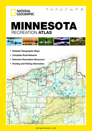
The company’s State Recreation Atlases are stapled 11 X 17-inch booklets. They are described as “part road atlas, part trail guide, part trip planner.”
Sold state by state, the atlases blend topographic base maps with inlayed hiking trails as well as roads and highways. You use them to drive, hike, camp, and generally explore a state.
So far, only a few states have been released for what will eventually be a nationwide series. I checked out the Minnesota edition this month on a road trip through the state and along Lake Superior.
My family and I drove north on Interstate Highway 35, from Minneapolis to Duluth. We snaked through the port city, making a right turn onto State Highway 61 to head north toward deep winter woods and ski trails beyond.
I checked the National Geographic Atlas once we reached Castle Danger, a blip of a community overlooking Lake Superior. The map revealed a trailhead for an afternoon hike, and soon I was trekking down a path and through the snow.
Later, we drove to a state park. I grabbed a park map at the entrance gate — the detail needed for a family hike was not available with National Geographic’s scale.
Our accommodations for the weekend, a cabin at the Grand Superior Lodge, was not on the atlas. The map scale, at 1:175,000, was too small to reveal the entrance to the resort.
I visited an area gear manufacturer, Granite Gear, which is on a back street in the town of Two Harbors. For directions, I checked a page in the atlas but also consulted a Google map on my iPhone when I got mixed around.
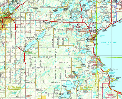
Indeed, the State Recreation Atlases are good for major detail and reference points but not suitable for fine details.
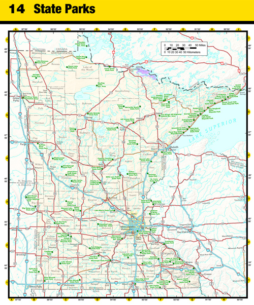
But as a top-level guide, the atlases are great. They show all state parks, most campgrounds, ski areas, private and public land boundaries, and information on hunting and fishing areas, to name a few of the details.
The State Recreation Atlases are available now for Alabama, Georgia, Florida, Michigan, Minnesota, and Wisconsin. Additional states to be added soon. Price is $24.95 at www.natgeomaps.com.
—Stephen Regenold