Palm Springs, Calif., is a great destination for hot and fun summer hikes. But it can also be a winter haven. Here, we break down some of the best hikes the area has to offer.
Palm Springs, Palm Desert, Coachella Valley, Racho Mirage, Cathedral City, Indio — all of these towns and cities make up the general Palm Springs, Calif., area.
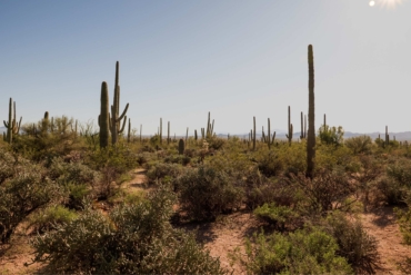
And all of them lie in a vibrant and diverse area of Southern California’s Sonoran Desert. That means, unlike being known for stellar beaches or giant sequoias, this part of the Golden State is instead known for rolling hills, winding switchbacks, cacti, and open views as far as the eye can see.
And whether you’re enjoying the trails on foot, by bike, or with a pup in tow, we’ve got a trail for you.
Araby Trail, Palm Springs
Araby Trail provides great views, is easily accessible from the airport, and is loaded with classic desert vibes. But even in December, it’s very hot and totally exposed with no shade. (I happened to go in the middle of the day.)
Like any hike when you’re in the desert, be sure to bring water and snacks as well as plan ahead. The Araby Trail is home to some steep but mostly gradual terrain. The switchbacks are frequent, and the trail and signage are well-maintained.
With half a dozen connections to other trails, this trail is a great jumping off point if you want to hike further back into the hills for more solitude — and more views.
- Length: 4 miles out and back (or longer)
- Terrain: Dirt and sand
- Difficulty: Moderate to hard
- Travel time: 15 minutes from the airport
- Access: Hikers, mountain bikers, equestrian (check trail signs)
The Cross Loop, Palm Springs

As the name suggests, this winding, smaller trail loop ends at a massive cross statue. It’s actually also lit up at night, so the trail is especially fun at sunset or dark. The Cross Loop is also fairly wide with not too much exposure, making it great for group hikes. Dogs are allowed on the trails, but make sure they’re leashed.
- Length: 2.3 miles
- Terrain: Packed dirt, gravel, sand
- Difficulty: Moderate
- Travel time: 30 minutes from the airport
- Access: Open to hikers, bikers, runners (dogs allowed on leash)
Bump and Grind Trail, Palm Desert

Bump and Grind falls into the boundary of the Santa Rosa and the San Jacinto Mountains National Monument. With several other mountain ranges very close (it juts up against the San Jacintos), it’s a varied and diverse way to experience Palm Springs with just one trail.
Whether you want to hike or run, you can’t go wrong with this trail. It’s challenging, with some gradual sections and some steeper sections, and has great, sweeping views. You can do the full loop and look back on the switchbacks that make their way around the peaks.
- Length: 4 miles
- Terrain: Dirt
- Difficulty: Moderate
- Travel time: 25 minutes from the airport
- Access: Open to hikers, runners, cyclists (dogs prohibited)
Roadrunner and Chuckwalla Trail, Palm Desert/Rancho Mirage

A local favorite, the Roadrunner and Chuckwalla Trail affords great views of the Chuckwalla Mountains to the near east. With a shorter mileage but still challenging terrain, and still very accessible from town, this trail is a great choice for a morning or afternoon pick-me-up hike.
- Length: 2.7-mile loop
- Terrain: Uneven dirt
- Difficulty: Moderate
- Travel time: 18 minutes from the airport
- Access: Open to hikers (no bikes, and dogs must be leashed)
Living Desert Wilderness Loop, Palm Desert

This trail actually starts inside the Living Desert Zoo & Gardens, so you’ll have to pay ($25 per adult) to enter. But if you’re hiking with the family or looking for an all-day outdoor excursion, it’s worth it. And you can check out the rest of the gardens after your hike.
The loop is 4.8 miles, with only a few short steep sections, although, there’s also one section of boulders. Definitely bring a good pack and sturdy shoes. The trail is also a bit wider than others on this list and does have a few wonderful spots of shade.
Don’t miss the views on the first half of the loop, if traveling clockwise, of nearby Eisenhower Mountain and out further, Coachella Valley. And don’t forget while inside the Living Desert Zoo to check out the bighorn sheep. (If you’re lucky, you may spot them while hiking too.)
- Length: 4.8-mile loop
- Terrain: Dirt, uneven, rocky
- Difficulty: Moderate to hard
- Travel time: 30 minutes from the airport
- Access: Open to hikers, no dogs allowed
Ladder Canyon/Painted Canyon Trail, Indio

With a good amount of elevation (similar to the Bump and Grind trail in terms of elevation and difficulty), this hiking destination is worth its weight in unique views. About 40 miles southeast of Palm Springs, the Ladder Canyon/Painted Canyon hike is located inside a slot canyon.
In our opinion, it’s one of the best slot canyon hikes in the whole area. It’s located within Mecca Hills Wilderness (dogs are not allowed). And because it’s BLM land, there are also things like camping found close by.
Note: AllTrails lists the mileage as 4.4, but we’d venture it’s closer to 5 miles. You’ll also want to make sure you check the weather before you go, as rains and flash floods can close this hike during the wet season.
- Length: 4.4-mile loop
- Terrain: Dirt
- Difficulty: Moderate
- Travel time: 1 hour from the airport
- Access: Hikers


