The first commercial handheld GPS unit weighed 1.5 pounds, cost $3,000, and could only run for a few hours before it went kaput. That was 1989, only 36 years ago, and in the time since, the eTrex model from Garmin has emerged as a banner-holder of the modern GPS.
But progress, friends! Pushing ever upward and out, and nudging the humble eTrex onto its most recent iteration: the eTrex Touch. The third version of a nuevo form factor released in 2023, the Touch needed to, of course, push the needle.
So, now the eTrex has a touchscreen (like the one on your phone). It also has Wi-Fi and Bluetooth (like a phone), can display weather forecasts (that it shuttles over from your phone), and can display preloaded maps (see above). It is, as any 5-year-old today would tell you, almost a phone.
In short: Can the handheld GPS maintain this trajectory before colliding with our pocket-saddled internet machines? I dove into the woods with this Garmin to find out.
Looking for a new GPS unit? Check out how the eTrex Touch compares to the rest of the market in GearJunkie’s Best Handheld GPS Buyer’s Guide.
-

-
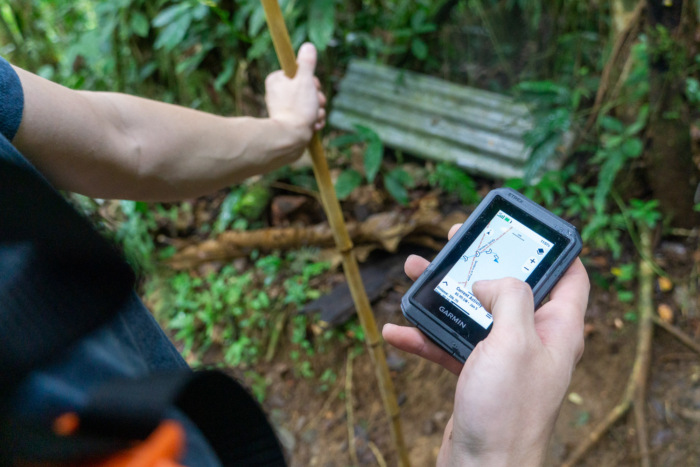
The Garmin eTrex Touch being used on a hike in Costa Rica; (photo/Nick Belcaster)
-
These are the best GPS units on the market today; (photo/Nick Belcaster)
-
(Photo/Nick Belcaster)
-
(Photo/Nick Belcaster)
-
(Photo/Nick Belcaster)
Specifications
Pros & Cons
Pros
- Touchscreen navigation is easy and fast
- IP67 is very protective
- Multi-sport activity profiles
- Preloaded topo maps
Cons
- Screen resolution isn't the best out there
- Menu trees feel dated
Garmin eTrex Touch GPS: Review

Nature abhors a vacuum, and apparently loves crabs. Carcinization is the tendency of many living things to evolve toward a crab-like structure, and it has happened at least five times, they say. It is the prevailing ideal form, or the coalescence of a thing.
The handheld GPS, too, angles toward a better, more efficient corporeal form: the smartphone. At least that’s how the Garmin eTrex Touch initially struck me, more and more like something else that does the job better. The implication is clear: Does this convergent evolution stand to consume the standalone GPS?
Holding the eTrex Touch in your hands, it seems like a silly question. This is the outdoors we’re talking about here! Specialization, redundancy, the 10 essentials, and all that!

The Touch Interface
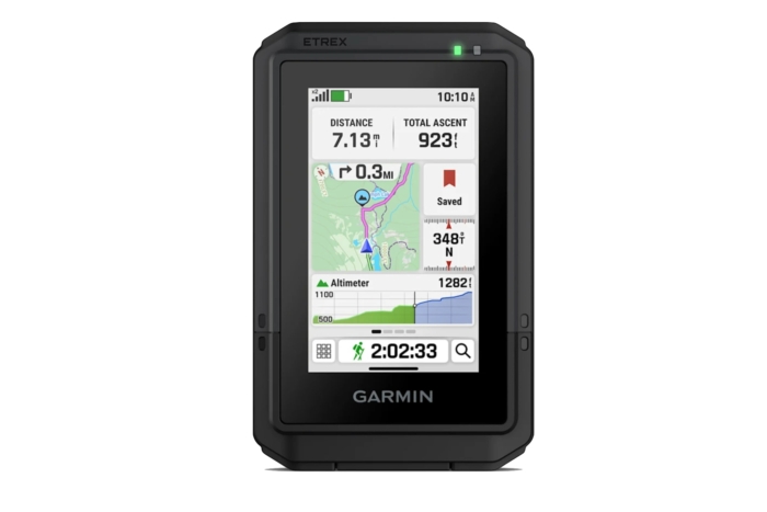
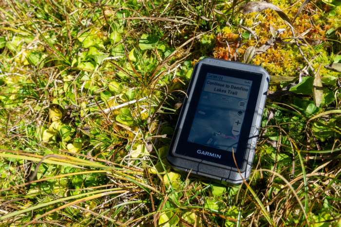
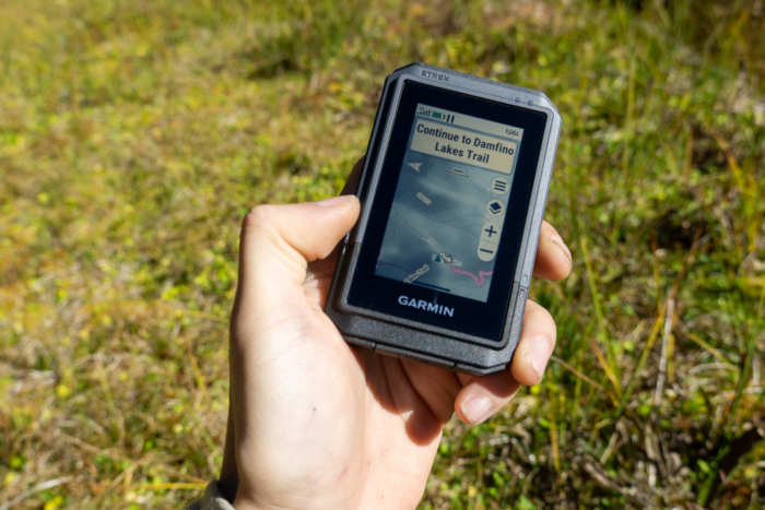
I’ve got some good mileage on the base model of the updated eTrex, the SE, and compared to that GPS, the eTrex Touch feels light-years ahead: it’s really the touchscreen that does it. The 3-inch diagonal color screen is high-resolution and bright, and works just as well as a modern phone touchscreen.
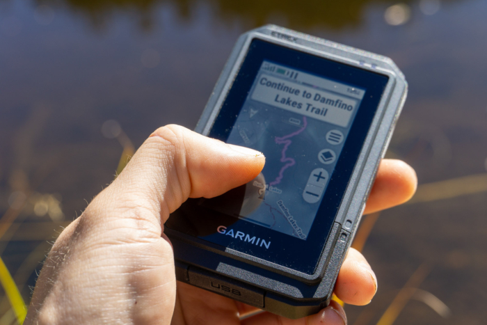
Swiping and zooming across maps is really the star here, and moving away from the antiquated pan-and-zoom button-mashing is a breath of fresh air when it comes to GPS units. This makes routine tasks like route creation and up-route terrain scanning quick and easy, compared to the slight struggle you’ll endure with devices like the eTrex SE.
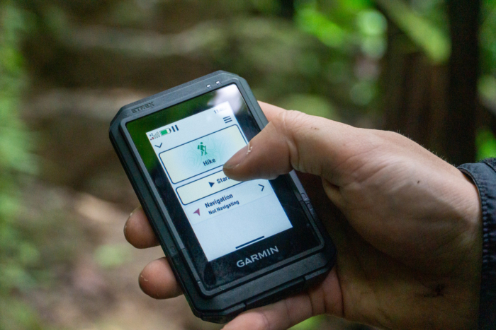
The obvious question that came to mind when first testing the eTrex Touch was whether or not the touchscreen could handle touch conditions such as being wet or dirty. Surprisingly, the screen handles these challenges fairly well. While it might need some periodic cleaning to read inputs, it doesn’t register raindrops as a touch or move through menus in your pocket.

Tip of the Spear GPS Capabilities
While the eTrex line is middle-tier in Garmin’s GPS lineup, the Touch is the leader of the group and gets the full suite of GNSS support and the latest tech.
Like the GPSMAP H1, the eTrex Touch receives satellite signals from the GPS, GLONASS, Galileo, QZSS, BeiDou, and IRNSS systems (surpassing even the Montana 710 series!). The Touch also sports a high-sensitivity receiver and is capable of Multi-Band frequency support, meaning it will toggle between GNSS signal bands when the data is degraded, such as in dense canopies or in canyons.
In addition, the Touch also hosts Garmin’s SatIQ tech, which intelligently switches between GNSS systems and Multi-Band mode to reduce battery consumption when the signal is strong and the added reception power isn’t warranted. This gives the Touch a stated run-time of up to 130 hours in all satellite systems + Multi-Band mode, which blows the Montana 710 out of the water (rated to ~24 hours at the same settings).
In practice, I found the eTrex Touch to be a refined GPS unit when looking specifically at fidelity. Like all GPS units I test, I took the Touch to the track to walk and track laps. Across 10 laps (with the full GNSS mode and Multi-Band turned on), the unit held tight to my lane, with no doglegs or loss of signal.

App Connectivity & Route Creation
Like most any Garmin GPS these days, the eTrex Touch also interfaces with the refined Garmin Explore app, allowing you a wider range of mapping abilities and easier route creation. In practice, it’s simple to clack together a route on the way to your destination, port it over to the unit before you leave the car, and immediately start moving along your route.
The mapping abilities on the device aren’t limited, either. Preloaded TopoActive maps host enough detail to make them actually enjoyable to use, and routable trails and roads mean that you can pick a destination and the device will snap to those paths. Very smart.
In the field, I used the eTrex Touch to both create routes at home to follow, and for spontaneous tracking when I wanted to remember a path I took. Both methods work simply and intuitively, and provide accurate routing as you work along the trail.
Of course, there’s still a little meat left on the bone for Garmin, too, and there’s a subscription-based upgrade (should you desire it). Outdoors Maps+ ($5 a month) provides you with additional map layers, and most importantly, satellite imagery that’s consistently updated. A very handy thing to have when navigating in changing terrain.

What Could Be Better?
My time testing the eTrex Touch overlapped with testing another of Garmin’s newest satellite messaging-capable devices, the Fenix 8 Pro, as well as a T-Mobile–serviced cellphone that utilizes SpaceX satellites to operate, essentially functioning like a satellite messenger, albeit without a dedicated device.
It doesn’t take much gray matter to imagine the next iteration of the eTrex sporting the Big Red Button on the side and all of the inReach messaging capabilities, or supporting third-party apps, or hailing you a ride from the airport. That’s the nature of the do-everything-device, but in reality, I think the eTrex Touch may be better without it. Like leaving your phone at home when running out for errands — it’s freeing to be off the cord for a bit.
Garmin eTrex Touch Conclusion: Is It Time to Ditch the GPS?

Hardly. The eTrex Touch is no phone, but it’s also not a GPS of yesteryear. At least for now, it’s still its own thing. Less of a multitool, more dedicated and refined. In a time when the biggest competitor to the old-school GPS is the phone in your pocket, the Touch makes good sense to keep around.
It isn’t, however, the latest and greatest GPS unit that Garmin makes. That’s the GPSMAP H1, which is, in my opinion, so loaded down with fluff as to be confusing to use (and wildly expensive). For less than half the spend, the eTrex Touch provides all an outdoors person might need.
After a solid summer’s worth of adventures, I’m convinced: You don’t always need the fanciest piece of tech in your pocket. Sometimes you just need something familiar, and the Garmin eTrex Touch feels right at home in my navigation kit.