The explosion of fall colors makes fall a great time to plan that last big hike, bike, or leaf-peeping road trip before winter. While the timing of this seasonal turning follows a fairly predictable timeline, weather trends and events can shift the color changes by several weeks, vary the intensity of peak fall colors, and shorten their window.
Alan Smith, meteorologist at OpenSnow, recently published his very in-depth 2026 Fall Foliage Outlook, breaking down regional forecasts for the onset and end of fall colors.
Smith says that drought in much of the West could lead to an earlier-than-normal change. “Areas that are experiencing drought and have had below-average late summer rain, such as Colorado, New Mexico, and Oregon, will likely see an earlier-than-normal leaf change this year,” Smith writes.
The National Integrated Drought Information System currently lists 49% of the nation in some level of drought, but that won’t lead to earlier fall colors across the board. Short-term factors, such as warmer September temperatures, could delay fall colors in places like the Southeast.
A non-drought spring and summer in the East should produce strong fall colors on a normal October timeline, though, again, short-term weather can change things quickly.
Like weather forecasts, predicting fall colors isn’t an exact science, but, thankfully, there are more tools than ever to help you nail peak fall colors for your autumn adventures.
Tools for Finding Peak Fall Colors
Interactive Maps
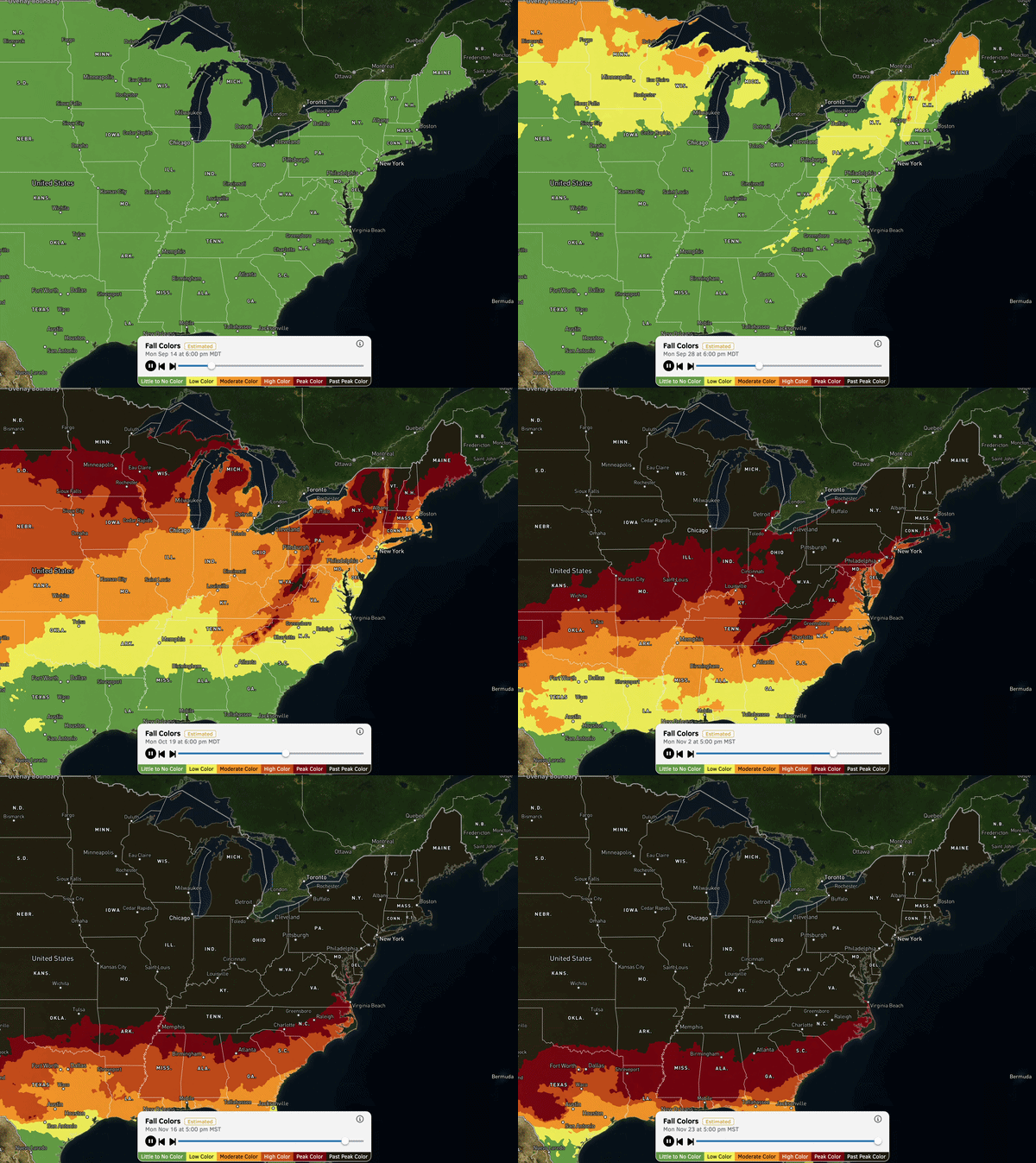
For a big-picture view of the fall colors timeline across the country, interactive maps from OpenSnow, the Farmers’ Almanac, and others provide a solid starting point for forecasting the progression of fall color from first turning to peak to leaf fall.
OpenSnow Fall Colors Map (Paid subscription required): This map layer can be toggled on and off in OpenSnow’s robust interactive maps. Zoom in and out on locations, and use the slider to see week-to-week estimates of fall color progression based on day length and forecast temperatures.
Old Farmer’s Almanac Fall Foliage Map: This map lets you visualize the progression of peak fall color across the country based on historical trends and the year’s weather patterns, though it’s not as interactive as other options and doesn’t update with more recent weather changes.
Explore Fall’s Fall Foliage Map: This free interactive map from meteorologist Evan Fisher lets you view the big picture of peak fall colors at a national scale or zoom in on specific areas. Use the date slider to see locations that should have fall color peaking for a specific date.

Destination-Specific Resources
Webcams: National Parks, towns, and even departments of transportation often have live-view webcams to give you real-time views of leaf progression. This is most useful if your dates are flexible and you’re able to leaf-chase on a whim when the timing is right. Great Smoky Mountains National Park is one of the top Southeastern fall destinations, and its webcams offer several expansive views of the forested mountains.
Tourism and Visitors’ Centers: Visitors’ centers in fall color hotspots are another great resource if you’ve got a specific destination in mind. My hometown of Breckenridge, Colo., is a popular stop for early-season, high-elevation swathes of yellow and orange turning aspens, and the local tourism group has a leaf-peeping guide with updated leaf conditions, leaf forecasts, and carousels of imagery from popular peeping locations. Visit the websites, pick up the phone, or shoot an email to these organizations to get location-specific intel on the latest peak-color estimates and trail recommendations.
Mapping Applications
Routes for Active Leaf-Peeping: Sure, you can drive around an area and soak up the fall color landscape from afar, but there’s something special about hiking, biking, or even off-roading through a corridor of trees with a carpet of color under your feet (or tires). Popular mapping apps such as onX Backcountry, CalTopo, AllTrails, and others offer route information and user reviews that can be another great source of beta for fall.
onX Hunt Deciduous Trees Layer: Evergreens — hence the name — aren’t of interest to leaf-peepers, so if you have an onX Hunt subscription, you can use the tree species layers to highlight areas with the deciduous trees that will provide the color show you seek. The U.S. Forest Service’s Forest Ecosystem Map is a free option with some similar layers, but it takes some tweaking to be useful. Go to the Deciduous Species Suitable Habitat Map and toggle on ‘All Layers’ to visualize potential fall color hotspots.